Site Section
Data & Maps
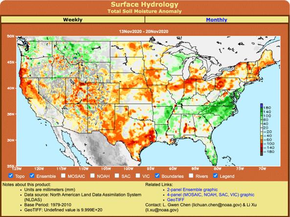
Surface Hydrology Maps
Associated Agencies
NOAA National Weather Service (NWS) Climate Prediction Center (CPC)
Surface Hydrology page displays weekly and monthly products from the North-American Land Data Assimilation System (NLDAS).
How to
What can I do with these data?
- View weekly and monthly hydrological data from the North-American Land Data Assimilation System (NLDAS).
How do I use the site?
- View hydrological data in the map viewer at the “Weekly” or “Monthly” scale
- To change products, select from the list under “Surface Hydrology (based on NLDAS)” within the left side menu panel
Access
Surface Hydrology Maps: displays NLDAS hydrology information at the Weekly and Monthly scales. Graphics and GeoTIFFS are available under “Related Links” below the map viewer.
Partner(s)
Representative Image