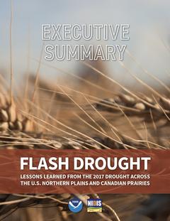
Executive Summary: Flash Drought: Lessons Learned from the 2017 Drought Across the U.S. Northern Plains and Canadian Prairies
This publication is a summary of the original 72-page report. To learn more about the 2017 U.S. Northern Plains and Canadian Prairies drought, analysis, and mitigation efforts, download a copy of the full report (high resolution PDF , low resolution PDF)
The 2017 drought was a rapid-onset event for northeast Montana, the Dakotas, and the Canadian Prairies during the spring and summer of 2017. It was the worst drought to impact the U.S. Northern Plains in decades and it decimated crops across the region, resulting in $2.6 billion in agricultural losses in the U.S. alone, not including additional losses in Canada. The unique circumstances of this drought created an opportunity to evaluate and improve the efficacy of drought-related coordination, communication, and management within the region in preparation for future droughts.
DROUGHT EVOLUTION
- In the spring months prior to drought onset, soils with adequate soil moisture were observed throughout much of the region.It is important to note that in Fall of 2016, abnormally-warm conditions lengthened the Fall growing season in some areas.This may have depleted soil moisture at a time when vegetative growth has normally ended and soil moisture is recharged with rainfall.These preceding conditions may have contributed to drought development in some areas.
- A warm February in 2017 caused early melt of plains snowpack while soils were still frozen, resulting in run-off without adding to soil moisture recharge.
- Precipitation was much below-normal in April and May, a critical time for pasture, rangelands, forage, and both winter and spring wheat.The hardest-hit areas saw the driest May–July season on record during 2017, dating back to at least 1895.
- Above-normal temperatures continued into the spring.Above-normal wind speeds from mid-May to mid-June 2017 contributed to increased evapotranspiration.
- Rapid deterioration of soil moisture conditions continued during June and July 2017, pushing the U.S.Northern Plains and southern Canadian Prairies into D2 (Severe) to D4 (Exceptional) drought, according to the U.S.Drought Monitor (USDM) and the North American Drought Monitor (NADM).
DROUGHT IMPACTS
- The U.S.agricultural sector experienced impacts early on in the year, including many spring-planted crops that failed to germinate, resulting in a total loss.Agricultural impacts persisted and worsened over the duration of the 2017 drought.
- Agriculture in the southern Canadian Prairies experienced poor spring germination, stunted crop development, heat stress, accelerated crop maturity, poor grain fill, below-normal yields, water supply shortages, poor pasture conditions, feed shortages, and wildfires.Livestock production was especially hard-hit due to the widespread scarcity of feed and water.
- Tribes in the region reported similar impacts to agriculture, livestock, and, in some areas, human health and domestic water supplies.Tribal cultural resources were also impacted, putting these resources at risk for future generations.
- Cool season grass species, which dominate much of the region, suffered from the lack of spring precipitation.This led to a decline in pasture and range conditions, and reduced forage production for summer grazing.
- Lower forage production for grazing forced ranchers to significantly reduce their herds by selling cattle earlier than usual.In the U.S., producers started selling cattle in May and June (early-season); in Canada, producers started to reduce and relocate herds in July (mid-season).
- Stock ponds for livestock water were depleted, and surface water samples showed signs of poor water quality (containing higher levels of salts, nitrates, and total dissolved solids).Some livestock perished or exhibited symptoms of poisoning due to poor water quality across the region.
- A shortage of pasture and forage, along with poorly-performing crops, caused many producers to harvest grain crops as forage to feed hungry livestock.
- Despite near-normal stream flows for the entire 2017 season, water supply to rural water providers was reduced in some areas.Rural water systems were restricted by their infrastructure and some providers were not able to keep up with increased water demand, leading to enforcement restrictions.
- The combination of below-normal precipitation and abnormally-high temperatures in July and August contributed to near-record levels of severely-low fuel moisture in the region’s forests and grasslands.These conditions worsened the fire season in 2017, setting records and contributing to large wildfires that exhibited erratic behavior and rapid growth.
DROUGHT RESPONSES
- Montana, North Dakota, and South Dakota activated their state drought task forces.These multi-agency groups considered drought conditions, reviewed impacts, and facilitated drought relief.State response varied depending on impacts, resource availability, and the authority of each state drought task force.
- Governors signed 19 drought-related executive orders between March and October 2017, including 8 in Montana, 2 in South Dakota, and 9 in North Dakota.
- State drought task forces collected data on local climate and hydrologic conditions, as well as impact reports.These were used to inform local decisions and to provide input to the USDM.
- On August 7, 2017, North Dakota Governor Burgum requested a presidential major disaster declaration for drought-affected areas of the state, based on the severity of drought conditions impacting producers and other residents.
- A “fast track” U.S.Department of Agriculture (USDA) Secretarial Drought Declaration policy came into effect for counties when drought was elevated to D2 (Severe Drought) and higher on the USDM.Programs such as the Livestock Forage Program, Livestock Indemnity Program, Small Business Loan assistance, cost-share for infrastructure, and others were also available through USDA.
- On July 31st, 2017, U.S.Dept of Interior allowed emergency grazing relief on the Charles M.Russell Wildlife Refuge in Montana for ranchers who lost grazing land due to the Lodgepole Fire Complex.
- Regional, federal, and academic partners coordinated to provide pertinent drought-related data, impact and outlook briefings, and early warning information to the region.These included the National Oceanic and Atmospheric Administration (NOAA), National Integrated Drought Information System (NIDIS), Regional Climate Services and National Weather Service (NWS), High Plains Climate Center (HPRCC), Western Regional Climate Centers (WRCC), USDA Northern Plains Climate Hub, and National Drought Mitigation Center (NDMC).In addition, federal staff from many other agencies in the region were also engaged during the drought.
- In coordination with the Great Plains Tribal Water Alliance—NOAA, NIDIS, and partners provided specific tribal webinars focused on tribal needs.
- Agriculture and Agri-Food Canada (AAFC) designated producers in drought regions as eligible for Livestock Tax Deferral to help offset the impact of selling cows to reduce herd sizes.
- Canadian provincial governments in the region provided targeted educational sessions and encouraged producers to test livestock water sources.
- Provincial groups used the Canadian Drought Monitor (CDM) as an input into drought response initiatives, including opening up grazing areas, performing additional water testing, and organizing educational sessions.
LESSONS LEARNED
- Regional Drought Early Warning Systems provide important networks through which partners convene across boundaries and exchange information before, during, and after droughts to improve our drought preparedness and response.
- Monitoring to provide early warning of potential drought conditions is vital for regional climatologists as well as federal, state/province, local, and tribal agencies in order to trigger timely and adequate drought response.
- Soil moisture conditions can change quickly, and soil moisture monitoring is a critical indicator in this dryland agriculture environment as well as for many other sectors.There are regional and national efforts to strengthen soil moisture monitoring.
- Snowpack on the plains/prairies is important for early spring moisture.An early melt is detrimental to spring growth of grass and wheat.
- Drought information providers must improve their understanding of the annual decision cycles of all sectors, including agriculture, tourism and recreation, and water supply to determine the most effective formats and timelines for delivering information to decision-makers.
- The scientific community needs to demonstrate the value of improved data collection and early drought indicators to policymakers, producers, and the general public.
- Building partnerships during non-drought periods facilitates information exchange and is critical to ensure proper relationships are in place for a coordinated, rapid response during drought.This includes strengthening coordination within and among federal, state/provincial, local, and tribal governments for achieving an effective drought response.
- It is difficult to plan for drought when you are in drought, and while short-term response plans provide support during the event, states can benefit from longer-term planning that includes mitigation and adaptation strategies.Many states have recognized the need to plan holistically across sectors.Approaching the whole of an ecosystem allows for consideration of building soil and plant health into water management strategies.
- Maintaining outreach to stakeholders and producers during non-drought periods is key to maintaining these relationships.State climate offices and local extension services are key conduits of information to those on the ground, and setting local information in the statewide context is helpful when delivering information.During non-drought periods, activities can be undertaken to improve resilience that will help mitigate impacts in times of drought.
- The reporting of year-round conditions and drought impacts should be encouraged.Impact reports can serve as alerts for climate and hydrologic indicators, and can reveal changing conditions in areas lacking data.
NEEDS AND GAPS
- Drought monitoring infrastructure requires improvements in the collection, assessment, and integration of drought indicators and impacts necessary to produce applicable, reliable, and timely drought forecasts.
- Investments in existing and new monitoring and observation networks are necessary to support and improve drought research, assessment, and prediction across the region.
- Producers have their own “early warning indicators” that can help inform the science of early warning.Better cooperation between drought information providers and resource professionals would enhance this information exchange.
- Improvements in seasonal forecasts will continue to enhance drought preparedness.
- Increased technical capacity of local drought task forces through the development, sharing, and evaluation of drought monitoring tools and triggers will improve drought response and management.
- Better cooperation and coordination with university Extension professionals in each county or region of a state is essential for assistance with the documentation of drought impacts and the distribution of information to individuals on the ground.
- Improved communication between producers and USDA professionals will facilitate awareness of drought-related programs, program deadlines, and enrollment or reporting requirements.
- Better communication between federal, state, tribal, local, and private entities engaged in drought planning and preparedness will improve information transfer and decision making.This reciprocation includes continuing coordination and partnership across the U.S.–Canadian border.
- While many lines of communication performed well in 2017, there is a need to better understand communication centers and pathways in the region, and the way drought is communicated—especially in rural areas.


