Please note: Due to a system outage with NOAA's National Centers for Environmental Information, certain maps and statistics on Drought.gov may be experiencing issues. We apologize for any inconvenience and are working to resolve these issues quickly
GFS Soil Moisture Anomaly
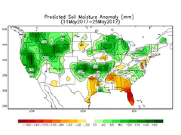
NOAA/National Weather Service/Climate Prediction Center (CPC)
The Climate Prediction Center has developed a soil moisture tool for the next 2 weeks based on the National Weather Service Global Forecast System (GFS) model. Note that these are only forecast tools. They may be used in making the official outlooks that go out to the public, but are not official forecasts in their own right. The GFS bias corrected ensemble forecasts (daily precipitation and temperature at 00Z & 12Z) for Week 1 and Week 2 are used to drive the soil moisture model.
How to
What can I do with these data?
- Check the chances for future conditions.
How do I use the site?
- Roll your cursor over the names/labels of anomaly products to view the maps.
- To view image, right-click the map and select “View Image.” To save image, right-click the map and select “Save Image As...”
Access
GFS Soil Moisture Anomaly – landing page for the Global Forecast System (GFS) Soil Moisture Anomaly maps