About the U.S. Drought Portal
Advancing drought science and preparedness across the nation
The U.S. Drought Portal
The U.S. Drought Portal (www.drought.gov) is the U.S. government’s authoritative drought information website. It provides a one-stop shop for data, decision-support products, resources, and information on drought—from drought monitoring and prediction, to planning and preparedness, to applied research.
First launched in 2008 as an online clearinghouse for drought information and science, it has evolved over time to address a growing public demand for actionable, reliable, and shareable information. By providing a centralized location for reliable, timely, and accessible drought information, Drought.gov offers an essential drought and climate service, improving the nation’s capacity to proactively manage drought-related risks and strengthen communities’ resilience to drought.
The award-winning U.S. Drought Portal is managed by NOAA’s National Integrated Drought Information System (NIDIS) in partnership with NOAA’s National Centers for Environmental Information (NCEI). The content builds on NIDIS interagency partnerships and leverages federal, tribal, state, and local government data and decision-support products.
Drought.gov is a resource for everyone who is impacted by drought, including policymakers and decision makers at all levels of government, researchers, the private sector, the media, and the public. For more information, please contact drought.portal@noaa.gov.
Key Features

2023 State Page Update
In April 2023, NOAA’s National Integrated Drought Information System (NIDIS) launched new and improved state pages on the U.S. Drought Portal.
The expanded Drought.gov state pages—which NIDIS developed in collaboration with NOAA’s National Centers for Environmental Information and state partners—provide a one-stop shop for state drought information, including interactive and easily shareable maps, statistics, and state government resources for all 50 states, as well as Puerto Rico, the U.S. Virgin Islands, and the U.S.-Affiliated Pacific Islands.
These state pages will make it easier for public- and private-sector decision makers, concerned citizens, and the media to learn and communicate about drought in their state, access key state drought resources, and make actionable decisions to improve their communities’ long-term drought resilience.
We’d love to hear your feedback! Let us know how Drought.gov is serving you by emailing us at drought.portal@noaa.gov or taking this website satisfaction survey.
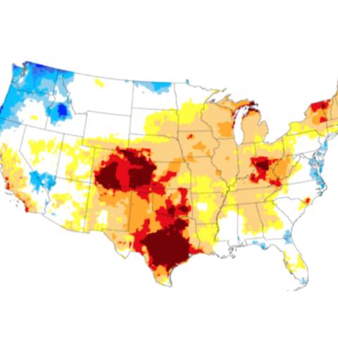
Data & Maps
Explore interactive data and maps by topic, including current conditions, outlooks and forecasts, impacts, and historical conditions going back up to 2,000 years. This section also includes data, maps, and tools for soil moisture, wildfire, water supply, snow drought, and more.
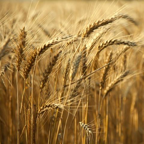
By Sector
Explore the cascading impacts of drought across economic sectors, such as agriculture, public health, water utilities, wildfire management, and tourism & recreation.
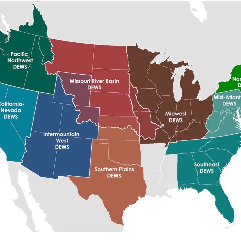
By Location
Explore current conditions, key indicators of drought, outlooks, forecasts, and historical drought conditions at different geographic scales, from the city and county level to across the globe. This section also contains curated resources for each of NIDIS’ nine regional Drought Early Warning Systems.

Research & Learn
Go “back to the basics,” and learn about flash drought, snow drought, ecological drought, and national initiatives like the National Coordinated Soil Moisture Monitoring Network and the NIDIS Drought and Wildland Fire Nexus. This section also includes information on ongoing and published NIDIS research designed to help build resilience to drought across the U.S.

News & Events
View the latest drought-related news, upcoming events, and recordings and summaries of past webinars. This section also includes timely updates on local drought conditions, outlooks, and impacts from NIDIS and its partners—including local drought alert emails and regional drought status updates.
About
Learn about the National Integrated Drought Information System, its partners, and the eight regional Drought Early Warning Systems (DEWS) across the U.S.