
Intermountain West
Drought can take different forms across the Intermountain West. This region includes many different climatic, geographic, economic, and social conditions. These include deserts and forests, fertile valleys and alpine peaks, densely populated cities, and some of the most remote landscapes in America. Drought onset may occur quickly and last a season, or begin gradually and last decades. The Rocky Mountain regions rely on winter snowpack to sustain cities, towns, agriculture and recreation. In the Southwest, the summer monsoons help people, and livestock, get through the hot summer months. In addition to (and because of) the highly variable precipitation, all five states in the Intermountain West also depend on the over-allocated Colorado River for a consistent water supply. The Intermountain West DEWS helps foster interstate coordination to cope with current and future droughts and growing water demands and supports increased communication and collaboration between scientific, water, and land management communities.
Primary contact: Meredith Muth, Acting Regional Drought Information Coordinator
Regional Activities
The following table highlights activities in the Intermountain West that are ongoing efforts related to drought, involve multiple partners, serve as a unique way to address regional drought needs, and are related to at least one of the components of drought early warning.
DEWS Component Legend
The Utah Drought Coordinator hosts regular webinars to discuss weather conditions around the state to contribute to the U.S. Drought Monitor. For more information on the Utah Drought Webinar…
This project is investigating how hypothetical reduction of 300,000 acre-feet of irrigation water for Pinal County agriculture would impact on the local economy.
This project examines potential climate change and variability adaptation strategies related to water and energy in the Colorado River and Rio Grande Basins, including northwestern Mexico.
This project examines the role of water management information and irrigation technologies in agricultural adaptation to climate variability and change in the 17 westernmost U.S. states.
The Arizona Drought Monitoring Technical Committee produces web-based short-term and long-term drought status updates on a monthly and quarterly basis, respectively.
Observation + Monitoring
When monitoring drought, it is important to look at data across the spectrum—from the atmosphere, land surface, and water availability below the surface. The list of data and maps below has been customized for the Intermountain West and provides a snapshot of conditions across that spectrum, including precipitation and temperature departure data, streamflow, reservoir storage, and various derived indices for monitoring drought in the region. Monitoring for the impact of drought is also important, and resources to submit conditions and/or impacts and view conditions are provided.
Regional Data and Maps
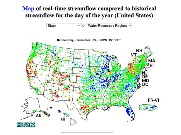
WaterWatch is a U.S. Geological Survey (USGS) World Wide Web site that displays maps, graphs, and tables describing real-time, recent, and past streamflow conditions for the United States.
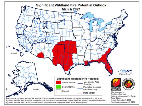
The National Significant Wildland Fire Potential Outlook is intended as a decision support tool for wildland fire managers, providing an assessment of current weather and fuels condition
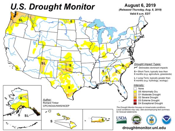
The U.S. Drought Monitor is a map updated each Thursday to show the location and intensity of drought across the country.
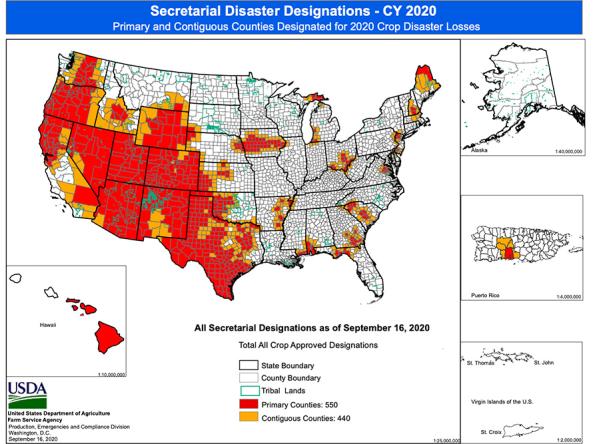
Maps displaying counties declared primary (red) or contiguous (orange) disaster counties by the Secretary of Agriculture.
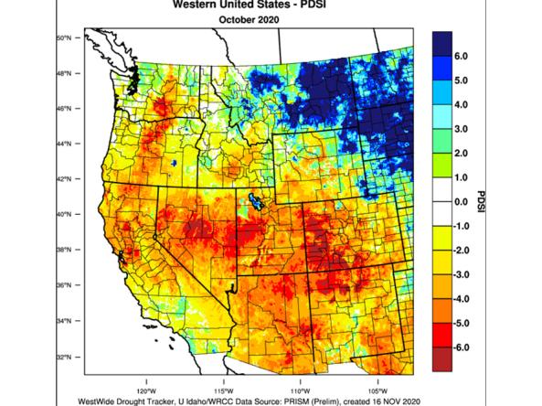
The WestWide Drought Tracker (WWDT) provides fine-scale drought monitoring and climate products for the Western United States.
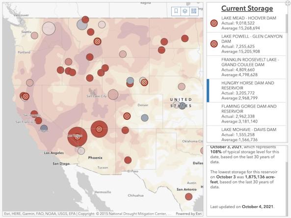
The Bureau of Reclamation's interactive Reservoir Storage Dashboard provides current conditions for 44 major Reclamation reservoirs and comparisons with historical storage data.
Planning + Preparedness
Thoughtful preparations and effective policies can help communities cope with drought impacts when they happen. The states of the Intermountain West DEWS region all have plans for responding to drought. These have been produced by the state agencies responsible for the states' drought response and are linked on this page.
For other groups within the region (counties, cities, industry groups, farms, and businesses) that would like to create their own drought plan, we have included links to resources on this page.
Regional Drought Planning Resources


Prediction + Forecasting
Across the Intermountain West, the timing of precipitation or a dry spell is an important aspect of water resource management. When will drought start? How long could the drought last? When will the monsoon start? How long will this year's snowpack last? This section includes resources for drought prediction and forecasting across various time scales. The appropriate time scale will depend upon your local climate, local crop cycles, local water demand, and the types of decisions being made (tactical or strategic).
Regional Forecasts and Outlooks
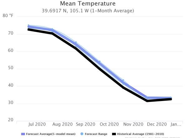
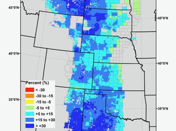
This tool, available as part of The Climate Toolbox, provides a graphical summary of seasonal climate forecasts of temperature and precipitation for the next sever months for a selected location.
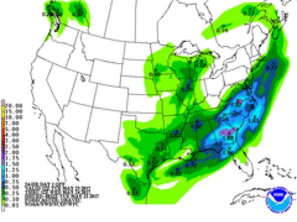
NWS WPC produces Quantitative Precipitation Forecasts (QPFs) that depict the amount of liquid precipitation expected to fall in a defined period of time.
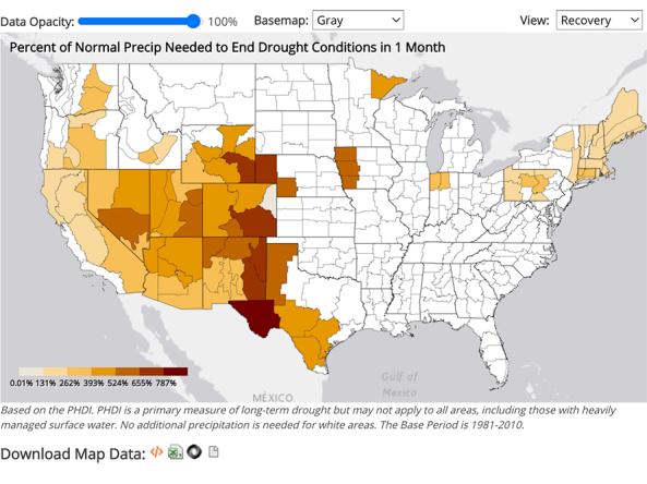
NCEI provides precipitation data that can be used to show probability or the amount of precipitation to ameliorate or end a drought at different monthly scales.
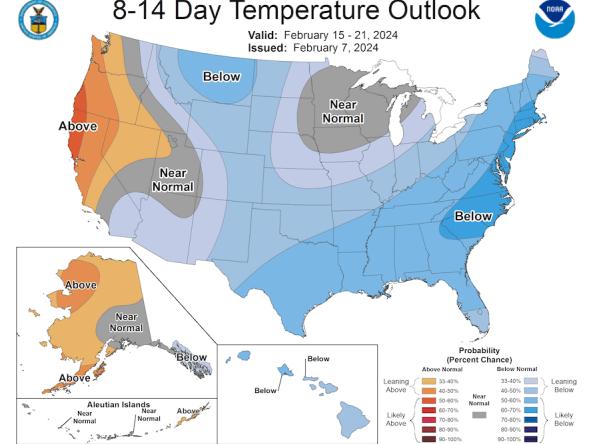
The Climate Prediction Center (CPC) produces temperature and precipitation outlooks for the U.S., including 6-10 day, 8-14 day, monthly, and seasonal outlooks.
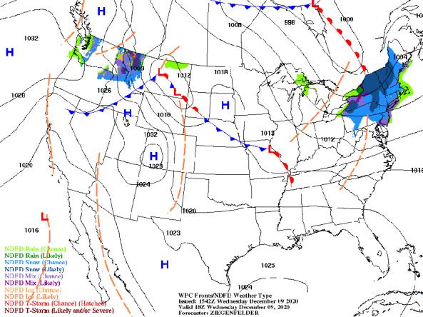
NWS provides a wide selection of forecast maps for temperature and precipitation for the next 12 hours to 6 days.
Grass-Cast indicates for ranchers and rangeland managers what productivity is likely to be in the upcoming growing season relative to their own county’s 34-year history.
Communication + Outreach
NIDIS’s mission for the Intermountain West includes providing those affected by drought with the best available information and resources to better prepare for, mitigate, and respond to the effects of drought. This includes communication and outreach by NIDIS and our partners within the drought early warning network.
The resources here highlight upcoming events or communications tools (podcasts, videos, social media) that are relevant to the Intermountain West.
Regional Communications Documents


Research + Applications
Research to better understand drought in the Intermountain West and its development, persistence, improvement, and interaction with other hazards is critical to providing timely and reliable information, products, and services in support of drought early warning. This page highlights research projects that are studying drought in the Intermountain West region, with support from NIDIS.