Combined Drought Indicator (CDI)
European Drought Observatory (EDO)
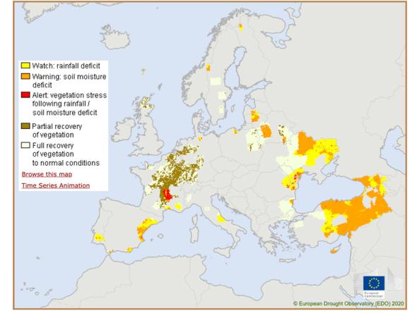
The Combined Drought Indicator (CDI) that is implemented in the European Drought Observatory (EDO) is used to identify areas affected by agricultural drought, and areas with the potential to be affected. The CDI, which was developed by Sepulcre-Canto et al. (2012), is derived by combining three drought indicators produced operationally in the EDO framework -namely the Standardized Precipitation Index (SPI), the Soil Moisture Anomaly (SMA), and the FAPAR Anomaly -in such a way that areas are classified according to three primary drought classes: (1) “Watch”, indicating that precipitation is less than normal; (2) “Warning”, indicating that soil moisture is in deficit; and (3) “Alert”, indicating that vegetation shows signs of stress. Two additional classes-namely “Partial recovery” and “Recovery” -identify the stages of the vegetation recovery process.
Access
EDO offers several tools for accessing and analyzing CDI data:
Documentation
CDI Fact Sheet: Overview, description and usage information for CDI