Site Section
Data & Maps
NDVI Greenness Maps
Associated Agencies
NOAA National Environmental Satellite Data and Information Service (NESDIS) Center for Satellite Applications and Research (STAR)
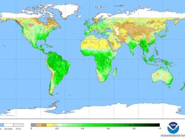
NOAA Center for Satellite Applications and Research (STAR) normalized difference vegetation index (NDVI) maps. NDVI is a simple graphical indicator that can be used to analyze remote sensing measurements and assess whether the target being observed contains live green vegetation or not.
How to
What can I do with these data?
- View current and past vegetation products and individual or compare images. Map also allows you to overlay vegetation products with other measurements (temperature, precipitation, humidity, etc.)
How do I use the site?
- Interactive Map: Use the Control Panel to select between dates, raster options and measurement options.
- Select “Update Map” to apply changes
- Download map in Google Earth .KMZ or in GeoTIFF files by selecting “Download” button at the bottom left of the interactive map
Access
NOAA STAR JPSS: Vegetation Index: Home page for the Vegetation Index product team
JSTAR Mapper: Interactive map viewer including layers for Green Vegetation Fraction, NDVI - Top of Atmosphere, NDVI - Top of Canopy, and EVI - Top of Canopy.


Representative Image