NorWeST Stream Temperature
United States Forest Service (USFS) Rocky Mountain Research Station (RMRS)
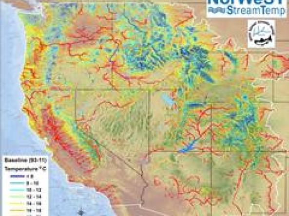
The NorWeST webpage hosts stream temperature data and climate scenarios in a variety of user-friendly digital formats for streams and rivers across the western U.S. The temperature database was compiled from hundreds of biologists and hydrologists working for >100 resource agencies and contains >200,000,000 hourly temperature recordings at >20,000 unique stream sites. Those temperature data were used with spatial statistical network models to develop 36 historical and future climate scenarios at 1-kilometer resolution for >1,000,000 kilometers of stream.
How to

How to use these data:
- Download the appropiate data by NorWeST Processing Units
- NorWeST provides a map to assist in identifying the correct processing unit (see image above)
- Scroll to unit and view the download format options
Access
NorWeST Stream Temp: landing page for the NorWeST program
NorWeST Stream Temperature Database: regional stream temperature database in a variety of user-friendly digital formats across Western United States.
NorWeST Modeled Stream Temperature Scenario Maps: regional modeled stream temperatures scenarios in a variety of user-friendly digital formats across Western United States.