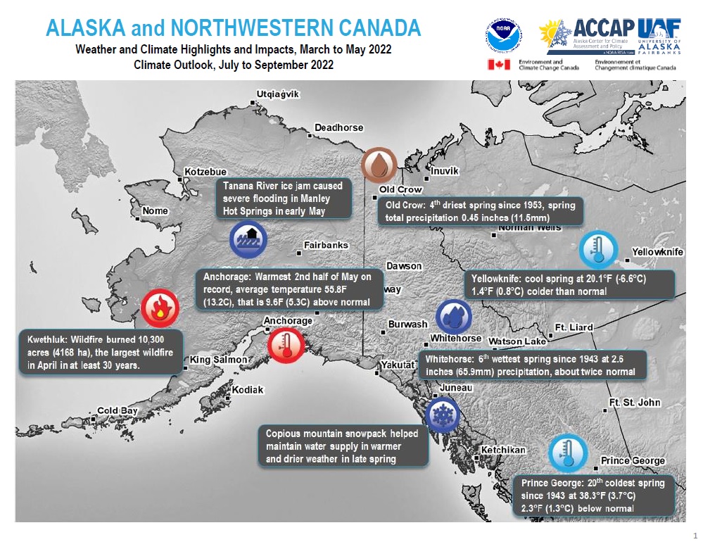
Quarterly Climate Impacts and Outlook for Alaska and Northwestern Canada for March–May 2022, with an outlook for July–September 2022. Dated June 2022.
The current snowpack in the Yukon is largely unprecedented, with many sites close to meeting or exceeding their historical monthly records. The higher than normal snowpack and cool spring temperatures may contribute to flooding. This will be especially true if warmer than average temperatures occur in the early summer and lead to rapid melt.
Quarterly Climate Impacts and Outlook for the Northeast Region for March–May 2022. Dated June 2022.
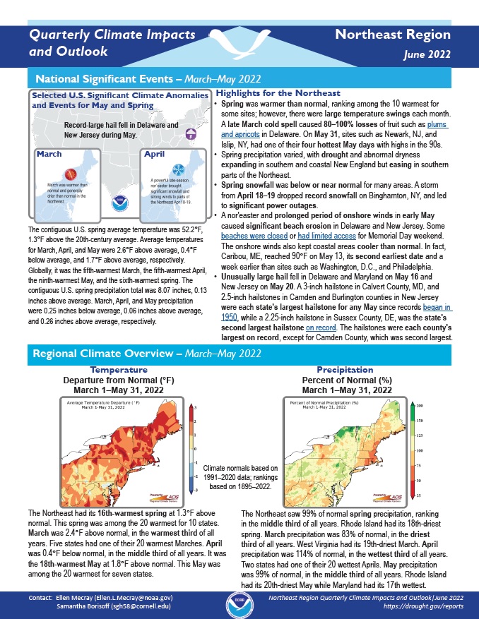
Spring was warmer than normal, ranking among the 10 warmest for some sites; however, there were large temperature swings each month. Spring precipitation varied, with drought and abnormal dryness expanding in southern and coastal New England but easing in southern parts of the Northeast.
Quarterly Climate Impacts and Outlook for the Gulf of Maine Region for March–May 2022. Dated June 2022.
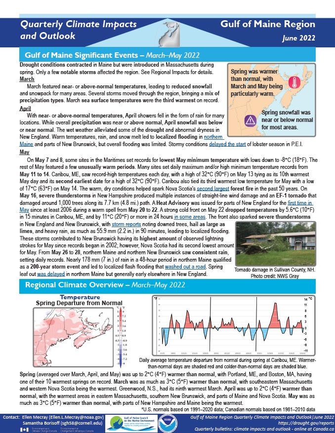
Spring was up to 2°C (4°F) warmer than normal, with Portland, Maine, and Boston, Massachusetts, having one of their 10 warmest springs on record. Spring precipitation ranged from 50% of normal to 175% of normal.
Quarterly Climate Impacts and Outlook for the Southeast Region for March–May 2022. Dated June 2022.
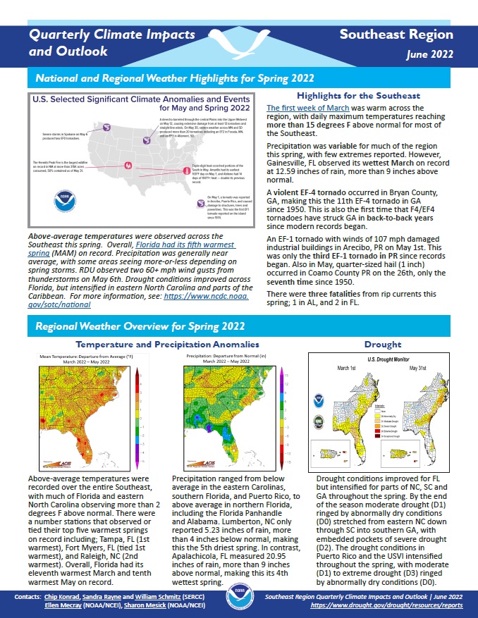
Above-average temperatures were recorded over the entire Southeast, with much of Florida and eastern North Carolina observing more than 2°F above normal. Precipitation ranged from below average in the eastern Carolinas, southern Florida, and Puerto Rico, to above average in northern Florida, including the Florida Panhandle and Alabama.
Quarterly Climate Impacts and Outlook for the Pacific Region for March–May 2022. Dated June 2022.
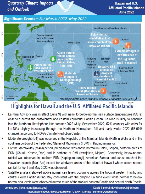
For the March–May period, precipitation was above normal in Palau, Saipan, northern areas of FSM (Chuuk, Kosrae, Yap), and in portions of RMI (Kwajalein, Majuro). Conversely, below-normal rainfall was observed in southern FSM (Kapingamarangi), American Samoa, and across much of the Hawaiian Islands (March–April) except for windward areas of the Island of Hawaiʻi where above-normal rainfall for April and May was observed.
The purpose of the 2022–2026 Northeast Drought Early Warning System (DEWS) Strategic Action Plan is to document regionally identified needs and offer a guide for future activities that will improve drought early warning and preparedness in the Northeast DEWS. Partners from across New England and New York attended virtual listening sessions in October and November of 2020 to discuss the progress made and identify next steps.
Despite the acceleration of climate change, assumptions of a stationary climate are still incorporated into the management of water resources in the U.S., with a preference towards 60-year (or longer) observation record lengths for drought characterization. Bias emerges by assuming that conditions from the early and mid-20th century are as likely to occur in today’s climate.
This basin master water control manual describes the overall water control plan for the Alabama-Coosa-Tallapoosa (ACT) River Basin. Descriptions of the basin, history of development, water control activities, and coordination with others are provided as supplemental information to enhance the knowledge and understanding of the basin water control plan. This manual provides a general reference source for ACT water control regulation. It is intended for use in day-to-day, real-time water management decision making and for training new personnel.
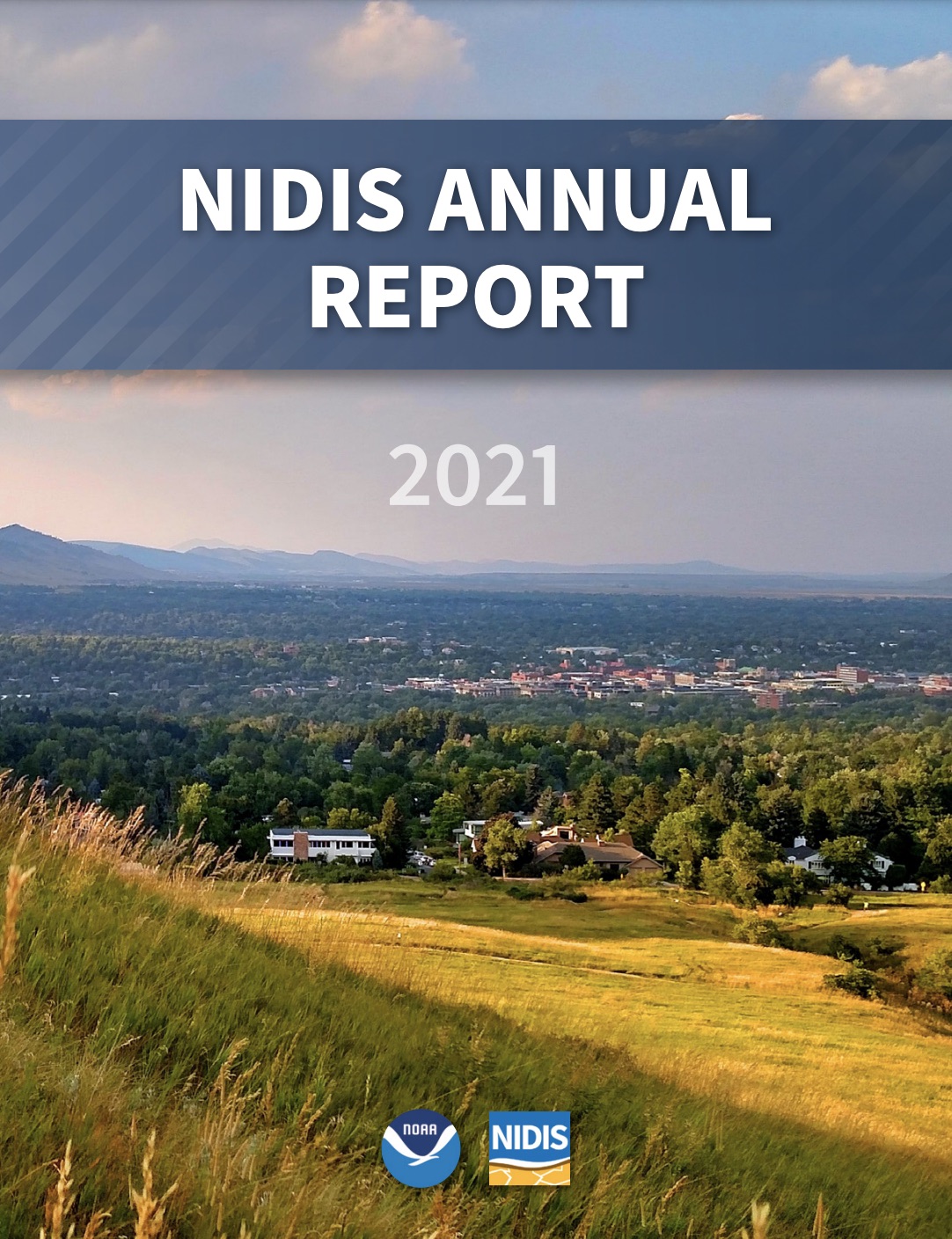
The National Integrated Drought Information System (NIDIS) is pleased to share our 2021 Annual Report to provide insight into the many accomplishments of the program over the previous year and the opportunities that lie ahead.
This study, led by researchers from the University of Nebraska Medical Center and published in the International Journal of Environmental Research and Public Health, assessed "potential changes in health risk from droughts during the last decade in the contiguous United States."