Quarterly Climate Impacts and Outlook for the Gulf of Maine Region for March - May 2021. Dated June 2021.
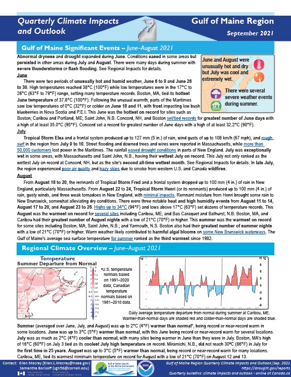
Summer was up to 2°C (4°F) warmer than normal, being record or near-record warm in some locations. Summer precipitation ranged from 50% of normal to 200% of normal.
Quarterly Climate Impacts and Outlook for the Southeast Region for June - August 2021. Dated September 2021.
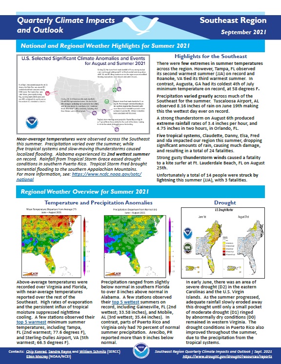
There were few extremes in summer temperatures across the region. Precipitation varied greatly across much of the Southeast for the summer.
NOAA’s Regional Climate Services Program created these Climate Outlooks to inform the public about recent climate impacts within their respective regions. Each regional report contains easy-to-understand language, and anyone can access them through the Drought Portal.
Quarterly Climate Impacts and Outlook for the Pacific Region for June - August 2021. Dated September 2021.
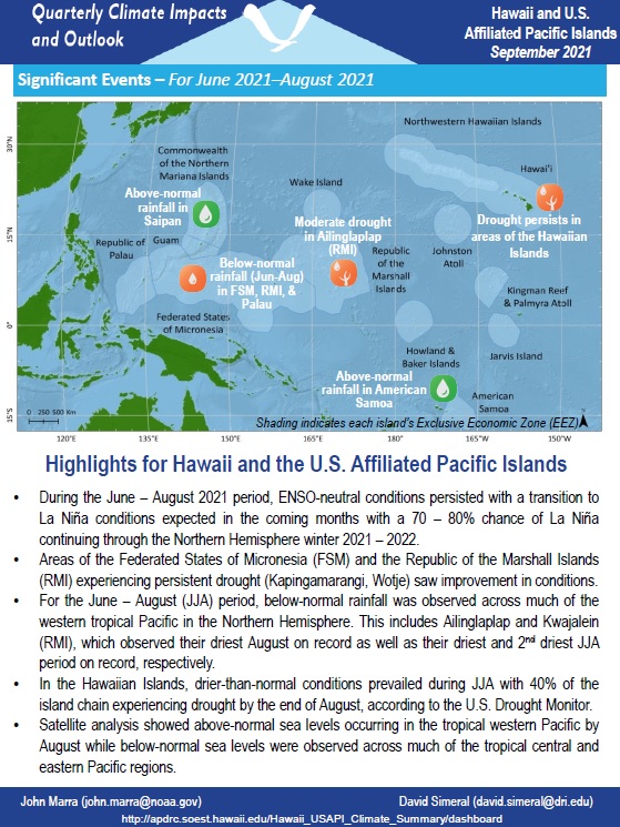
During the June–August 2021 period, ENSO-neutral conditions persisted with a transition to La Niña conditions expected in the coming months and a 70%–80% chance of La Niña continuing through the Northern Hemisphere winter 2021–2022.
Quarterly Climate Impacts and Outlook for the Northeast Region for June - August 2021. Dated September 2021.
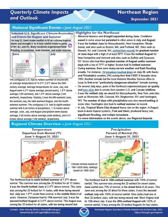
The Northeast had its sixth-hottest summer at 1.5°F above normal. This summer was among the 20 hottest for all 12 states. The Northeast had its 10th-wettest summer with 116% of normal rainfall. This summer was among the 20 wettest for seven states.
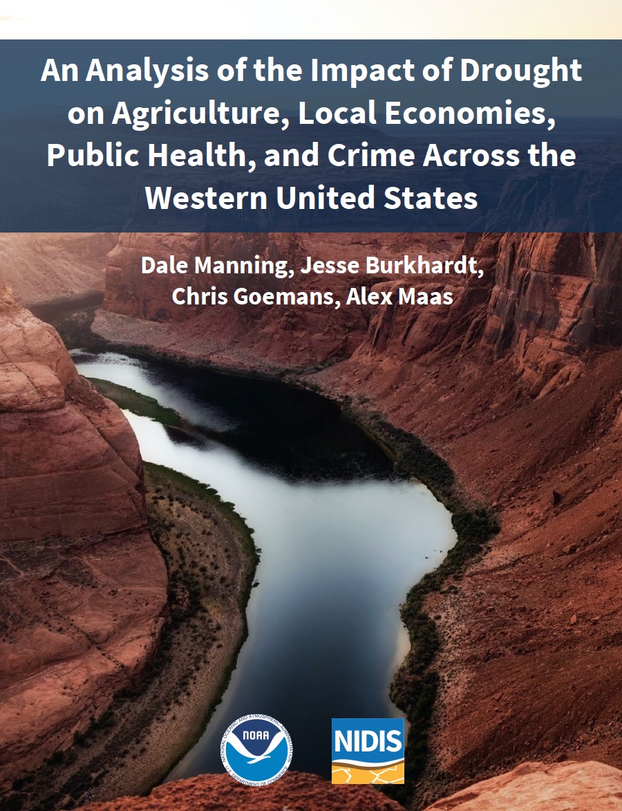
Severe, extreme, or exceptional drought conditions have become increasingly common throughout the western United States over the past 20 years. Abnormally dry conditions can lead to a wide range of negative economic impacts across a wide range of sectors that either directly or indirectly depend on weather-dependent ecosystem services.
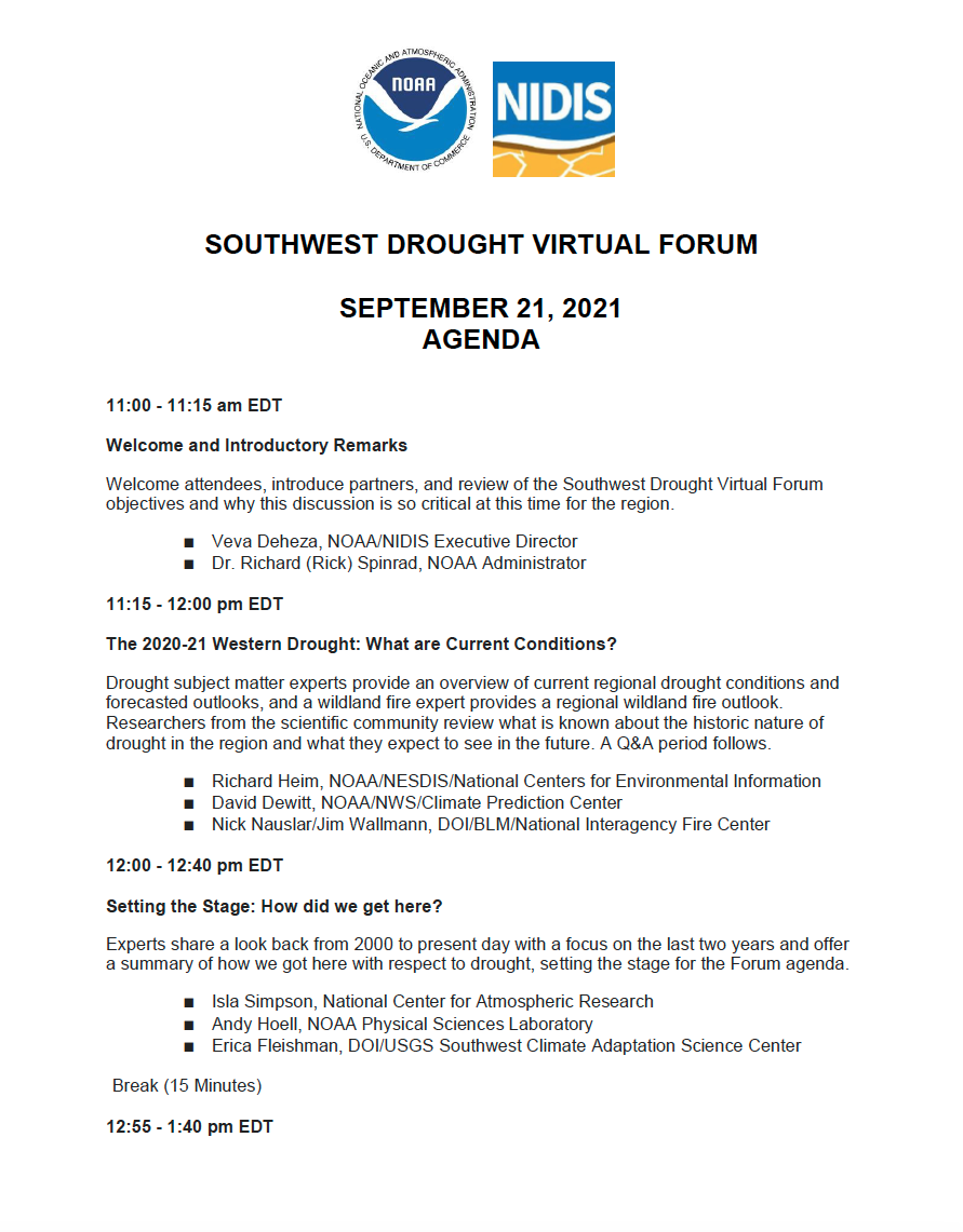
In September, the National Integrated Drought Information System (NIDIS) will host a Southwest Drought Virtual Forum. The Forum will assemble stakeholders, decision makers, and drought experts for a cross-cutting dialogue on worsening drought conditions in the Southwestern United States, and response and relief efforts across levels of government and sectors, with the goal of supporting communities impacted by ongoing water scarcity and building long-term drought resilience in the region.
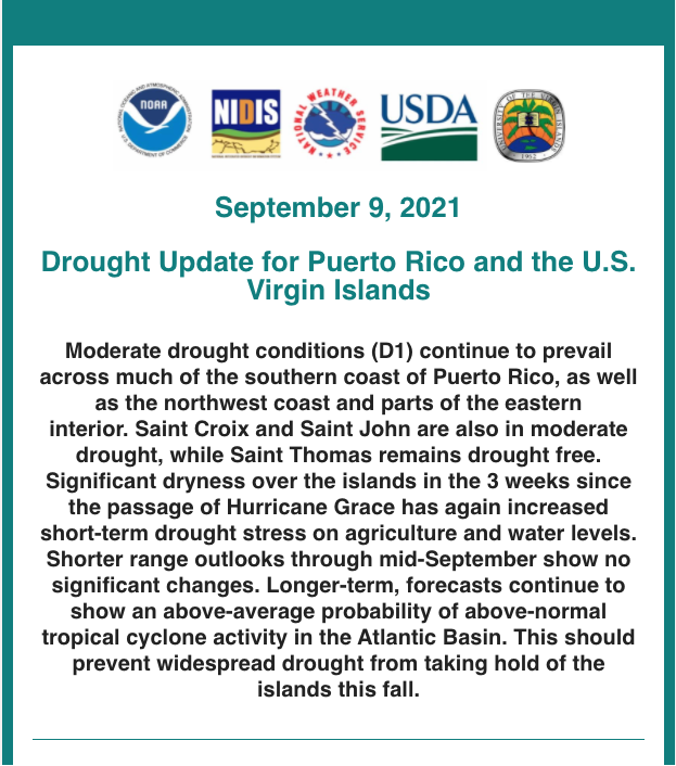
This drought update is issued in partnership between the National Integrated Drought Information System (NIDIS), National Oceanic and Atmospheric Administration (NOAA) National Weather Service, and the U.S. Department of Agriculture (USDA), and the University of the Virgin Islands. The purpose of the update is to communicate a potential area of concern for drought expansion and/or development within Puerto Rico and the U.S. Virgin Islands based on recent conditions and the upcoming three month forecast.
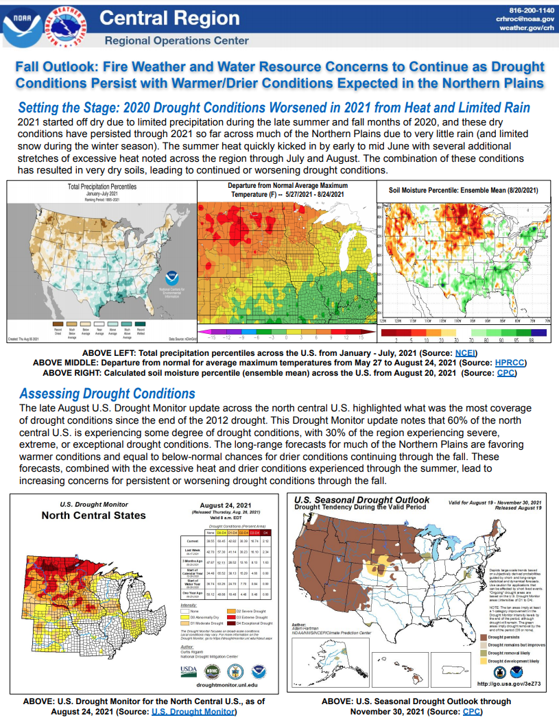
The National Weather Service Central Region developed 2021 Fall Hazard Outlooks in coordination with NOAA's National Centers for Environmental Information and National Integrated Drought Information System (NIDIS); U.S. Department of Agriculture; High Plains Regional Climate Center; and National Interagency Fire Center's Geographic Area Coordination Centers. This outlook highlights the various Fall hazards that could occur and potential impacts across the Northern Plains.
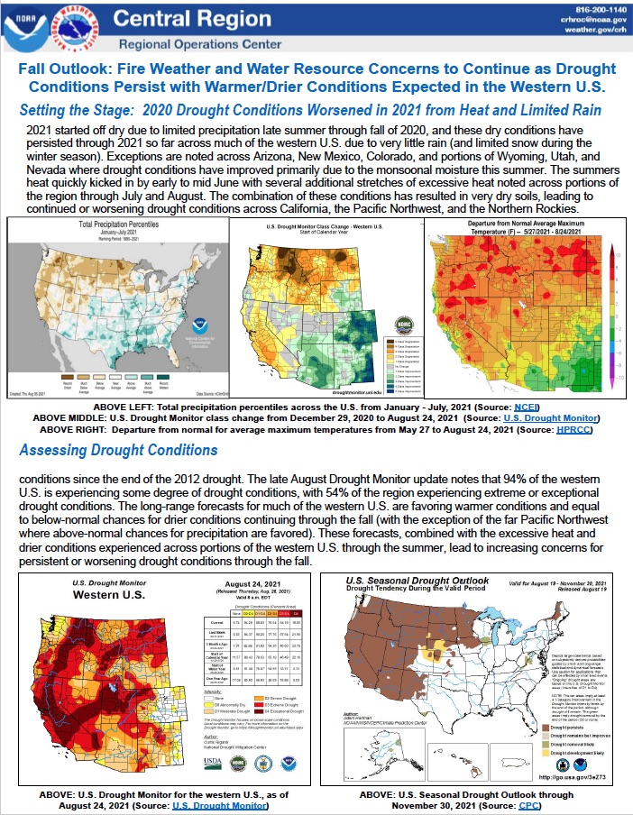
The National Weather Service Central Region developed 2021 Fall Hazard Outlooks in coordination with NOAA's National Centers for Environmental Information and National Integrated Drought Information System (NIDIS); U.S. Department of Agriculture; High Plains Regional Climate Center; and National Interagency Fire Center's Geographic Area Coordination Centers. This outlook highlights the various Fall hazards that could occur and potential impacts across the Western U.S.
Droughts are often thought of as slow-moving natural hazards. However, some serious droughts occur with such rapid onset that it seems as if they appear in a “flash,” rendering them and their consequences hard to predict and prepare for. These flash droughts can have substantial agricultural and economic consequences, including billions of dollars in losses.