Quarterly Climate Impacts and Outlook for the Great Lakes Region for September – November 2018. Dated December 2018.
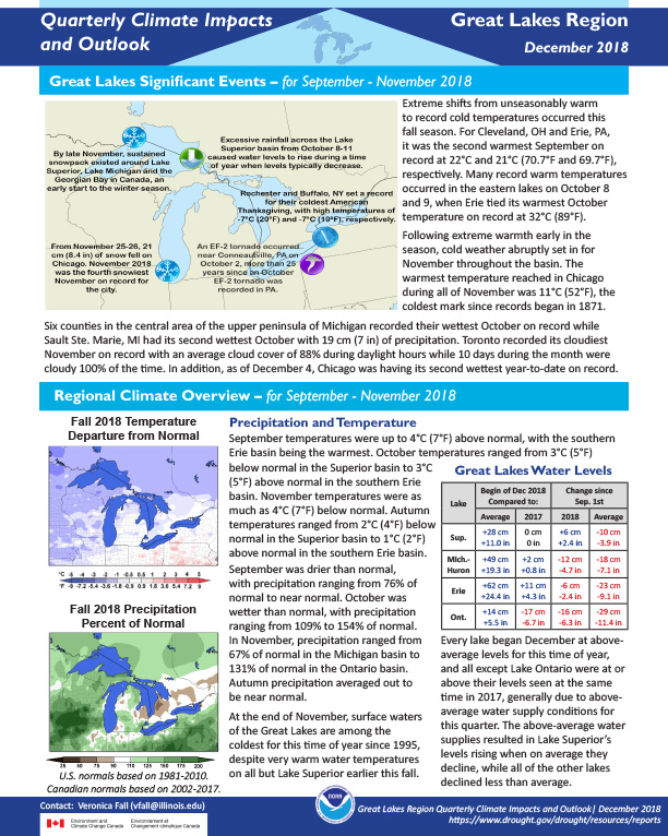
Extreme shifts from unseasonably warm to record cold temperatures occurred this fall season. Autumn precipitation averaged out to be near normal.
Quarterly Climate Impacts and Outlook for the Missouri River Basin September – November 2018. Dated December 2018.
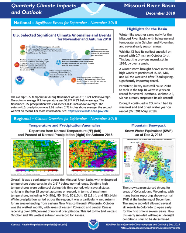
Overall, it was a cool autumn across the Missouri River Basin, with widespread temperature departures in the 2-6°F below-normal range. While precipitation varied across the region, it was a particularly wet autumn for an area extending from eastern New Mexico through Wisconsin.
Quarterly Climate Impacts and Outlook for the Northeast Region for September – November 2018. Dated December 2018.
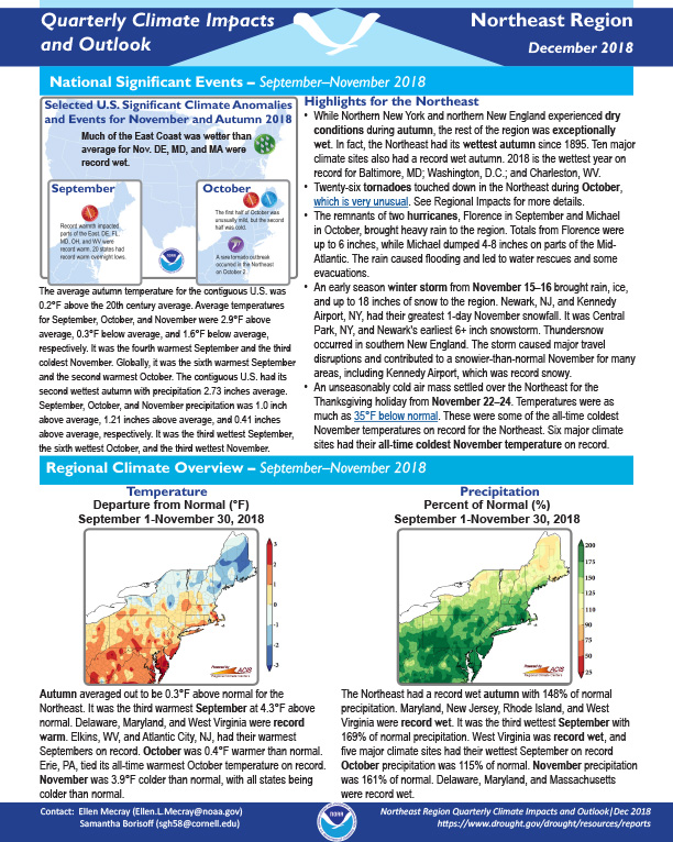
Autumn averaged out to be 0.3°F above normal for the Northeast. The Northeast had a record wet autumn with 148% of normal precipitation.
Quarterly Climate Impacts and Outlook for the Southern Region for September – November 2018. Dated December 2018.
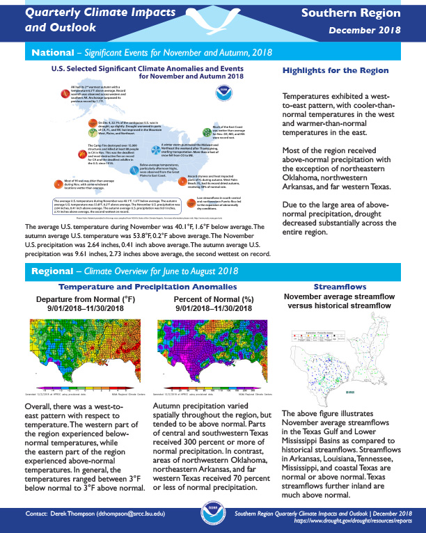
Temperatures exhibited a west-to-east pattern, with cooler-than-normal temperatures in the west and warmer-than-normal temperatures in the east. Most of the region received above-normal precipitation with the exception of northeastern Oklahoma, northwestern Arkansas, and far western Texas.
Quarterly Climate Impacts and Outlook for the Gulf of Maine Region for September – November 2018. Dated December 2018.
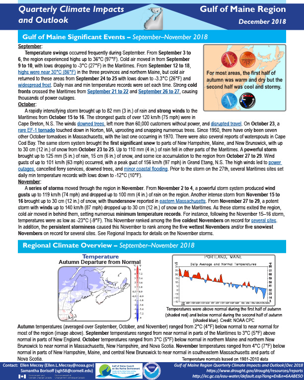
Autumn temperatures ranged from 2°C (4°F) below normal to near normal for most of the region. Autumn precipitation generally ranged from 75% of normal in northern New Brunswick to 200% of normal in southeastern Massachusetts.
Quarterly Climate Impacts and Outlook for the Southeast Region for September – November 2018. Dated December 2018.
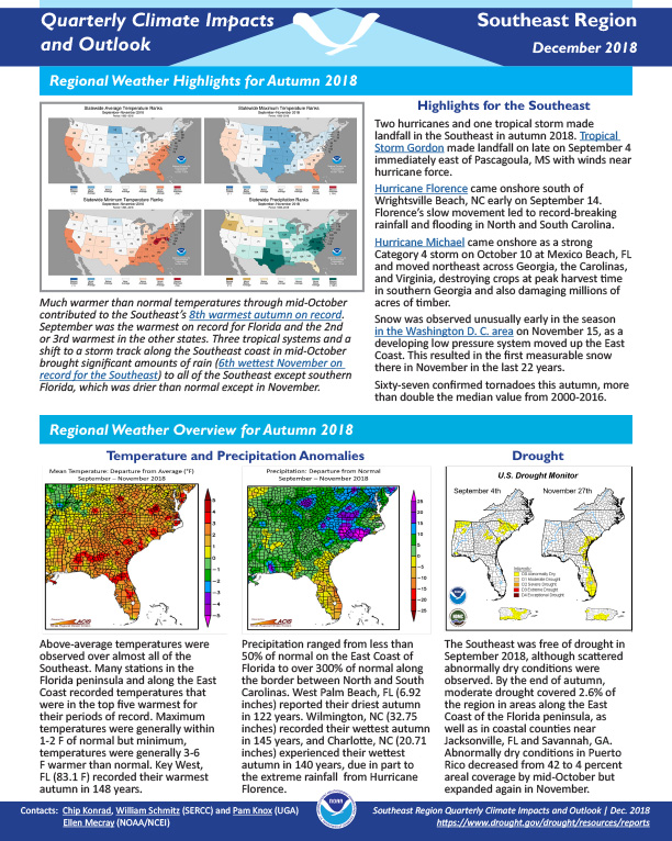
Above-average temperatures were observed over almost all of the Southeast. Precipitation ranged from less than 50% of normal on the East Coast of Florida to over 300% of normal along the border between North and South Carolinas.
Quarterly Climate Impacts and Outlook for the Western Region for September – November 2018. Dated December 2018.
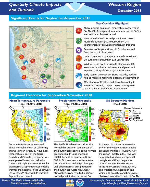
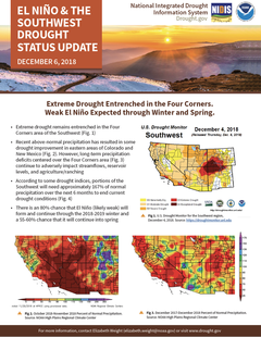
Above normal minimum temperatures were observed in California, Nevada, and Oregon. Near to well above normal precipitation was observed across much of the Southwest (Arizona, New Mexico, and southern UT) with an improvement of drought conditions in this area.
The purpose of this Northwest Florida Water Management District Water Supply Assessment update is to determine, “Whether existing and reasonably anticipated sources of water and conservation efforts are adequate to supply water for all existing legal uses and reasonably anticipated future needs and to sustain the water resources and related natural systems.” Learn more and view past water supply assessment updates on the Northwest Florida Water Management District website.
The purpose of the Alabama Drought Management Plan is to provide information and procedural details associated with Alabama’s drought planning and response activities. The 2018 revision of the Plan is now fully in accordance with the Alabama Drought Planning and Response Act and the subsequent regulations promulgated in support of that Act.