Quarterly Climate Impacts and Outlook for the Northeast Region for March–May 2026. Dated June 2026.
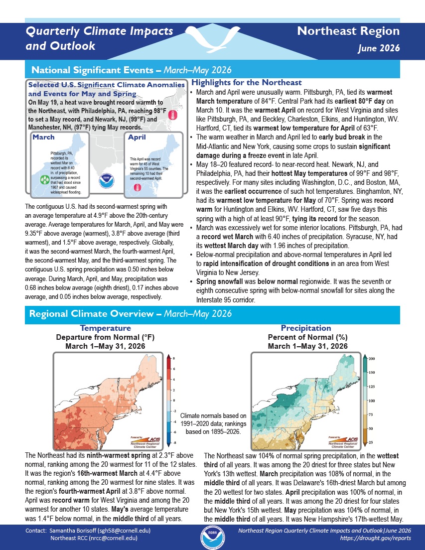
The Northeast had its ninth-warmest spring at 2.3°F above normal, ranking among the 20 warmest for 11 of the 12 states. The Northeast saw 104% of normal spring precipitation, in the wettest third of all years. It was among the 20 driest for three states but New York's 13th wettest.
Quarterly Climate Impacts and Outlook for the Pacific Region for March–May 2026. Dated June 2026.
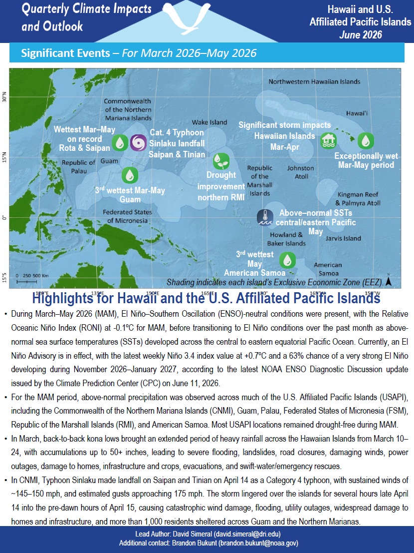
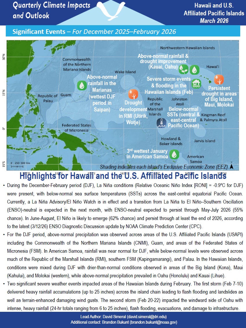
Above-normal precipitation was observed across much of the U.S.–Affiliated Pacific Islands (USAPI), including the Commonwealth of the Northern Mariana Islands, Guam, Palau, Federated States of Micronesia, Republic of the Marshall Islands, and American Samoa. Most USAPI locations remained drought-free.
Quarterly Climate Impacts and Outlook for the Missouri River Basin for December 2025–February 2026. Dated March 2026.
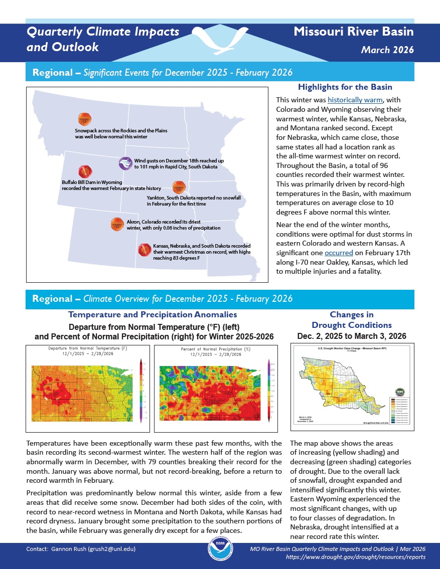
Temperatures have been exceptionally warm these past few months, with the basin recording its second-warmest winter. Precipitation was predominantly below normal this winter, aside from a few areas that did receive some snow.
Quarterly Climate Impacts and Outlook for the Gulf of Maine Region for December 2025–February 2026. Dated March 2026.
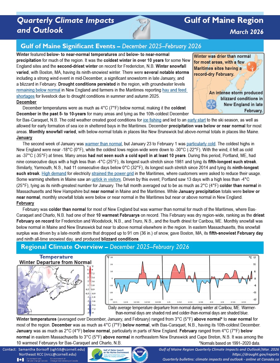
Winter featured below- to near-normal temperatures and below- to near-normal precipitation for much of the region. It was the coldest winter in over 10 years for some New England sites and the second-driest winter on record for Fredericton, N.B. Winter snowfall varied, with Boston, Massachusetts, having its ninth-snowiest winter.
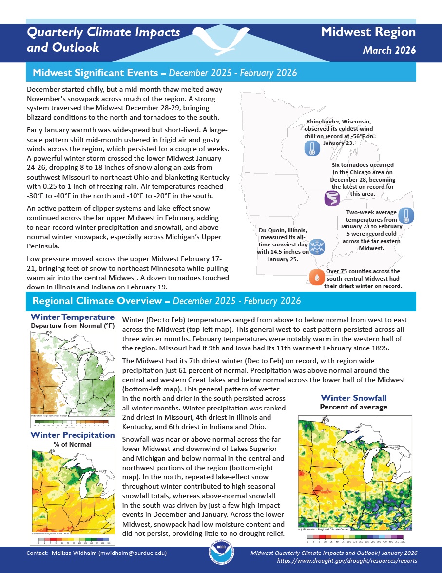
Quarterly Climate Impacts and Outlook for the Midwest Region for December 2025–February 2026. Dated March 2026.
Winter temperatures ranged from above to below normal from west to east across the Midwest. This general west-to-east pattern persisted across all three winter months. The Midwest had its 7th driest winter (December to February) on record, with region wide precipitation just 61% of normal.
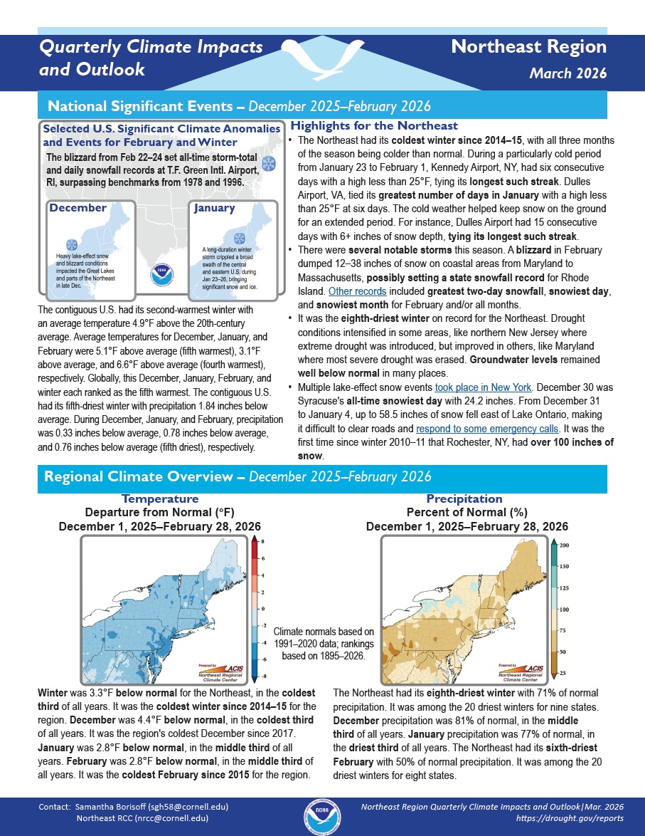
Quarterly Climate Impacts and Outlook for the Northeast Region for December 2025–February 2026. Dated March 2026.
Winter was 3.3°F below normal for the Northeast, in the coldest third of all years. It was the coldest winter since 2014–15 for the region. The Northeast had its eighth-driest winter with 71% of normal precipitation. It was among the 20 driest winters for nine states.
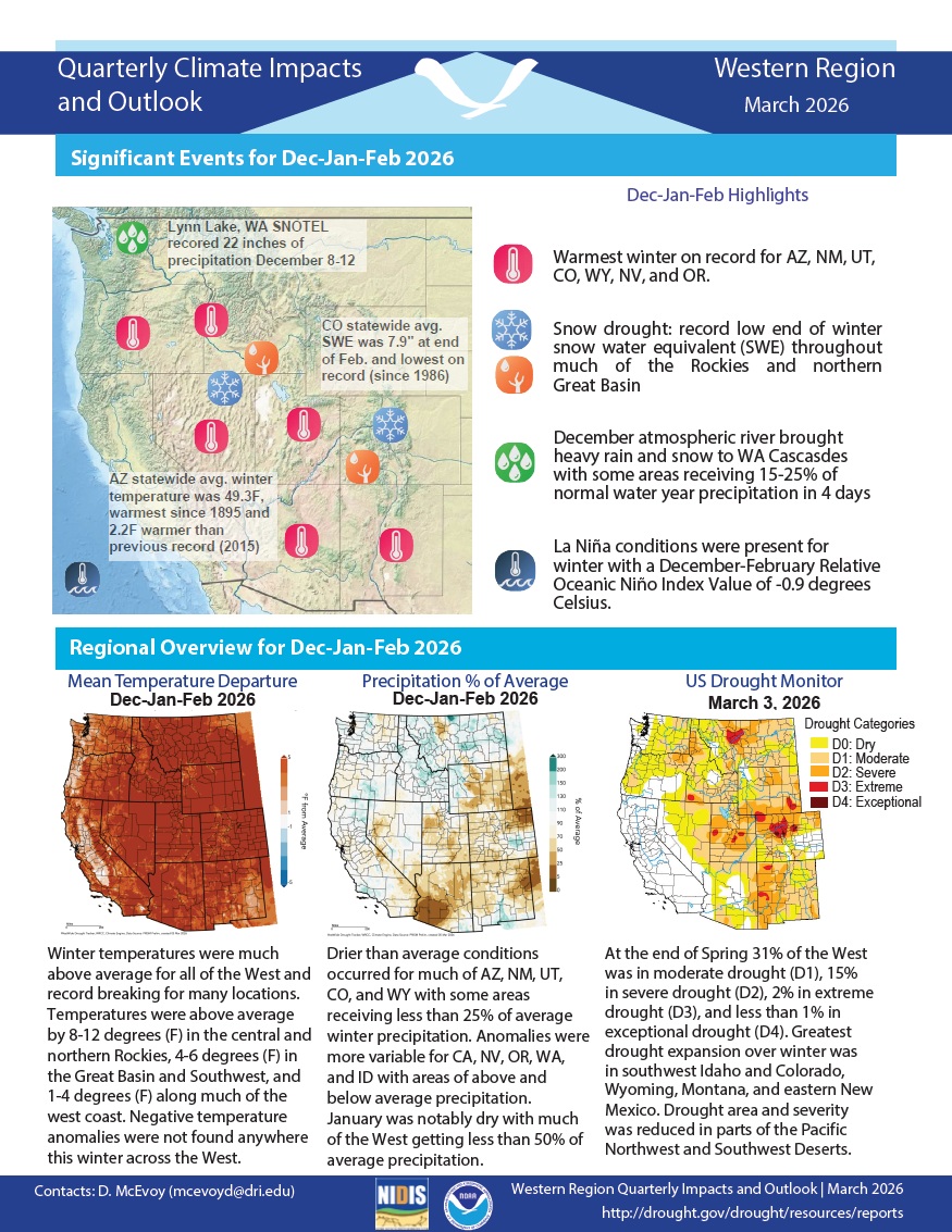
Quarterly Climate Impacts and Outlook for the Western Region for December 2025–February 2026. Dated March 2026.
Winter temperatures were much above average for all of the West and record breaking for many locations. Drier-than-average conditions occurred for much of Arizona, New Mexico, Utah, Colorado, and Wyoming, with some areas receiving less than 25% of average precipitation.
Quarterly Climate Impacts and Outlook for the Pacific Region for December 2025–February 2026. Dated March 2026.
Quarterly Climate Impacts and Outlook for the Gulf Coast Region for September–November 2025. Dated December 2025.
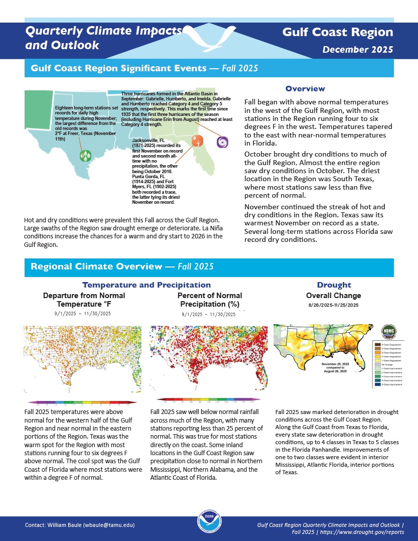
Fall 2025 temperatures were above normal for the western half of the Gulf Region and near normal in the eastern portions of the Region. Fall 2025 saw well below normal rainfall across much of the Region, with many stations reporting less than 25 percent of normal. This was true for most stations directly on the coast.
Quarterly Climate Impacts and Outlook for the Southern Region for September–November 2025. Dated December 2025.
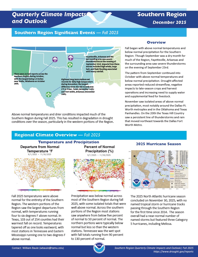
Fall 2025 temperatures were above normal for the entirety of the Southern Region. The western portions of the Region saw the largest departures from normal, with temperatures running four to six degrees F above normal. Precipitation was below normal across most of the Southern Region during fall 2025, with some isolated totals that were well above normal.