CPC Soil Moisture Outlooks - Monthly and Seasonal
NOAA/National Weather Service (NWS) Climate Prediction Center (CPC)
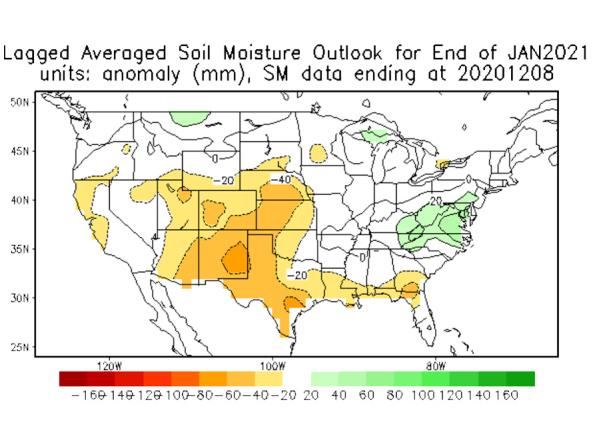
The Climate Prediction Center has developed monthly and seasonal tools based on the Constructed Analog on Soil Moisture (CAS). Note that both of these are only forecast tools. They may be used in making the official outlooks that go out to the public, but are not official forecasts in their own right.
How to
What can I do with these data?
- Check the chances for future conditions.
How do I use the site?
- Roll your cursor over the names/labels of outlook products to view the maps.
- To view image, right-click the map and select “View Image.” To save image, right-click the map and select “Save Image As...”
Access
Monthly and Seasonal Soil Moisture Outlooks – landing page for the Constructed Analog on Soil Moisture (CAS) monthly and seasonal soil moisture outlook maps
Documentation
In order to understand how continental soil moisture is used in a constructed analogue one needs to know first how soil moisture data are obtained.
Soil moisture is not measured at enough places for a long enough time to base a monitoring system for the United States on true observations. Rather, soil moisture data are generated by models in which observations play a role, but much else is generated by smart physics. Symbolically a soil moisture model can be represented by dw/dt = P - E - R + other, where w is soil moisture, P is precipitation, E is evaporation, and R is surface runoff. The w data set we will use here has been described in Huang et al(1996), where a simple hydrological model was presented. About 5 parameters are fitted to reproduce observed runoff in Oklahoma, given observed P. The E (based on Thornwhaite's expression for potential evaporation, requiring T as input) and w are important 'data' coming out of this procedure, and will be treated as proxy-observations below. Using the Oklahoma fitted parameters elsewhere, a data set for the period 1932-present has been generated at 344 Climate Divisions in the US. {As an aside: Global gridded data for a coarse resolution 1979-1998 is available also}.
One particularly important consideration is that the interannual variability in P is 2 to 3 times larger than that in E. This places an enormous burden on having accurate P - in fact everything else is secondary. This is precisely the reason why we cannot (as yet) use soil moisture produced by such comprehensive approaches as CDAS/Reanalysis (Kalnay et al 1996), because even though NCEP's Medium Range Forecast (MRF) has a better land surface model than was used in Huang et al (1996), the MRF does not assimilate observed P, but rather generates its own precipitation in the 6 hours leading up to making the next guess field - these P estimates are unsatisfactory. We thus resort to a stand alone off line model integration of a soil model requiring only P and T as input. The GCIP Land Data Assimilation Project (LDAS) is based on much the same considerations, using however the ETA land surface model. {We do consider to use the state of the art ETA land surface model (replacing Huang et al 1996) at a future time.}


