Navajo Nation Drought Severity Evaluation Tool
Navajo Nation Department of Water Resources, NASA Western Water Applications Office, Desert Research Institute
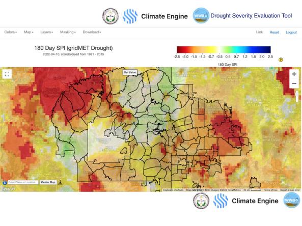
On the Navajo Nation in the four corners of the southwestern U.S., water is scarce and highly variable, and drought is pervasive. The Navajo Nation Drought Severity Evaluation Tool (DSET) is a co-developed cloud-based web application designed to meet the needs of water resource managers from the Navajo Nation, improving drought reporting and management. DSET is a spin-off of Climate Engine, a web application based on Google Earth Engine that enables users to process, visualize, download, and share global and regional climate and remote-sensing products on-demand.
The drought reports combine satellite data, modeled inputs, and in-situ data from the Navajo Nation in a web-based platform, which harnesses Google Earth Engine. The drought tool is the result of a partnership between the Navajo Nation Department of Water Resources, the Desert Research Institute, and NASA's Western Water Applications Office.
How To
Introductory Video: Introduction to DSET, with an overview of the most pressing water issues on the Navajo Nation, spoken firsthand from residents