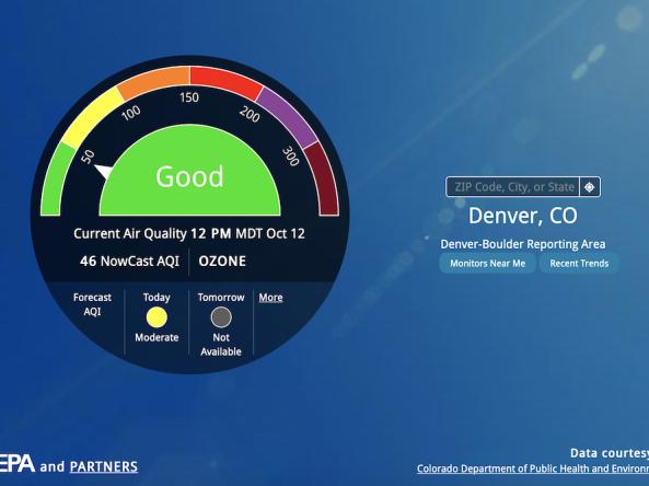
AirNow is a one-stop source for air quality data, including current and forecast air quality maps and data for more than 500 cities across the U.S., as well as Canada and Mexico.
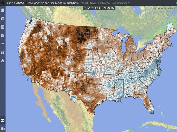
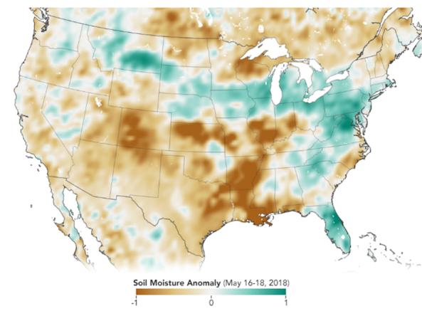
Crop-CASMA is a web-based geospatial application that provides access to high-resolution data from NASA SMAP and MODIS missions to map soil moisture and crop vegetation conditions a
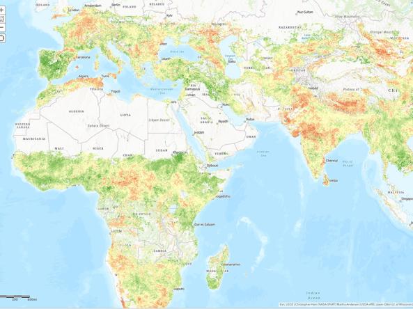
NASA/USDA provides access to Evaporative Stress Index (ESI) data products - a drought index based on remotely sensed evapotranspiration (ET).
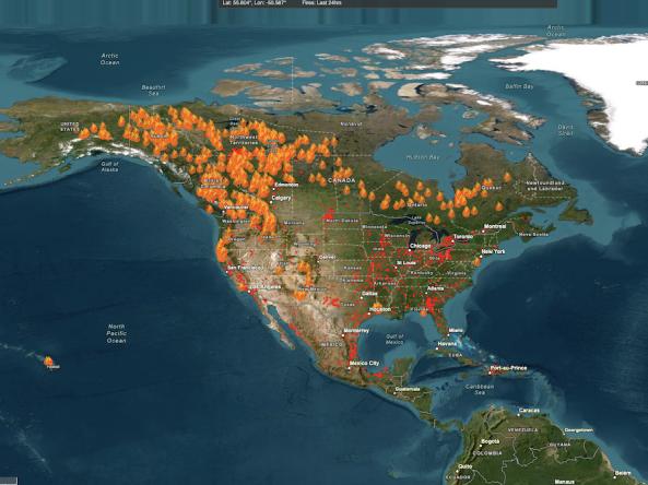
The Fire Information for Resource Management System (FIRMS) US/Canada is a joint effort by NASA and the U.S.
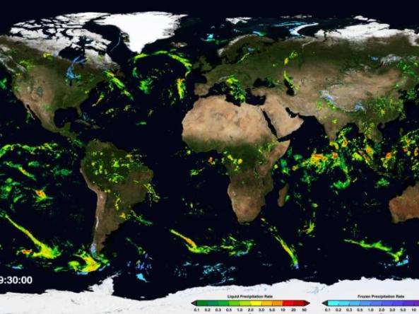
NASA GPM-IMERG: The Integrated Multi-satellitE Retrievals for GPM (IMERG) algorithm combines information from the GPM satellite constellation to estimate precipitation
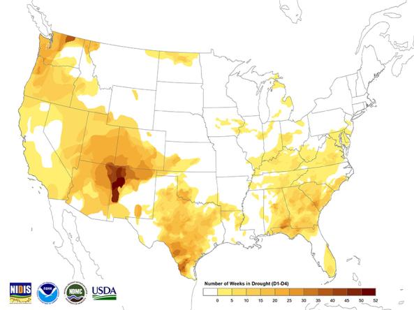
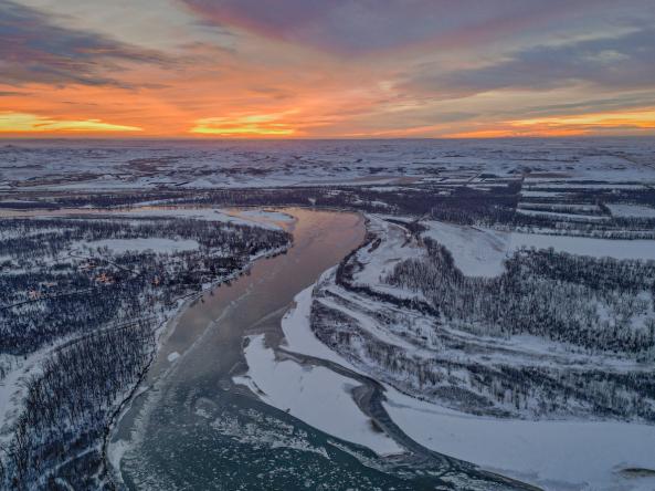
The U.S. Drought Monitor (USDM) is a weekly map, released each Thursday, to show the location and intensity of drought across the country.
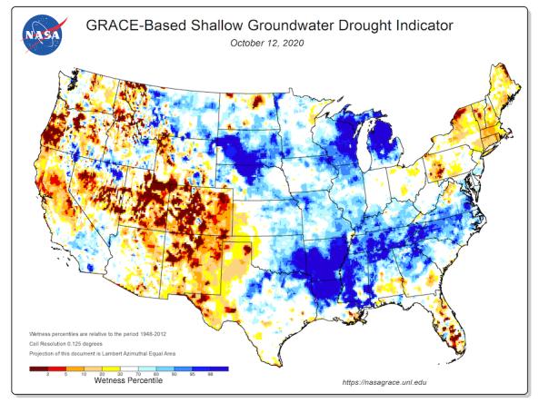
Groundwater and soil moisture drought indicators based on terrestrial water storage observations derived from GRACE satellite data and integrated with other observations, produced each week by NASA
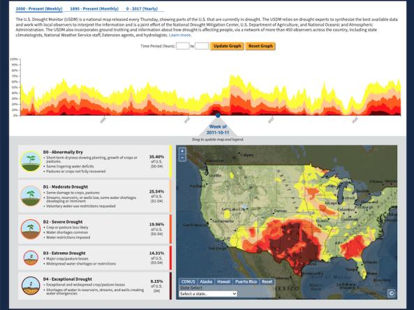
The U.S. Drought Portal's Historical Data & Conditions Tool displays three historical drought datasets side by side on an interactive time series graph and map: U.S.
NASA GPM-IMERG: The Integrated Multi-satellitE Retrievals for GPM (IMERG) algorithm combines information from the GPM satellite constellation to estimate precipitation
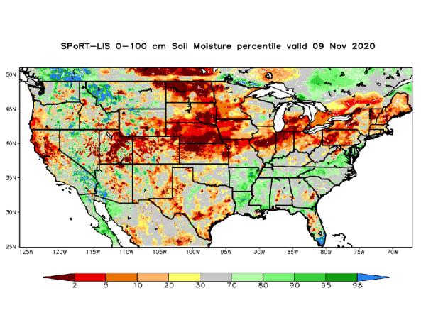
NASA’s Short-term Prediction and Transition Center – Land Information System (SPoRT-LIS) provides high-resolution (about 3-km) gridded soil moisture products in real-time to support regional and lo
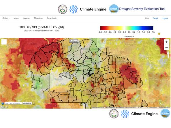
The Navajo Nation Drought Severity Evaluation Tool (DSET) is a co-developed cloud-based web application designed to meet the needs
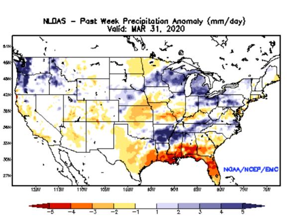
NLDAS Drought Monitor Products: an experimental drought monitor derived from near real-time soil moisture output from both the NASA MOSAIC and NCEP Noah land surface models.
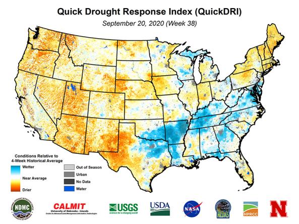
Quick Drought Response Index (QuickDRI): a geospatial tool that characterizes the intensification of short-term drought condition patterns on a weekly basis across the continental United States (CO
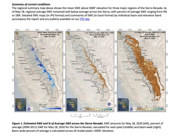
Provided by the University of Colorado Boulder and NASA's Jet Propulsion Laboratory, these reports provide near-real-time estimates of snow-water equivalent (SWE) at a spatial resolution of 50
A team of scientists at the NASA Goddard Space Flight Center conducted research to quantify the relative importance—or “drought explainability”—of specific indicators with respect to the 
The Soil Moisture Active Passive (SMAP) mission is an orbiting observatory that measures the amount of water in the top 5 cm of soil everywhere on the Earth’s surface every 3 days.
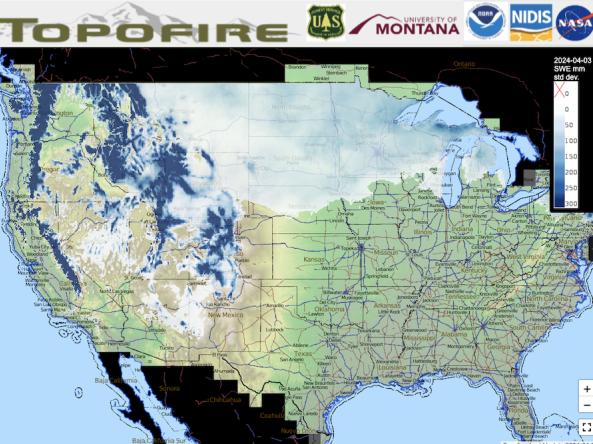
Topofire is a topographically resolved wildfire danger and drought monitoring system for the contiguous U.S.
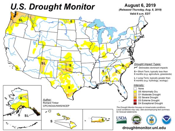
The U.S. Drought Monitor is a map updated each Thursday to show the location and intensity of drought across the country.