Resources for Soil Moisture Network Operators
Explore resources for soil moisture network operators, curated by the National Coordinated Soil Moisture Monitoring Network.
The National Coordinated Soil Moisture Monitoring Network (NCSMMN) is a multi-agency effort led by NOAA’s National Integrated Drought Information System (NIDIS) to support network managers, researchers, data users, and others working to ensure high-quality, nationwide soil moisture information for the public good.
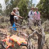
Robust, usable datasets start with good data collection. This page provides resources for managers and staff of long-term soil moisture monitoring networks. It addresses all steps of network management, from siting and installation to data quality control and long-term planning.
To stay notified on upcoming virtual seminars, workshop events, and opportunities for collaboration, sign up for the NCSMMN newsletter.

Featured Resources
A Strategy for the National Coordinated Soil Moisture Monitoring Network
The NCSMMN Strategic Plan identifies a roadmap and resources needed to implement a coordinated national network, alongside resources for both soil moisture data users and network operators.
Soil Moisture Data Quality Guidance
The Soil Moisture Data Quality Guidance document provides guidelines to standardize soil moisture data collection by mesonets and other long-term monitoring networks. It supports monitoring networks in self-assessment to create greater transparency in the quality of data for soil moisture data users.
List of U.S. Soil Moisture Networks
View a list of networks conducting long-term soil moisture monitoring in the U.S. through the U.S. Soil Moisture Networks Portal.
Resources for Network Operators
The resources below are collected from NCSMMN partners and range from support for budgeting and network planning, to operations and maintenance, to effective communication of soil moisture information.
Budgeting

Developing realistic budgets for long-term network maintenance, operations, and upgrades can support successful funding practices necessary to network survival.
The resources below provide templates and guidance for financial planning for network longevity.
- Network Budgeting Template: This spreadsheet provides a template to develop budgets for start-up, annual, and longer-term network operations and maintenance costs (from Colorado State University’s Integrated Rocky Mountain-region Innovation Center for Healthy Soil [IN-RICHES])
- Mesonet Essentials: Funding Your Mesonet: Mesonet Essentials is a resource created in collaboration with members of the American Association of State Climatologists (AASC) and the national mesonet community. This website describes considerations and tips to plan for long-term funding of a meteorological monitoring network.
- Charting a Course for Sustainable Hydrological and Meteorological Observation Networks in Developing Countries: This report provides an overview of budgeting approaches, costs, and considerations for operations and maintenance of long-term data collection networks (Grimes et al. 2022).
Network Planning and Preparation
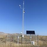
When expanding or establishing a network, conducting long-term planning, envisioning network life cycle goals and costs, following recommended quality assurance practices, and standardizing practices can facilitate usability of the data and program longevity. Below are resources for network planning and coordination with other existing networks.
- AASC Mesonet Community Atlas: This website provides a directory of all state mesonets. A mesonet (mesoscale network) is a long-term weather monitoring network that meets the American Association of State Climatologists’ (AASC) standards for station density, sensor quality, and site placement.
- U.S. Soil Moisture Networks Portal: View a list of networks conducting long-term soil moisture monitoring in the U.S.
- Summary of Statewide, Regional, and National Soil Moisture Monitoring: This PDF provides an overview of existing soil moisture monitoring networks in the U.S. as of 2021. It also discusses approaches to sensor type selection, description of common measurement depths across networks, and existing efforts to synthesize datasets at national and international scales (excerpt from the NCSMMN Strategic Plan).
- Planning a Long-Term Soil Moisture Monitoring Network: This PDF provides an overview of soils classification, site selection, sensor selection, development of installation protocols, and other considerations prior to site establishment (excerpt from Soil Moisture Data Quality Guidance).
- Environmental Considerations for Station Siting: This PDF offers in-depth discussion of site selection and potential approaches to network design (excerpt from Soil Moisture Data Quality Guidance).
- Mesonet Essentials: Mesonet Network Design: Mesonet Essentials is a resource created in collaboration with members of the American Association of State Climatologists (AASC) and the national mesonet community. This web page is a resource for selecting station sites to ensure adequate network coverage across geographies.
- AASC Recommendations and Best Practices for Mesonets: This document provides recommendations for weather network siting, sensor selection, maintenance protocols, and more (AASC 2019).
- Considerations in Soil Moisture Network Design: This PDF discusses potential intended applications, spatial distribution of sites, and recommended depths for monitoring (excerpt from the NCSMMN Strategic Plan).
- Sensor Selection: This PDF offers guidance to determine appropriate soil moisture sensor type based on soil type, installation technique, site considerations, and more (excerpt from Soil Moisture Data Quality Guidance).
- Sensor Selection Under Limiting Conditions: This table is a quick reference to select sensors based on network constraints such as soil type, space, etc. (excerpt from Soil Moisture Data Quality Guidance).
- Sensor Types and Selection: This PDF describes soil moisture sensor options, technologies associated with sensor types, and considerations for sensor selection (excerpt from the NCSMMN Strategic Plan).
- Checklist for Installing a New Sensor Network: This document lists steps for network establishment prior to, during, and post-installation (excerpt from Soil Moisture Data Quality Guidance).
Calibration, Installation, and Metadata Collection
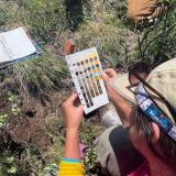
Appropriate calibration, installation, and metadata collection methods are essential to maintain quality assurance and useful data in the future. The resources below provide guidance and recommend practices for each of these important steps.
- Guidelines for Sensor Calibration: This PDF offers guidance from the NCSMMN community on soil moisture sensor calibration by soil type (excerpt from Soil Moisture Data Quality Guidance).
- Producing Representative Soil Moisture Data: Sensor Calibration and Post-Deployment Strategies: This PDF covers laboratory and field calibration of sensors, representativeness checks, and climatological comparisons (excerpt from Soil Moisture Data Quality Guidance).
- Field Estimation of Soil Water Content: A Practical Guide to Methods, Instrumentation, and Sensor Technology (2008): This guide describes methods for in-field estimation of soil water content (from the International Atomic Energy Agency).
- Mesonet Essentials: Operations & Maintenance: Mesonet Essentials is a resource created in collaboration with members of the American Association of State Climatologists (AASC) and the national mesonet community. This web page includes calibration methods and maintenance for soil moisture and meteorological sensors.
- Installation and Maintenance of Soil Moisture Stations: This PDF covers pre-installation guidance and recommended practices for soil moisture sensor installation (excerpt from the NCSMMN Strategic Plan).
- In Situ Soil Moisture Sensors in Undisturbed Soils: This video recommends practices for soil moisture sensor installation with step-by-step instructions (Caldwell et al. 2022).
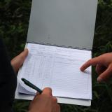
- Soil Moisture Metadata Guidance: This document describes steps to assure quality metadata collection for soil moisture networks. It provides a tiering system to classify network data quality relative to community recommended practices.
- Metadata Quality Table: This table provides a quick reference to self-identify quality tier classification for soil moisture metadata (excerpt from Soil Moisture Metadata Guidance).
Operations & Maintenance
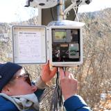
High-quality data relies on proper station upkeep, which, in turn, depends on planning and knowledge of recommended practices for sensor care, replacement, and repair. Manufacturers provide the most relevant information specific to sensor type. However, the resources below provide general recommendations for operations and maintenance of long-term soil moisture networks.
- AASC Recommendations and Best Practices for Mesonets: This document provides guidance to operate and maintain mesonets (from the American Association of State Climatologists).
- Mesonet Essentials: Operations and Maintenance: Mesonet Essentials is a resource created in collaboration with members of the American Association of State Climatologists (AASC) and the national mesonet community. This web page includes examples of different types of maintenance and why each activity is important, using case studies as examples.
- Mesonet Essentials: Challenges for Mesonets: Mesonet Essentials is a resource created in collaboration with members of the American Association of State Climatologists (AASC) and the national mesonet community. This web page includes examples of challenges to network success and recommendations from experienced network managers.
- Mesonet Essentials: Planning and Executing Site Visits: Mesonet Essentials is a resource created in collaboration with members of the American Association of State Climatologists (AASC) and the national mesonet community. This web page provides information about maintenance schedules, sensor calibration, and useful tools for a site visit for meteorological sensors common to mesonet stations.
- AASC Mesonet Paper on Operating a Network: This article includes recommendations for appropriate documentation during site visits, common causes of sensor errors, and more (Fiebrich et al. 2020).
- Maintenance: This PDF provides information on in-field calibration, preventative maintenance of soil moisture sensors, unscheduled maintenance, and management of land cover (excerpt from the NCSMMN Strategic Plan).
Quality Assurance & Quality Control
Quality assurance refers to practices taken to ensure data robustness prior to data collection, such as sensor calibration, installation protocols, and collection of metadata. Quality control refers to practices undertaken to improve data integrity and flag errors following data collection. Both are important to producing usable, robust datasets. The resources below provide guidance on practices for producing high-quality data.
- Producing Representative Soil Moisture Data: Sensor Calibration and Post-Deployment Strategies: This PDF describes quality assurance practices for sensor calibration (before deployment) and options for validation (after deployment) (excerpt from Soil Moisture Data Quality Guidance).
- Quality Control and Quality Assurance of Soil Moisture Data: This PDF describes how to identify, flag, and address potential data errors (excerpt from Soil Moisture Data Quality Guidance).
- Data Quality Tiers of Soil Moisture Data: This PDF describes a tiering system to self-characterize soil moisture data quality for data users and for network documentation (excerpt from Soil Moisture Data Quality Guidance).
- AASC Mesonet Paper on Operating a Network: This paper includes approaches to basic quality control for meteorological and soil moisture data (Fiebrich et al. 2020).
Sharing and Standardizing Soil Moisture Information
Coordination across soil moisture networks improves data utility by standardizing approaches, building opportunities to collaborate, and leveraging work and expertise across institutions. The resources below offer further information about the NCSMMN, existing soil moisture networks in the United States, and opportunities to find or share data.
- National Coordinated Soil Moisture Monitoring Network (NCSMMN): This website provides background information about the NSCMMN, including upcoming events, ongoing and recent projects, and more.
- U.S. Soil Moisture Networks Portal: This web page features an interactive map of networks that are conducting long-term soil moisture monitoring in the U.S.
- International Soil Moisture Network (ISMN): This collaborative initiative provides data access and downloads from participating networks, worldwide. New networks may share data through this portal.
- CUAHSI Hydrologic Information System: This non-profit operated website provides a portal for data sharing or download.
- Synoptic Data Viewer: Synoptic Data is a core partner in a National Weather Service-led data acquisition project in the Upper Missouri River Basin. Synoptic provides data aggregation across networks nationally and beyond. Some services are for a fee, but networks can also opt in to sharing data using this platform at no cost. Public data can be directly downloaded by users with a free account.
Communicating Soil Moisture
The public value of soil moisture data relies on clearly and effectively communicating soil moisture information in a usable format. The resources below provide considerations for designing communications, as well as examples of user-focused formats to report soil moisture data.
- User-Specific Needs for National Soil Moisture Products: This PDF describes considerations and example data formats for accessible, intuitive soil moisture products (excerpt from the NCSMMN Strategic Plan).
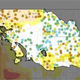
- Upper Missouri River Basin Soil Moisture and Snow Maps Dashboard: This web page features interactive maps of in situ soil moisture and snowpack data from the Montana, Nebraska, North Dakota, South Dakota, and Wyoming state mesonets. The dashboard is the result of a project to display soil moisture data from new stations with a short period of record, by creating maps that take into account trends, soil type, and plant stress.
- Modeling and Remote Sensing: This PDF provides helpful contextual information on how modeled and remotely-sensed soil moisture estimates are generated and their relationship to in situ data (excerpt from the NCSMMN Strategic Plan).
- Soil Moisture 101: What It Means and How It’s Measured: This recorded webinar provides an introduction to in situ, remotely-sensed, and modeled soil moisture data and products (from the NCSMMN, NIDIS, and the National Weather Service).
Explore Related Pages
The National Coordinated Soil Moisture Monitoring Network
The National Coordinated Soil Moisture Monitoring Network (NCSMMN) is a multi-agency, multi-institutional initiative to integrate soil moisture data from around the country and to capitalize on its transformative potential for a wide range of applications across economic sectors.
Soil Moisture Data & Maps
The techniques for monitoring soil moisture are undergoing rapid growth and innovation with the advent of new in situ and proximal sensors, new satellite and other remote sensing technologies, and enhanced modeling capabilities. Explore soil moisture data and maps on Drought.gov.