NRCS SNOTEL and Snow Course Data
U.S. Department of Agriculture's (USDA's) National Resources Conservation Service (NRCS)
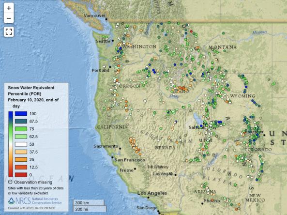
Point maps and interactive maps of snow water equivalent, snow depth, and snow density from the Natural Resources Conservation Service (NRCS) Snow Telemetry (SNOTEL).
SNOTEL is an automated near real-time data collection network that provides mid- to high-elevation hydroclimatic data from mountainous regions of the western United States. A standard SNOTEL station provides snow water equivalent, snow depth, precipitation, and temperature data. The SNOTEL network is maintained by the USDA Natural Resources Conservation Service Snow Survey and Water Supply Forecasting Program.
How to
How to use this site:
- Select between available snow products – Snow Water Equivalent, Snow Depth, and Snow Density
- Each product includes links to available map products
Access
NRCS SNOTEL & Snow Course Data: View precipitation, streamflow, and snow water equivalent conditions on interactive maps
Predefined Maps: Explore predefined maps organized by data type