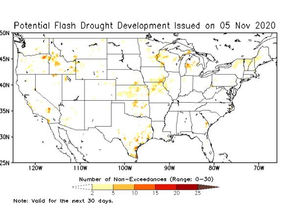
Potential Flash Drought Detection Tool from NLDAS-2
National Oceanic and Atmospheric Administration's (NOAA) Climate Prediction Center (CPC)
This flash drought detection product is a "subseasonal tool to predict areas susceptible to flash drought development using the Phase 2 of the North American Land Data Assimilation System (NLDAS-2) data. The tool calculates the rapid change index (RCI) using 7-day mean evapotranspiration anomalies. RCI is the accumulated magnitude of moisture stress changes (standardized differences) occurring over multiple weeks, and drought is likely to develop when RCI is negative. Since RCI changes with time, like all drought variables, it is difficult to capture drought development signals by monitoring RCI maps. This tool is used to inform the official forecasts.
In order to create an intuitive drought prediction map that directly depicts drought tendency, we use a threshold method to identify grid points with large decreases of 7-day mean evapotranspiration anomaly (i.e., RCI less than −0.5) in the last 30 days and under the condition that 3-month standardized precipitation index is less than −0.4. The real-time tool started running on 1 April 2018 at the NOAA Climate Prediction Center (CPC) and has been used to support CPC’s Monthly Drought Outlook efforts" (Chen et. al., 2020).
ACCESS
Drought.gov includes the Potential Flash Drought Detection product on the Drought.gov Outlooks and Forecast maps.
The NOAA/CPC website has maps of the Potential Flash Drought Detection product, which are updated daily.
The raw data is available as GeoTIFF files from NOAA/CPC.
Drought.gov produces image tiles in XYZ format that are usable in GIS mapping applications.
DOCUMENTATION
The product is documented in the publication "Real-Time Prediction of Areas Susceptible to Flash Drought Development" by L. Gwen Chen, Adam Hartman, Brad Pugh, Jon Gottschalck and David Miskus


