Tree Mortality Viewer
California Department of Forestry and Fire Protection, U.S. Forest Service
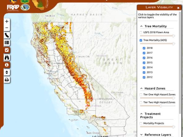
California has been facing the worst epidemic of tree mortality in modern history. Five years of drought, combined with the increased infestation of native bark beetles, have contributed to the death of millions of trees on federal, state, and private lands across California.
The purpose of this viewer is to allow private citizens and stakeholder entities to participate in understanding the areas of greatest impact. Primary layers include the U.S. Forest Service Aerial Detection Survey (depicting tree mortality), High Hazard Zones (for prioritizing hazard tree removal), and public Mortality Projects (where hazard tree removal projects have occurred).
Access
Tree Mortality Viewer: Interactive map of California showing numbers of dead trees per acre, high hazard zones, asset locations, and more information related to drought-caused tree mortality
Documentation
Tree Mortality Viewer help page: Learn about the application and its data sets