An official website of the United States government
Here’s how you know
The .gov means it’s official.
Federal government websites often end in .gov or .mil. Before sharing sensitive information, make sure you’re on a federal government site.
The site is secure.
The
https://
ensures that you are connecting to the official website and that any information you provide is encrypted and transmitted securely.
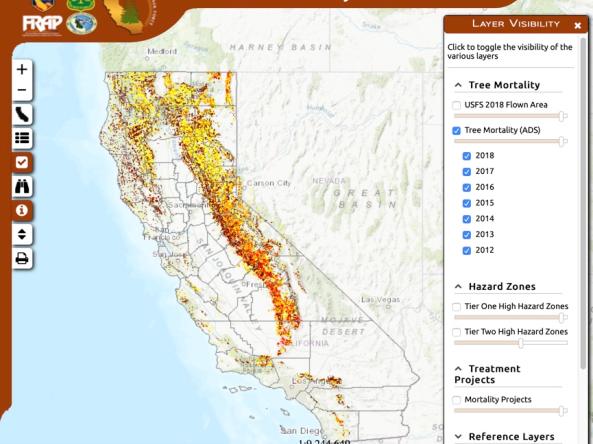
Interactive map shows results of 2012-2018 aerial tree-mortality surveys: numbers of dead trees per acre, high hazard zones, asset locations and more information related to drought-caused tree
Period of Record
2012 - 2018
File Format
images
pdf
Looking for State or Local Maps?
The Current Conditions page features national conditions. You can also explore maps of current and future conditions by state, watershed, county, or city.