U.S. Topsoil Moisture Monitoring
NOAA National Weather Service (NWS) Climate Prediction Center (CPC)
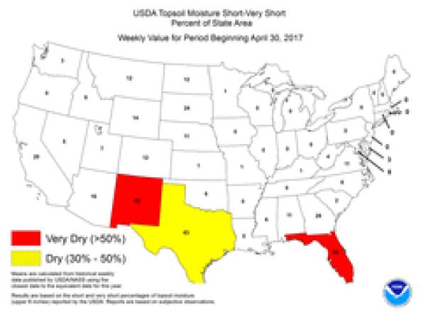
The Climate Prediction Center produces Topsoil Moisture Monitoring maps based on United States Department of Agriculture (USDA) state reports of topsoil moisture conditions.
Means are calculated from historical weekly data published by the U.S. Department of Agriculture's (USDA's) National Agricultural Statistics Service using the closest date to the equivalent date for the year. Results are based on the short and very short percentages of topsoil moisture (upper 6 inches) reported by the USDA. Reports are based on subjective observations.
How to
What can I do with these data?
- View current observations and compare current and past conditions
How do I use the site?
- Click on the images to enlarge.
- To save image, right-click the map and select “Save Image As...”
Access
Topsoil Moisture Monitor maps: home page for the Topsoil Moisture Monitor. Maps include USDA Topsoil Moisture Short-Very Short Percent of State Area, USDA Topsoil Moisture Short-Very Short Current Vs. 5-Year Mean, and USDA Topsoil Moisture Short-Very Short Vs. 10-Year Mean.