California-Nevada Drought & Climate Outlook Webinar - October 9, 2016
Current Drought Conditions
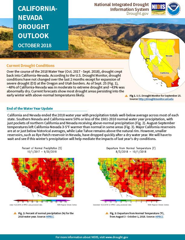
Over the course of the 2018 Water Year (Oct. 2017 - Sept. 2018), drought crept back into California-Nevada. According to the U.S. Drought Monitor, drought conditions have not changed over the last 2 months except for expansion of severe drought (D3) at the Oregon and Utah borders. As of Sept. 25, ~48% of California-Nevada was in moderate to extreme drought and ~43% was abnormally dry. Current forecasts show most drought areas persisting into the early winter with above-normal temperatures likely.
End of the Water Year Update
California and Nevada ended the 2018 water year with precipitation totals well-below average across most of each state. Southern Nevada and California were 50% or less of the 1981-2010 normal water year precipitation, with just pockets of northern California and Nevada receiving above-normal precipitation. August-September temperatures left California-Nevada 3-5°F warmer than normal in some areas (Fig. 3). Major California reservoirs are at or just below historical averages, while Lake Tahoe remains above the natural rim. However, smaller reservoirs, such as Rye Patch reservoir in Nevada, have dropped quickly after a dry water year. We will have to wait and see if this winter’s precipitation will help mediate the impacts of last year’s dry conditions.
Drought & Climate Outlook
- ENSO: ENSO-neutral conditions continued as most of the equatorial Pacific sea surface temperatures are near-to-above average, but recent westerly wind anomalies are adding confidence in the El Niño forecast. NOAA’s ENSO alert system status is currently an El Niño Watch, with a 50-55% chance of El Niño developing during the fall, increasing to 65-70% during winter 2018-2019. For more information, check out the NOAA ENSO blog.
- Temperature: Warm temperatures are favored over California-Nevada through early winter with >40% chance of above-normal Oct.-Dec. temperatures, with the greatest chances over the southeastern part of the region.
- Precipitation: Most of California and Nevada have equal chances of above, below, and normal October-December precipitation except at the northern (favoring below) and southern (favoring above) boundaries of the region. Current drought conditions are forecasted to persist through early winter.
- Wildfire: The National Significant Wildland Fire Potential Outlook shows above-normal wildfire potential in October over north-central California-Nevada as well as coastal California.
Tools presented during the September webinar:
- Redesigned California Climate Tracker (link is external)(CACT) from the Western Regional Climate Center & California Dept. of Water Resources. Now featuring interactive data dashboard that shows the most recent month’s climate information. A ‘Heatmap’ that color-codes temperature or precipitation departures from normal from 1895 to Present has been added to the dashboard.
- Water Storage Tracking in California(link is external) from CNAP, a NOAA RISA & USGS. Combines daily storage updates from 28 reservoirs with snow-pack totals for the Sierra Nevada.
- Odds of Reaching Normal Water Year Precipitation(link is external) from CW3E & USGS. Shows the odds of reaching 100% of normal precipitation by the end of the water year, based on how much has historically been observed during a full water year.


