Quarterly Climate Impacts and Outlook for the Great Lakes Region for March–May 2025. Dated June 2025.
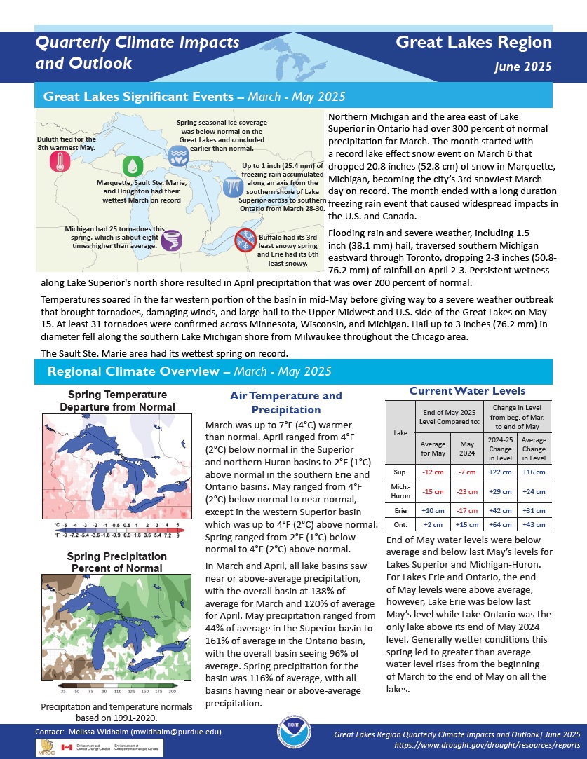
Spring temperatures ranged from 2°F (1°C) below normal to 4°F (2°C) above normal. Spring precipitation for the basin was 116% of average, with all basins having near or above-average precipitation.
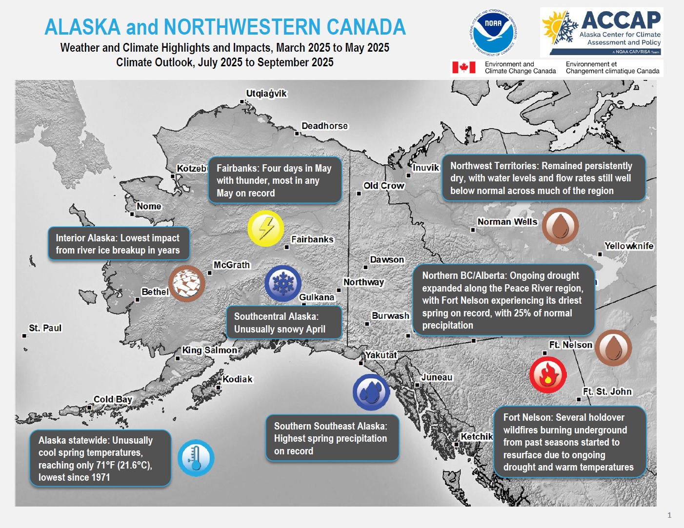
Quarterly Climate Impacts and Outlook for Alaska and Northwestern Canada for March–May 2025, with an outlook for July–September 2025. Dated June 2025.
ECCC, NOAA, and partners created these outlooks to inform the public about recent impacts within their respective regions. Each regional report contains easy-to-understand language, and anyone can access them through the U.S. Drought Portal.
Quarterly Climate Impacts and Outlook for the Western Region for March–May 2025. Dated June 2025.
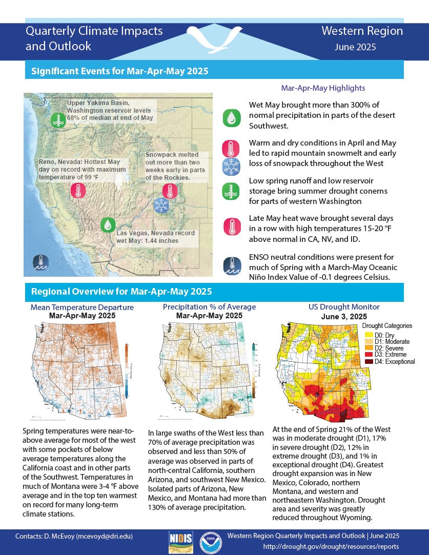
Spring temperatures were near to above average for most of the West, with some pockets of below-average temperatures along the California coast and in other parts of the Southwest. In large swaths of the West, less than 70% of average precipitation was observed. Less than 50% of average precipitation was observed in parts of north-central California, southern Arizona, and southwest New Mexico.
Quarterly Climate Impacts and Outlook for the Pacific Region for March–May 2025. Dated June 2025.
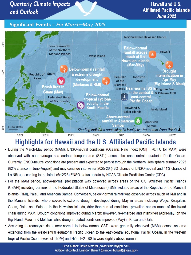
For the March-May period, above-normal precipitation was observed across areas of the U.S. Affiliated Pacific Islands (USAPI) including portions of the Federated States of Micronesia (FSM), isolated areas of the Republic of the Marshall Islands (RMI), Palau, and American Samoa. Conversely, below-normal rainfall was observed across much of RMI and in the Mariana Islands. In the Hawaiian Islands, drier-than-normal conditions prevailed across much of the island chain.
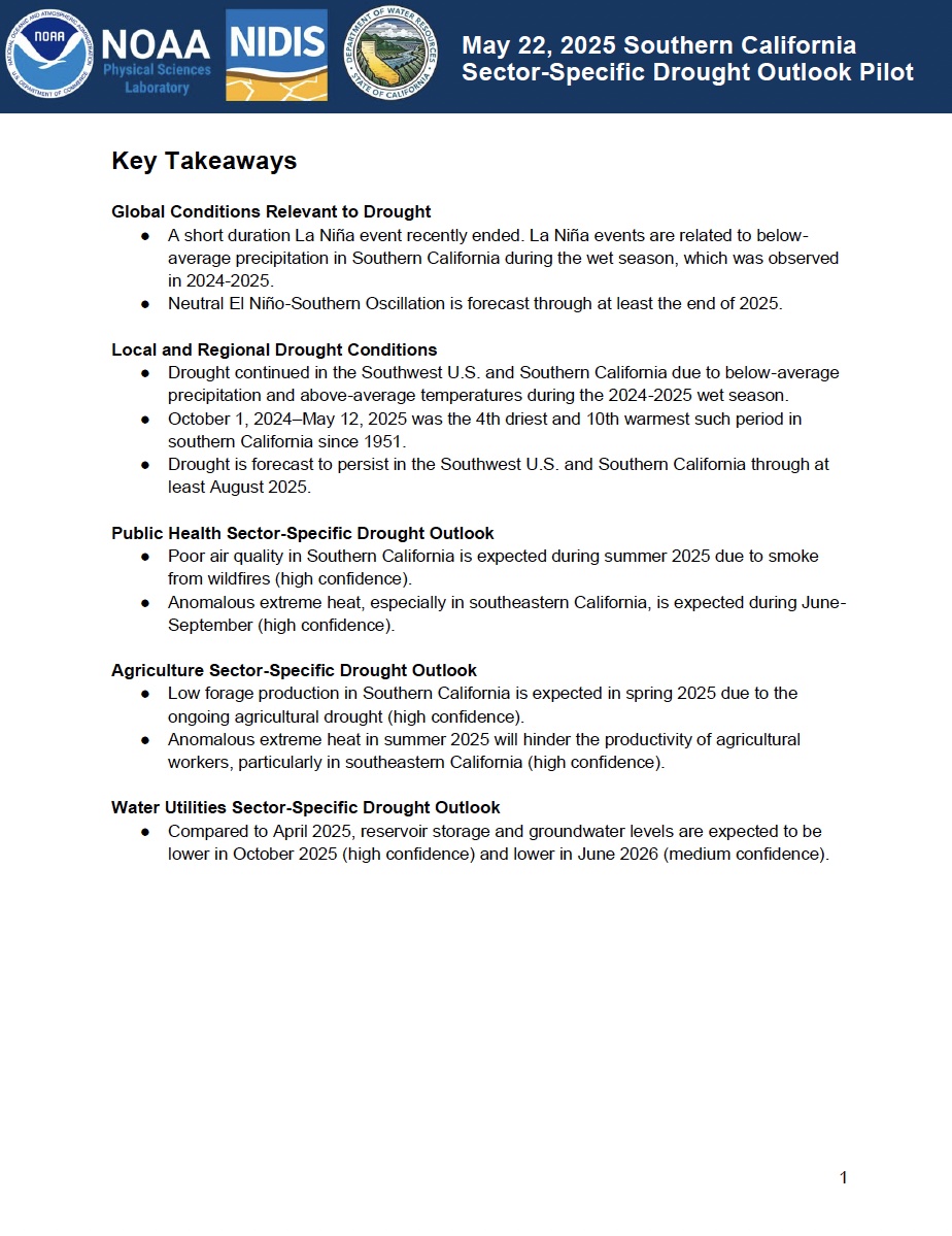
NOAA’s National Integrated Drought Information System (NIDIS) and Physical Sciences Laboratory are partnering with the California State Climatologist/California Department of Water Resources, NOAA’s National Weather Service and National Centers for Environmental Information, and the California-Nevada Adaptation Program (a NOAA CAP team) on the Sector-Specific Drought Early Warning Outlook – Southern California Pilot.
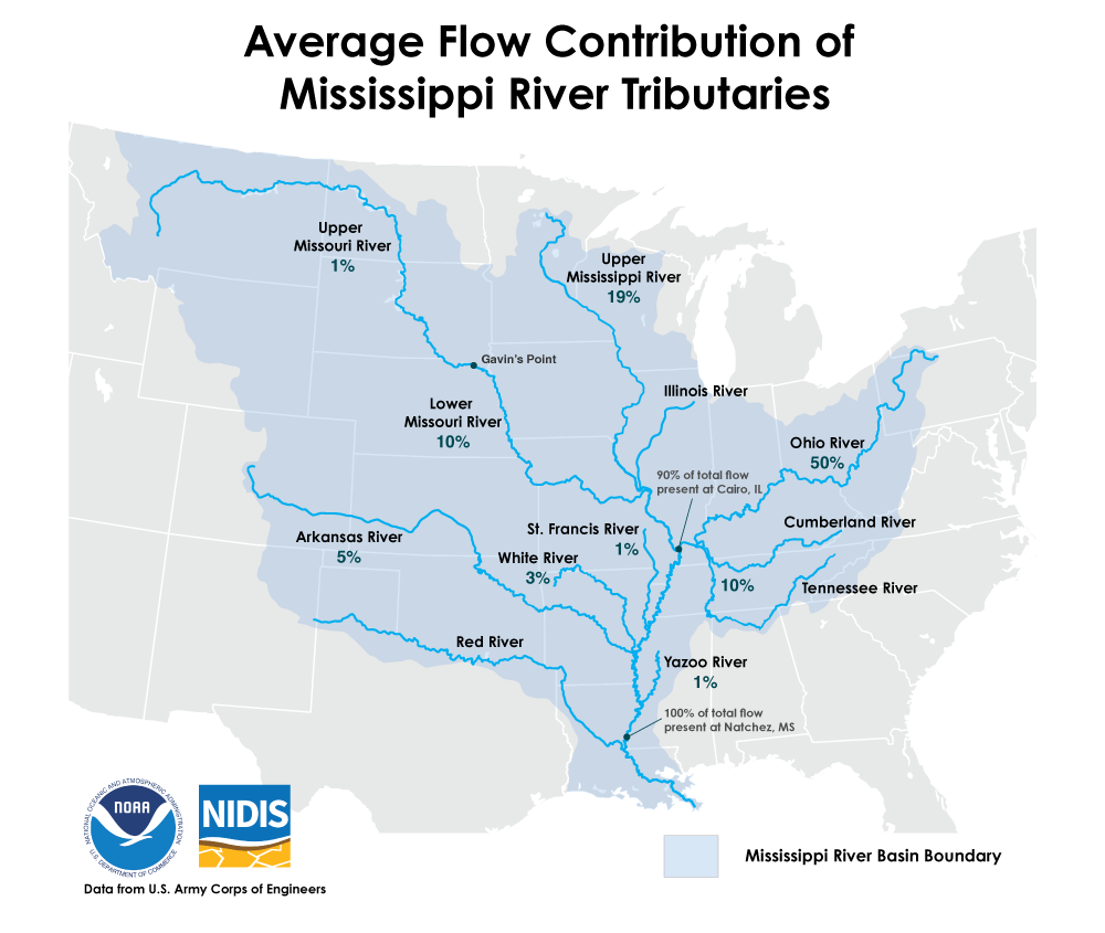
When considering low water or flooding on the Lower Mississippi, the rain that falls in Mississippi, Arkansas, or Louisiana has very little to do with it. This is because most of the water in the Lower Mississippi comes from upstream rivers. At the point where the Ohio River meets the Mississippi River (i.e., Cairo, Illinois), 90% of the water has entered the mainstem Mississippi River which will then be discharged into the Gulf. The final 10% of river flows come from the St.
This report summarizes the ideas and thoughtful participation of speakers and attendees of the 2024 Midwest Drought Early Warning System (DEWS) Partners Meeting, held in Indianapolis, Indiana on August 20-22, 2024.
NOAA’s National Integrated Drought Information System (NIDIS) and Physical Sciences Laboratory are partnering with the California State Climatologist/California Department of Water Resources, NOAA’s National Weather Service and National Centers for Environmental Information, and the California-Nevada Adaptation Program (a NOAA CAP team) on the Sector-Specific Drought Early Warning Outlook – Southern California Pilot.
Quarterly Climate Impacts and Outlook for the Mid-Atlantic Region for December 2024–February 2025. Dated March 2025.
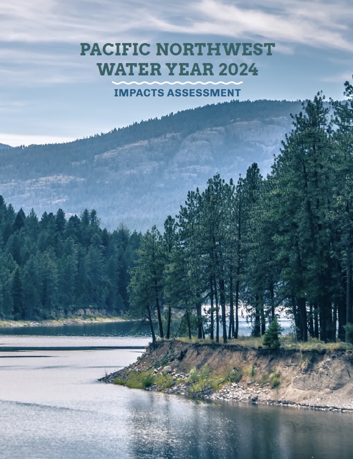
The purpose of the Pacific Northwest Water Year 2024 Impacts Assessment is to connect the water year conditions to sector-specific impacts to inform planning, response actions, and technical and scientific information needs. Ultimately, the assessment can be used as a resource for future management of drought and other climate extremes.