Mississippi River Flow Contribution Diagram
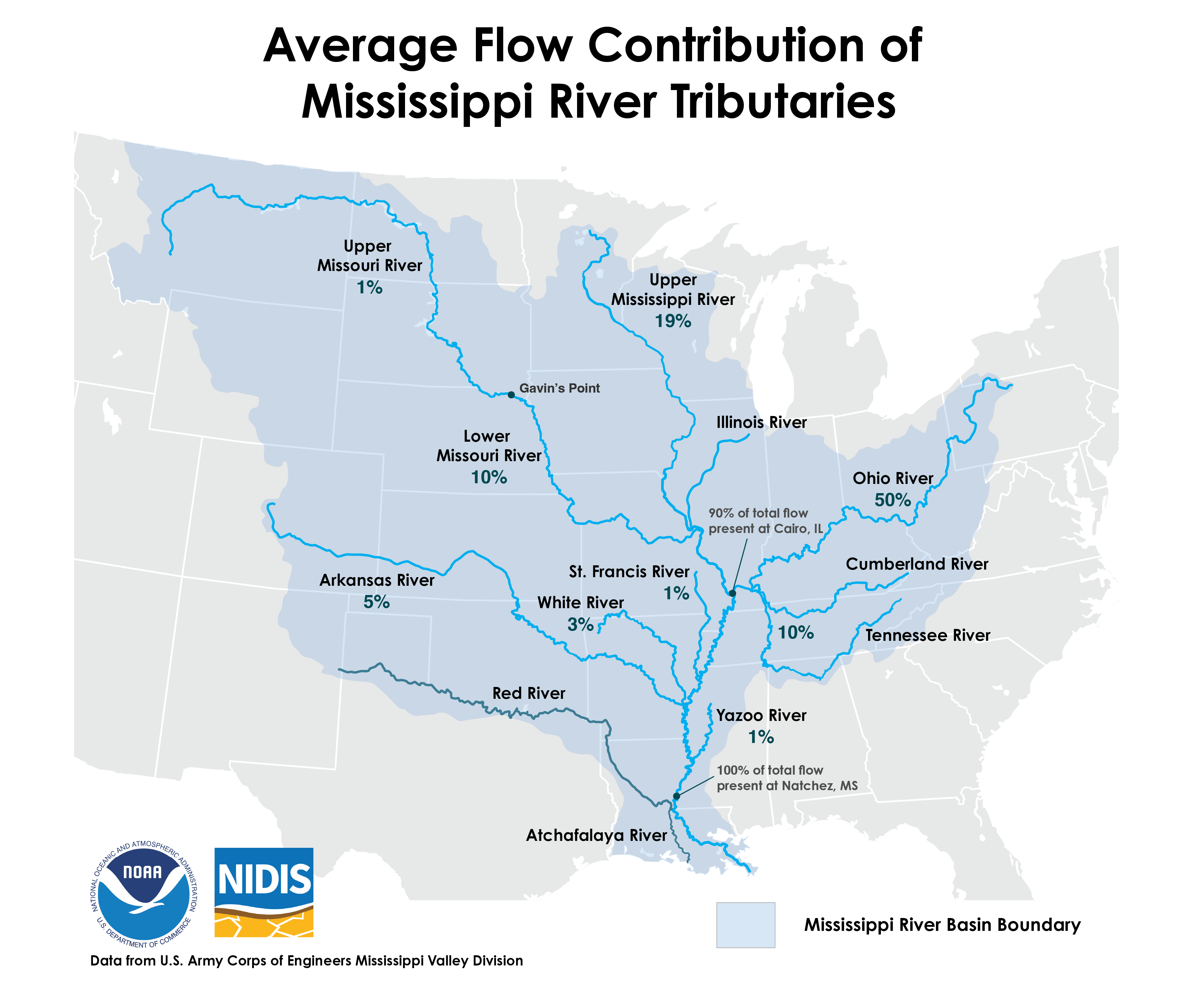
This graphic shows flow distribution across the Mississippi River Basin using data from the U.S. Army Corps of Engineers.
When considering low water or flooding on the Lower Mississippi, the rain that falls in Mississippi, Arkansas, or Louisiana has very little to do with it. This is because most of the water in the Lower Mississippi comes from upstream rivers. At the point where the Ohio River meets the Mississippi River (i.e., Cairo, Illinois), 90% of the water has entered the mainstem Mississippi River which will then be discharged into the Gulf. The final 10% of river flows come from the St. Francis, White, Arkansas, and Yazoo Rivers, which enter the mainstem Mississippi below Cairo.
Note: The Red and Atchafalaya Rivers do not flow into the Mississippi. The average flow contribution from the Illinois River is captured in the flow contribution for the Upper Mississippi.
