National Integrated Drought Information System (NIDIS)
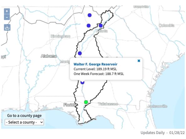
The ACF River Basin Drought and Water Dashboard is a web-based application that allows decision makers to view real-time information on the ACF River Basin all in one place.
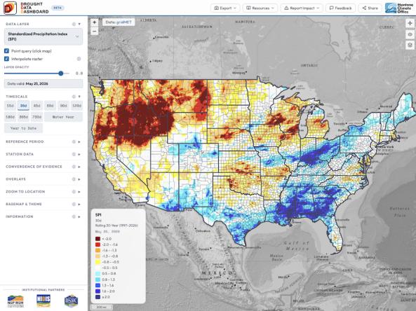
The Drought Data Dashboard, or D³, is an interactive mapping tool that allows users to view, analyze, and customize the display of key drought indices and climate variables across the co
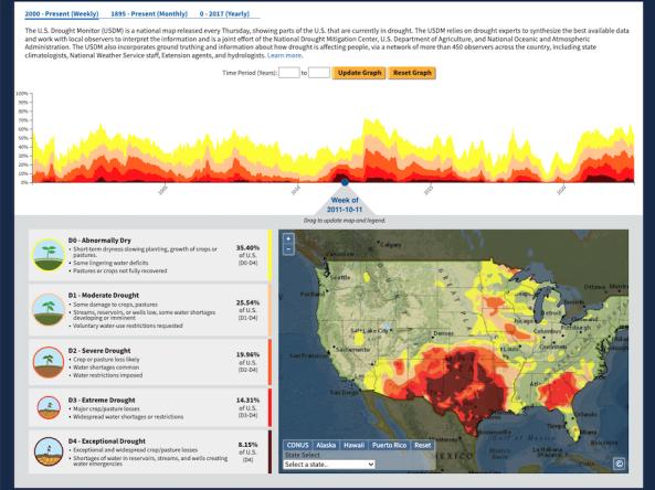
The U.S. Drought Portal's Historical Data & Conditions Tool displays three historical drought datasets side by side on an interactive time series graph and map: U.S.
A team of scientists at the NASA Goddard Space Flight Center conducted research to quantify the relative importance—or “drought explainability”—of specific indicators with respect to the 
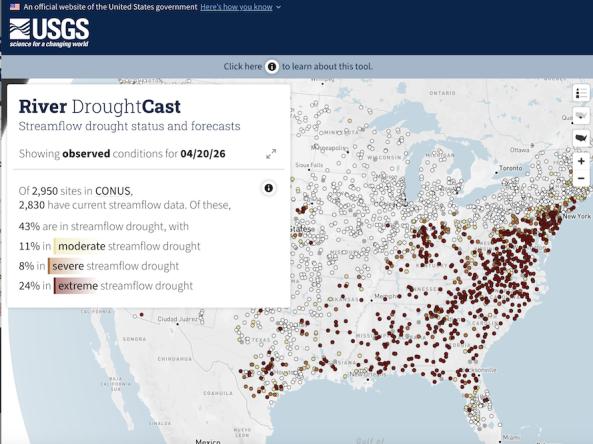
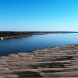
River DroughtCast is an interactive online tool that delivers current streamflow drought conditions and weekly forecasts of streamflow drought at approximately 3,000 USGS streamgages with mor
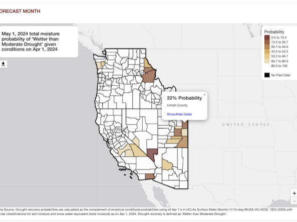
The Climate Toolbox’s Drought Recovery Tool allows users to investigate the probability of recovering from drought conditions in the Western U.S.
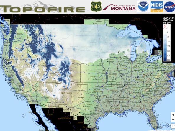
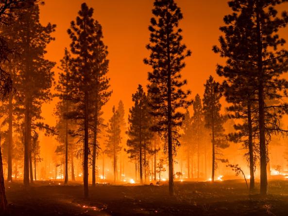
Topofire is a topographically resolved wildfire danger and drought monitoring system for the contiguous U.S.
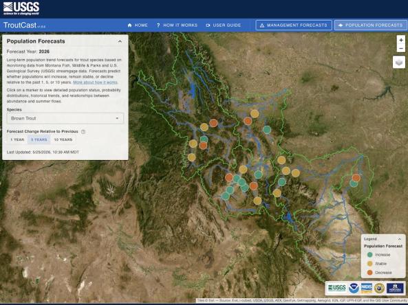
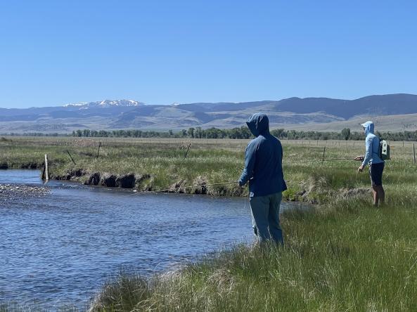
TroutCast is an interactive tool that helps users explore the projected impacts of drought on trout across Montana’s renowned blue-ribbon rivers.
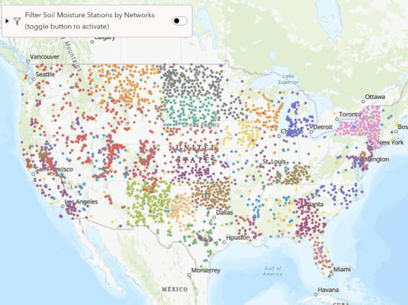
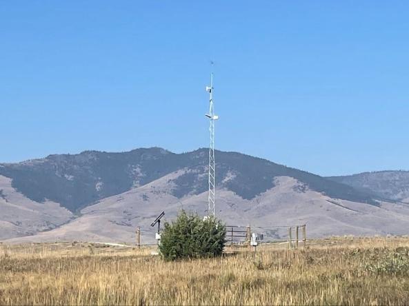
From 2018-2026, the research-based website NationalSoilMoisture.com provided high-resolution gridded soil moisture products derived from in situ soil moisture measurements, Natural Re