Topofire
University of Montana, U.S. Forest Service, National Aeronautics and Space Administration (NASA), NOAA's National Integrated Drought Information System (NIDIS)
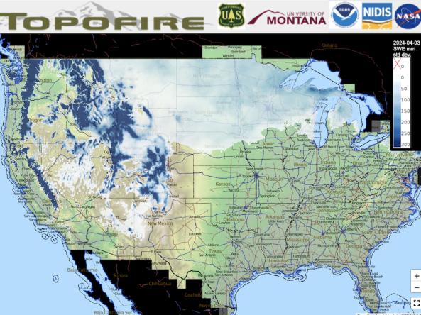
Topofire is a topographically resolved wildfire danger and drought monitoring system for the contiguous U.S.
The Topofire model methodology considers terrain and solar radiation, thus better capturing the effect that terrain geometries have on the spatial distribution of energy inputs. The model generates daily, near real-time, high-resolution (250m) gridded soil moisture and snow water equivalent (SWE) anomalies, using the 30-year period of record 1992-2021. Anomalies for each day are determined by first calculating the mean from a 14-day window around that day, and then the current day anomaly is the departure from the 14-day mean relative to the other 30 years of data. The soil moisture anomalies are for the total column.
How To
What can I do with these data?
- View current conditions for soil moisture and snow water equivalent (SWE) to assess ground and fuel moisture levels and drought conditions.
How do I use the site?
- Select the variable to display on the map from the layers tab on the left side panel.
- Adjust the map base layer on the right side panel.
- Use the + or - buttons to zoom in or out of the map image.
- To save the map image, take a screenshot of the map.
Access
Interactive Map: Access the Topofire interactive map viewer
Daily Grids: Download daily historical gridded data
Documentation
For details about Topofire, see: TOPOFIRE: A Topographically Resolved Wildfire Danger and Drought Monitoring System for the Conterminous United States
Learn more about the NIDIS-funded research to upgrade the Topofire model.