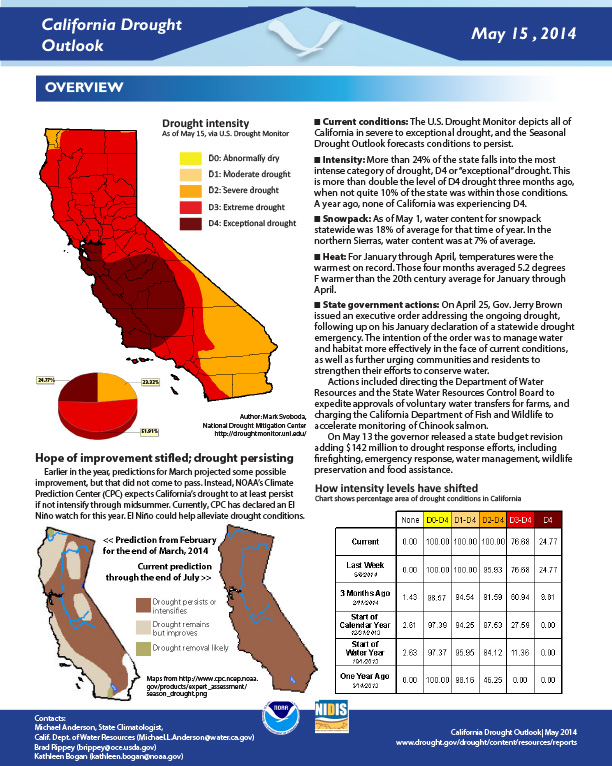
California Drought Outlook. Current conditions, outlooks, and impacts.
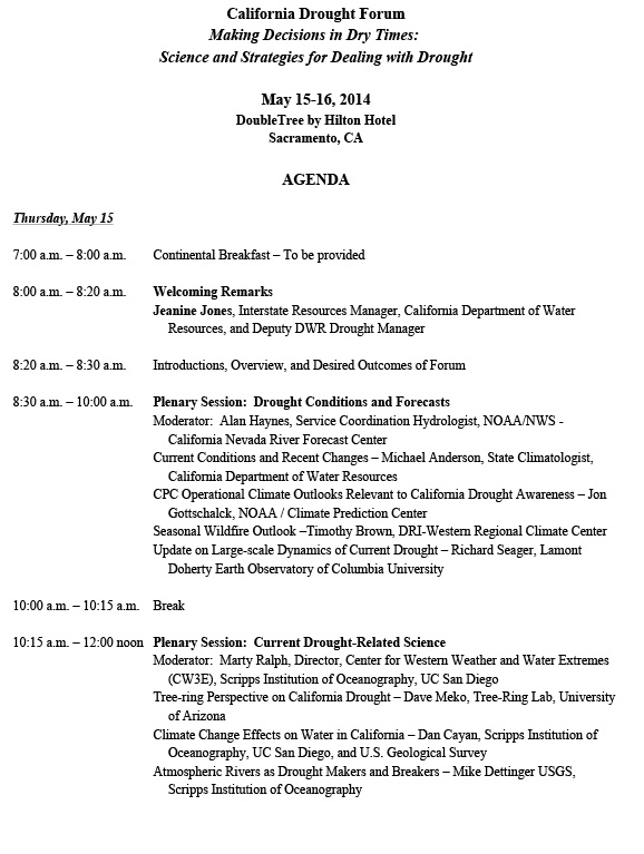
Agenda from the California Drought Forum Making Decisions in Dry Times: Science and Strategies for Dealing with Drought. Held May 15-16, 2014 in Sacramento, CA.
Presented at the California Drought Forum May 14-15, 2014 in Sacramento, CA.
Presented at the California Drought Forum May 15-16, 2014 in Sacramento, CA.
Capsule bios for presenters at drought forum in Sacramento, May 15-16, 2014.
Presented at the California Drought Forum May 15-16, 2014 in Sacramento, CA.
Overview of NOAA and NIDIS activities in the Russian River.
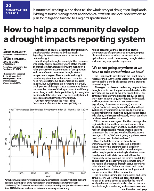
NIDIS news story about helping communities develop drought impacts reporting methods. The article spends time talking about issues faced on tribal lands, specifically on Hopi lands.
Suggest EDIT:
Story about issues on tribal lands, specifically Hopi lands, on how communities can develop drought impacts reporting methods. Existing resource management and technical staff can use local observations to plan for mitigation tailored to a region’s specific needs.
From Dry Times, the NIDIS newsletter.
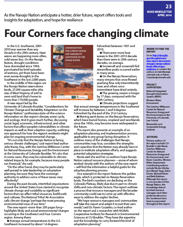
NIDIS Newsletter about the climate change concerns occuring in the Four Corners region of the southwest. Uses weather data from the region to support the claims of a changing climate in the region.
Suggested edit:
Dry Times Volume 4 Issue 1
Prior to becoming a bi-weekly email newsletter, “Dry Times,” the NIDIS newsletter, appeared twice a year in the spring and fall.