Quarterly Climate Impacts and Outlook for the Great Lakes Region for September–November 2023. Dated December 2023.
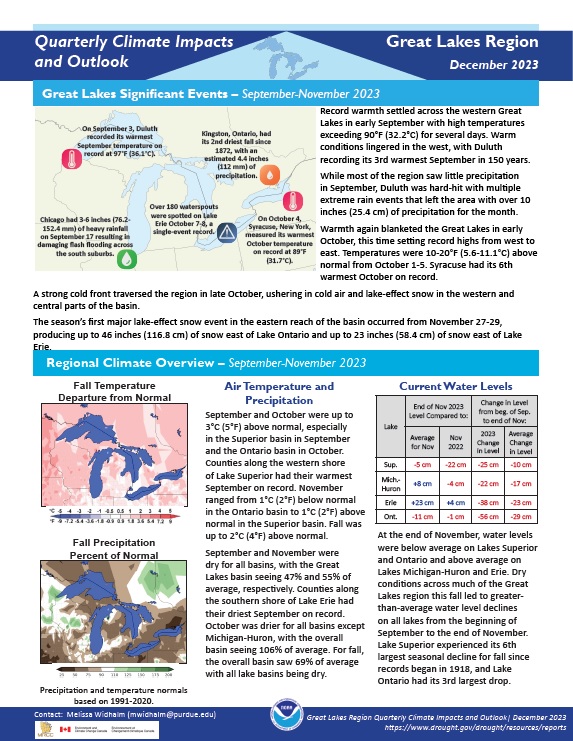
Fall temperatures in the region were up to 2°C (4°F) above normal. The overall basin saw 69% of average precipitation with all lake basins being dry.
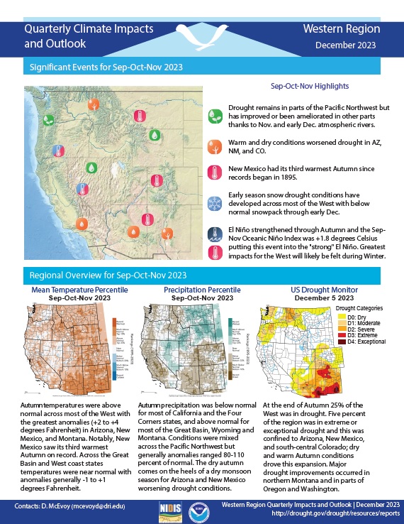
Quarterly Climate Impacts and Outlook for the Western Region for September–November 2023. Dated December 2023.
Quarterly Climate Impacts and Outlook for the Missouri River Basin for September–November 2023. Dated December 2023.
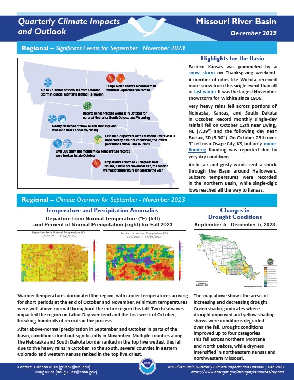
Warmer temperatures dominated the region, with cooler temperatures arriving for short periods at the end of October and November. Minimum temperatures were well above normal throughout the entire region this fall. After above-normal precipitation in September and October in parts of the basin, conditions dried out significantly in November.
Quarterly Climate Impacts and Outlook for the Southeast and Caribbean Region for September–November 2023. Dated December 2023. (Updated February 2024 to add Spanish translation of Caribbean information.)
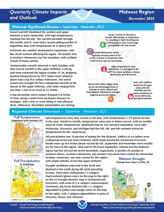
Quarterly Climate Impacts and Outlook for the Midwest Region for September–November 2023. Dated December 2023.
Fall temperatures were near normal in the east, with temperatures 1–3°F above normal in the west. Month-to-month, temperatures were near or above normal, with no notable areas of cooler temperatures. Fall precipitation was 70% of normal for the Midwest. Deficits of 4–8 inches were widespread across the lower Midwest, while areas around the Minnesota-Wisconsin border were up to 4 inches above normal for fall.
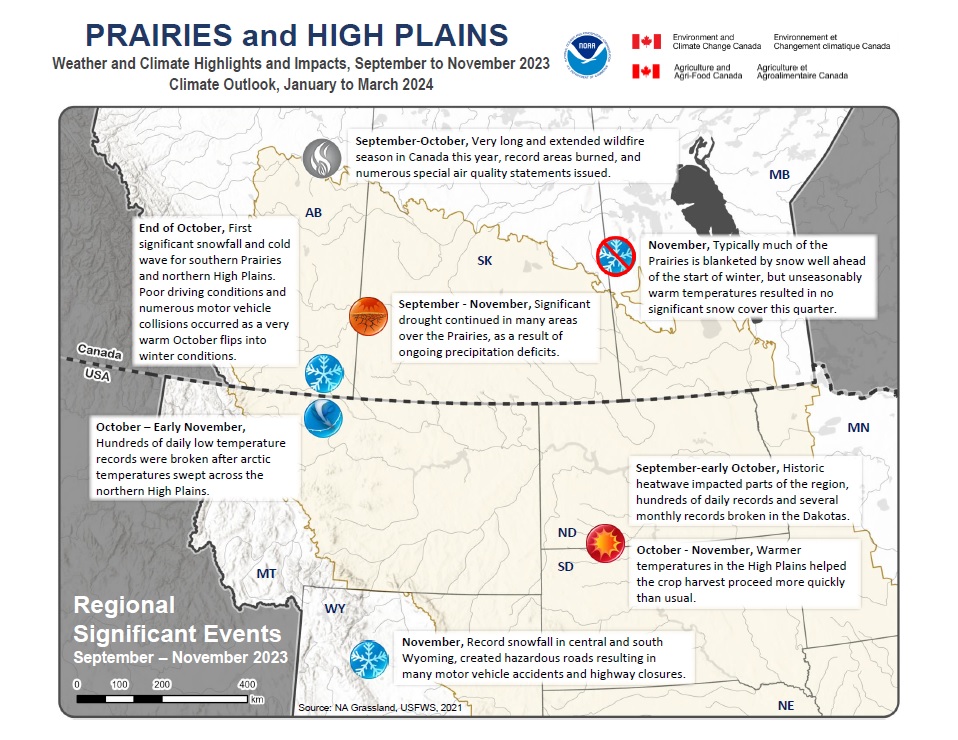
Quarterly Climate Impacts and Outlook for the Canadian and U.S. Prairies and High Plains for September–November 2023, with an outlook for January–March 2024. Dated December 2023.
The Prairies and High Plains generally experienced warmer fall conditions, except the area that borders Montana and the Dakotas. Precipitation was well below normal for much of the Prairies, with parts of central Alberta receiving less than 30% of its seasonal amount.
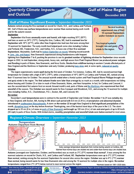
Quarterly Climate Impacts and Outlook for the Gulf of Maine Region for September–November 2023. Dated December 2023.
Autumn (averaged over September, October, and November) was as much as 3°C (5°F) warmer than normal. It was among the five warmest autumns on record for Charlo, New Brunswick, and Caribou and Portland, Maine. Precipitation for autumn (accumulated from September to November) ranged from 50% of normal to 125% of normal.
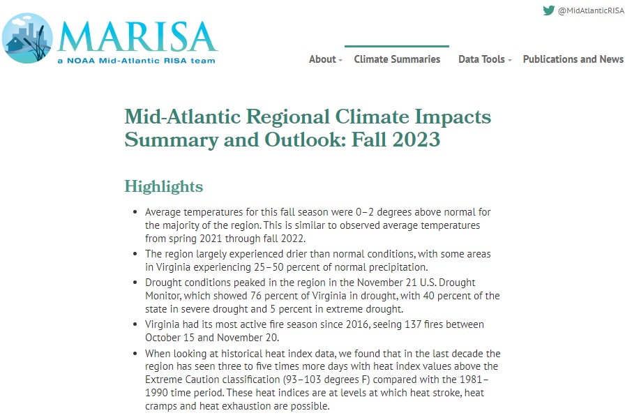
Quarterly Climate Impacts and Outlook for the Mid-Atlantic Region for September–November 2023. Dated December 2023.
Average temperatures for this fall season were 0–2 degrees above normal for the majority of the region. This is similar to observed average temperatures from spring 2021 through fall 2022. The region largely experienced drier than normal conditions, with some areas in Virginia experiencing 25%–50% of normal precipitation.
Quarterly Climate Impacts and Outlook for the Northeast Region for September–November 2023. Dated December 2023.
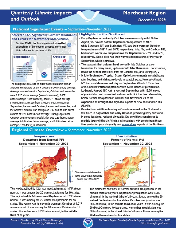
The Northeast had its 12th-warmest autumn at 1.4°F above normal. It was among the 20 warmest autumns for 10 states. The Northeast saw 86% of normal autumn precipitation, in the middle third of all years.
Quarterly Climate Impacts and Outlook for the Pacific Region for September–November 2023. Dated December 2023.
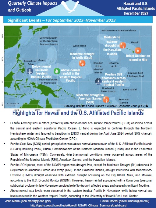
For the Sept-Nov (SON) period, precipitation was above normal across much of the U.S. Affiliated Pacific Islands (USAPI) including Palau, Guam, Commonwealth of the Northern Mariana Islands (CNMI), and in the Federated States of Micronesia (FSM). Conversely, drier-than-normal conditions were observed across areas of the Republic of the Marshal Islands (RMI), American Samoa, and the Hawaiian Islands.