This Puerto Rico and U.S. Virgin Islands drought early warning update was originally sent via email on July 28, 2020.
Drought conditions are expected to improve across the local islands through September after near record dryness in April through June: Potential Impacts across Puerto Rico and the U.S. Virgin Islands.
Se espera que las condiciones de sequía mejoren en las islas locales hasta septiembre después de una sequedad casi récord de abril a junio: Impactos potenciales en Puerto Rico y las Islas Vírgenes Estadounidenses.
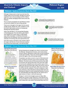
Quarterly Climate Impacts and Outlook for the Midwest Region for March – May 2020. Dated June 2020.
Spring temperatures averaged very close to normal across the Midwest. Precipitation was below normal in much of Minnesota and Iowa, and above normal for much of the remainder of the Midwest.
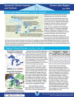
Quarterly Climate Impacts and Outlook for the Great Lakes Region for March – May 2020. Dated June 2020.
Spring temperatures averaged out to be within 1°C (2°F) of normal in most areas. Spring precipitation ranged from 70% to 112% of average, with the overall basin seeing 98% of average.
Quarterly Climate Impacts and Outlook for the Chesapeake Bay Region for March – May 2020. Dated June 2020.
Temperatures varied widely across the spring months, with sites across the Chesapeake Bay watershed experiencing one of the warmest months of March on record, followed by one of the coldest months of April on record. The southeastern portion of the Mid-Atlantic region experienced drier conditions than normal, while the northwestern portion of the region experienced up to 150 percent of normal precipitation.
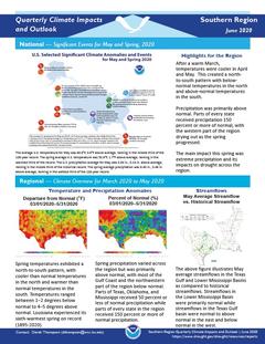
Quarterly Climate Impacts and Outlook for the Southern Region for March – May 2020. Dated June 2020.
After a warm March, temperatures were cooler in April and May. This created a north-to-south pattern with below-normal temperatures in the north and above-normal temperatures in the south. Precipitation was primarily above normal. Parts of every state received precipitation 150 percent or more of normal, with the western part of the region drying out as the spring progressed.
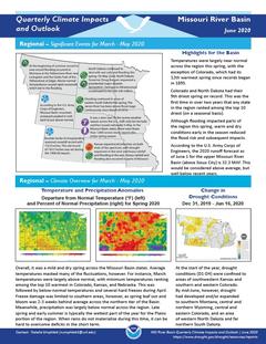
Quarterly Climate Impacts and Outlook for the Missouri River Basin March – May 2020. Dated June 2020.
Temperatures were largely near normal across the region this spring, with the exception of Colorado, which had its 12th warmest spring since records began in 1895. Although flooding impacted parts of the region this spring, warm and dry conditions early in the season reduced the flood risk and subsequent impacts.
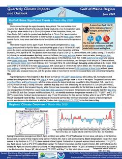
Quarterly Climate Impacts and Outlook for the Gulf of Maine Region for March – May 2020. Dated June 2020.
Spring temperatures (averaged over March, April, and May) were within 1°C (2°F) of normal for most areas, with parts of the Maritimes being colder and parts of New England being warmer. Spring precipitation (accumulated from March to May) ranged from 50% of normal to 110% of normal for much of the region.
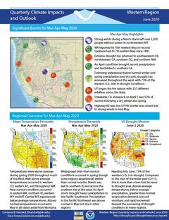
Quarterly Climate Impacts and Outlook for the Western Region for March – May 2020. Dated June 2020.
Temperatures were above average during spring 2020 throughout much of the West. Widespread drier-than-normal conditions occurred in spring though some regions experienced wetter than normal months.
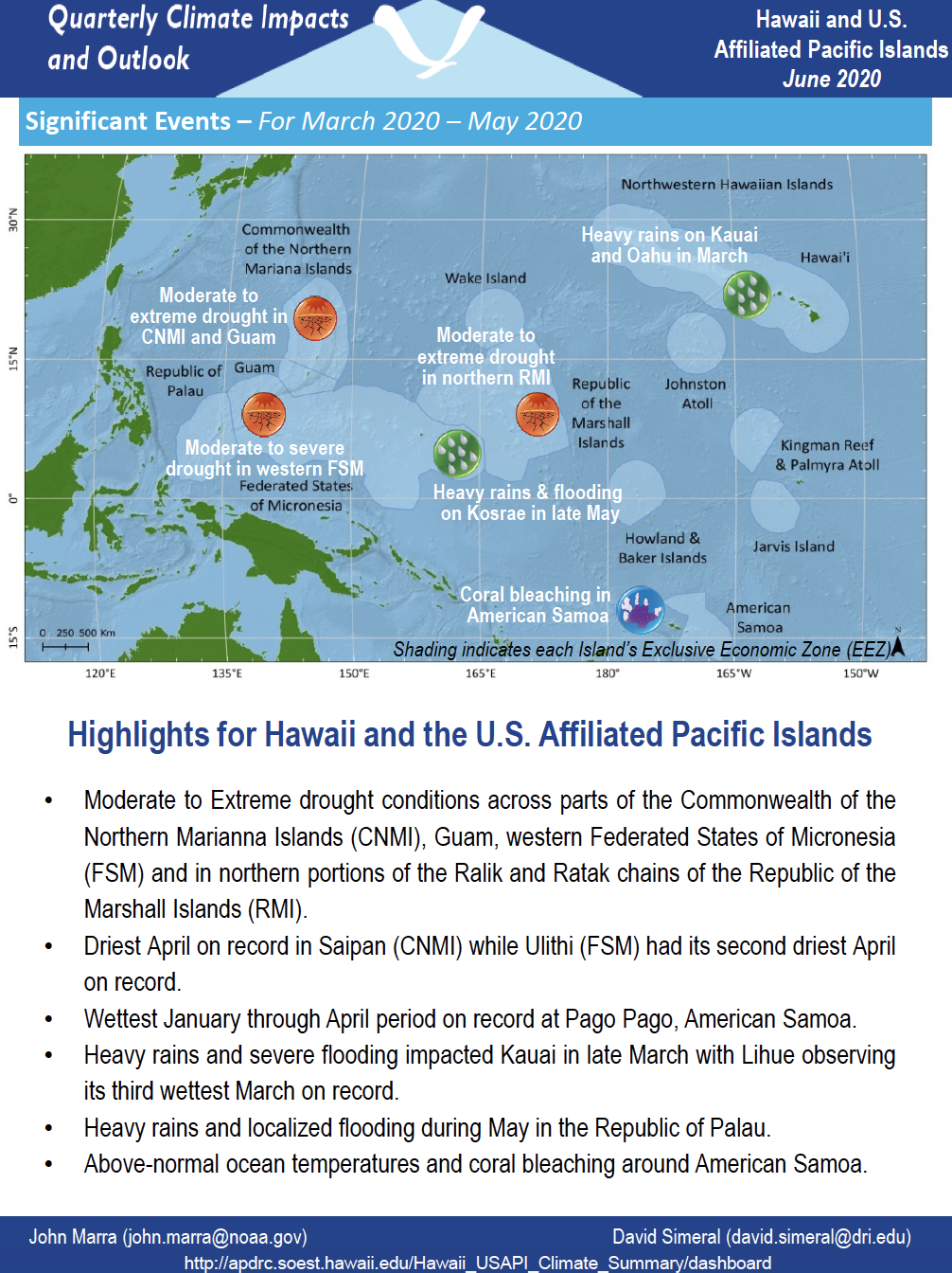
Quarterly Climate Impacts and Outlook for Hawaii and the U.S. Pacific Islands Region for March – May 2020. Dated June 2020.
Includes significant events, regional climate overview, and sectoral impacts for March – May 2020; regional outlook for June – August 2020.
Quarterly Climate Impacts and Outlook for the Southeast Region for March – May 2020. Dated June 2020.
Above-average temperatures were observed across the Southeast this spring. Precipitation varied across the region, however two tropical storms and a slow-moving upper level low observed throughout the spring, caused flooding in local areas of the Southeast.