




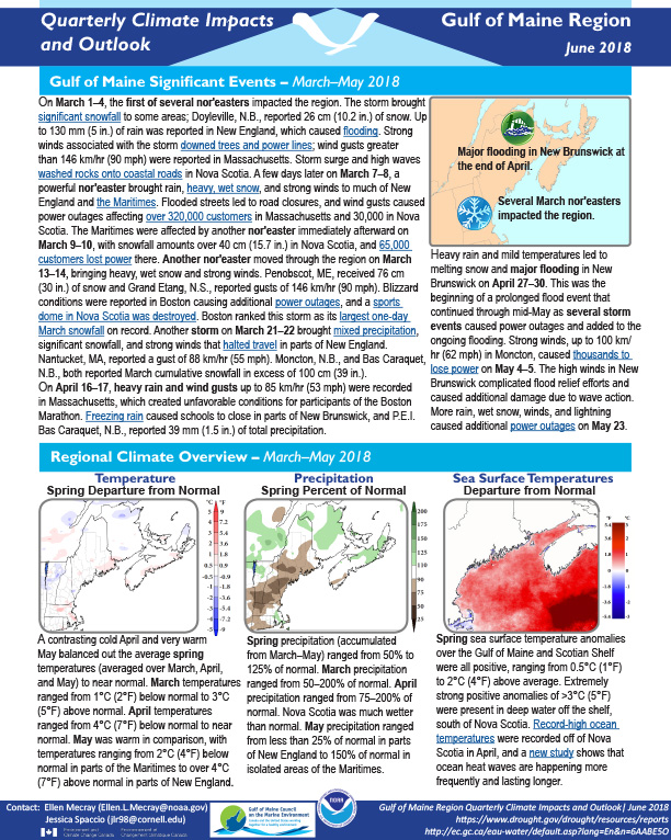
Quarterly Climate Impacts and Outlook for the Gulf of Maine Region for March – May 2018. Dated June 2018.
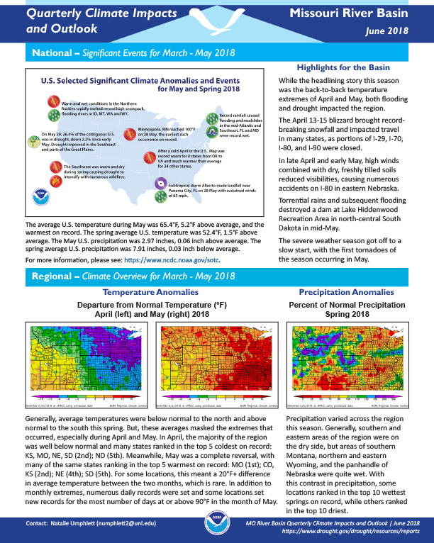
Quarterly Climate Impacts and Outlook for the Missouri River Basin March – May 2018. Dated June 2018.
While the headlining story this season was the back-to-back temperature extremes of April and May, both flooding and drought impacted the region.
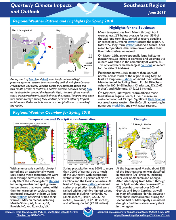
Quarterly Climate Impacts and Outlook for the Southeast Region for March – May 2018. Dated June 2018.
Mean temperatures from March through April were at least 2°F below average for over 55% of the 215 long-term (i.e., period of record equaling or exceeding 50 years) stations across the region. A total of 52 long-term stations observed March–April mean temperatures that were ranked within their five coldest values on record.
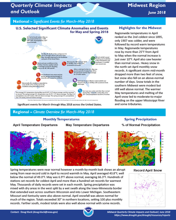
Quarterly Climate Impacts and Outlook for the Midwest Region for March – May 2018. Dated June 2018.
Regionwide temperatures in April ranked as the 2nd coldest since 1895, only 1907 was colder, and were followed by record warm temperatures in May. Regionwide temperatures rose by more than 25°F from April to May when the normal increase is just over 10°F. April also saw heavier than normal snows.
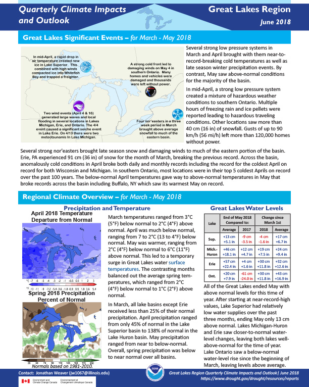
Quarterly Climate Impacts and Outlook for the Great Lakes Region for March – May 2018. Dated June 2018.
Several strong low pressure systems in March and April brought with them near-to-record-breaking cold temperatures as well as late season winter precipitation events. By contrast, May saw above-normal conditions for the majority of the basin.
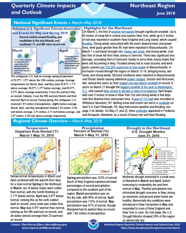
Quarterly Climate Impacts and Outlook for the Northeast Region for March – May 2018. Dated June 2018.
On March 2, the first of several nor'easters brought significant snowfall. Up to 40 inches of snow fell in central and eastern New York, while up to 5 inches of rain was reported in southern New England and Long Island, which caused flooding. Strong winds associated with the storm downed trees and power lines; wind gusts greater than 90 mph were reported in Massachusetts.
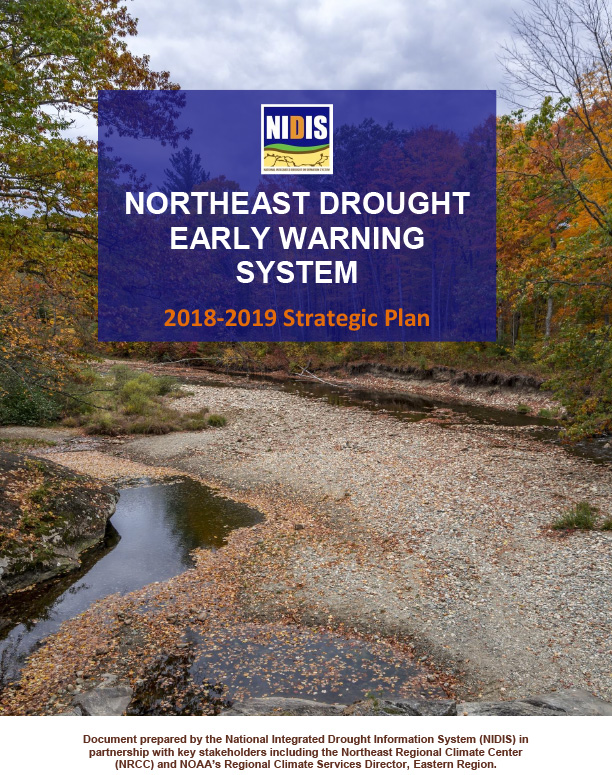
Introduction to the Northeast Drought Early Warning System
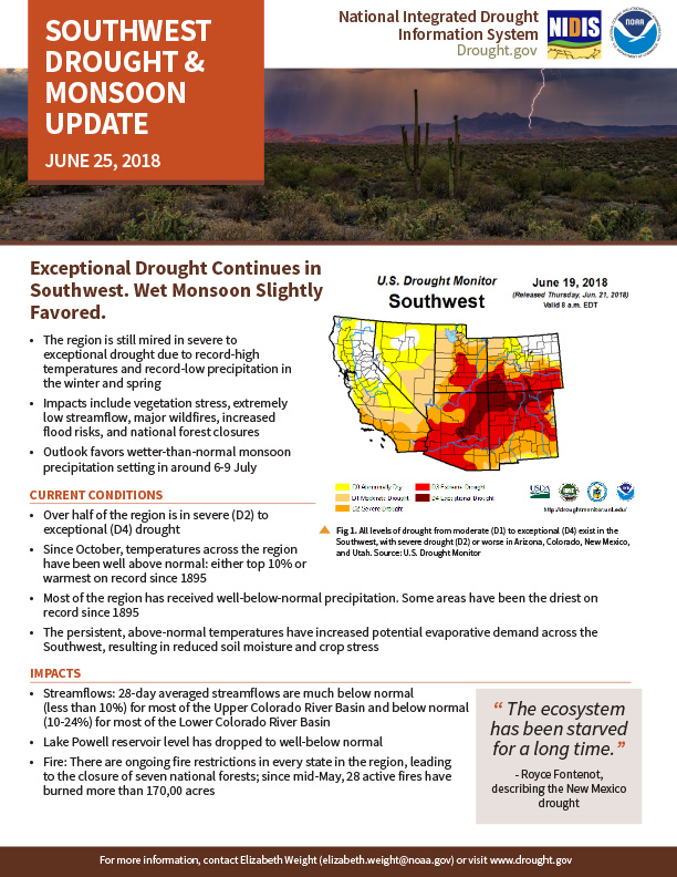
Exceptional Drought Continues in Southwest. Wet Monsoon Slightly Favored.
The region is still mired in severe to exceptional drought due to record-high temperatures and record-low precipitation in the winter and spring Impacts include vegetation stress, extremely low streamflow, major wildfires, increased flood risks, and national forest closures Outlook favors wetter-than-normal monsoon precipitation setting in around 6-9 JulyCURRENT CONDITIONS
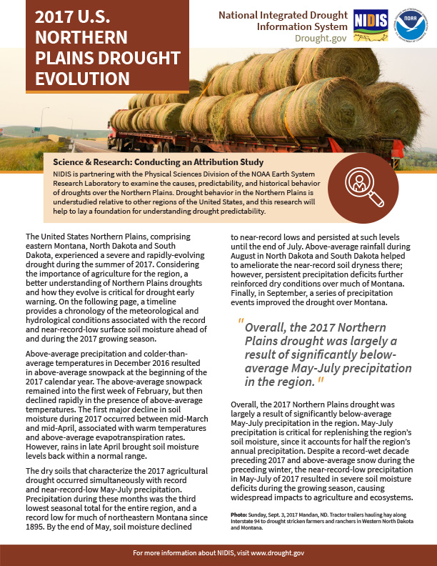
The United States Northern Plains, comprising eastern Montana, North Dakota and South Dakota, experienced a severe and rapidly-evolving drought during the summer of 2017. Considering the importance of agriculture for the region, a better understanding of Northern Plains droughts and how they evolve is critical for drought early warning. In the document, a timeline provides a chronology of the meteorological and hydrological conditions associated with the record and near-record-low surface soil moisture ahead of and during the 2017 growing season.
A two-page status update on drought conditions, including current conditions, impacts, and outlook, in the Midwest and Northern Plains regions for June 21, 2018.