Site Section
Data & Maps
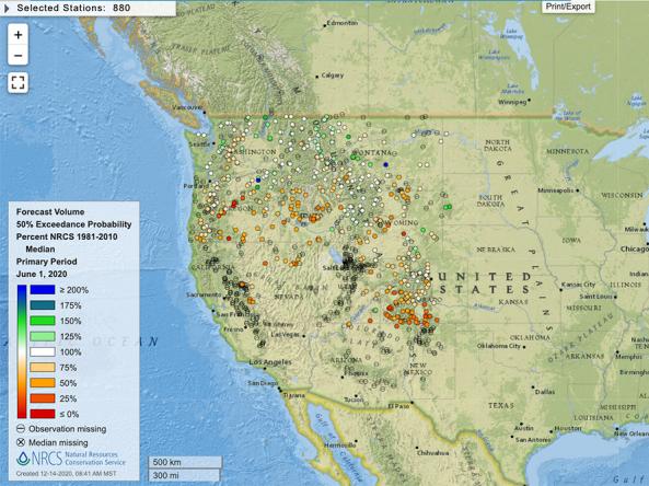
Streamflow Forecast Maps for the Western United States
Associated Agencies
United States Department of Agriculture (USDA) Natural Resources Conservation Service (NRCS)
Available in spring and summer for the western U.S. Monthly streamflow maps compare percent of monthly average flow to their respective 1981-2010 average.
Access
NRCS Interactive Map: Interactive map viewer showing streamflow conditions, as well as other water data (e.g., snow water equivalent, precipitation, reservoir storage)
Partner(s)
Representative Image