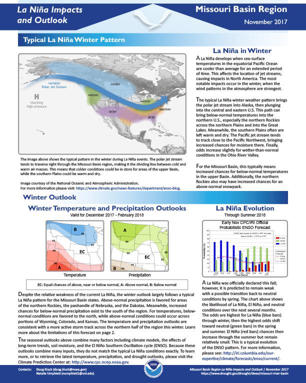
Defines La Niña; gives outlook for winter temperatures and precipitation; possible effects of La Niña on the Missouri Basin, including agriculture, the economy, and the river itself.
NOAA’s Regional Climate Services Program created these Outlooks to inform the public about recent impacts within their respective regions. Each regional report contains easy-to-understand language, and anyone can access them through the Drought Portal at https://www.drought.gov/drought/resources/reports.
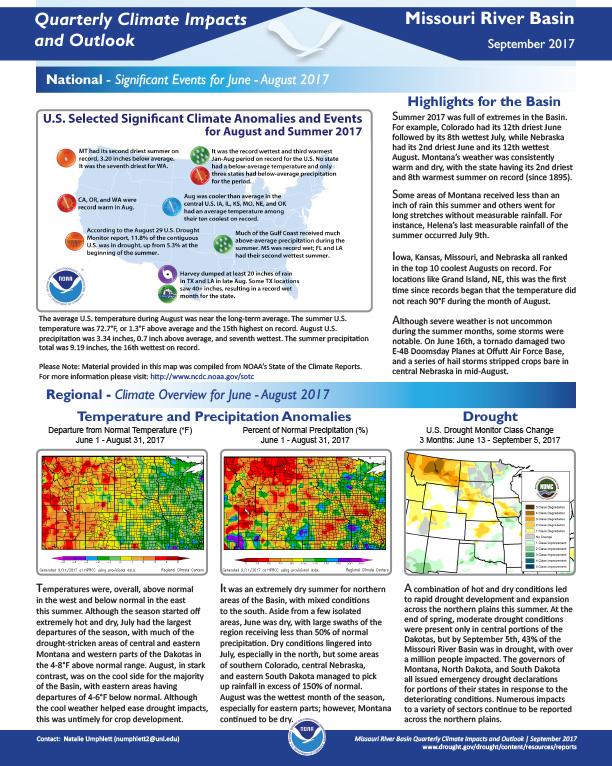
Quarterly Climate Impacts and Outlook for the Missouri River Basin June – August 2017. Dated September 2017.
Summer 2017 was full of extremes in the Basin. For example, Colorado had its 12th driest June followed by its 8th wettest July, while Nebraska had its 2nd driest June and its 12th wettest August. Montana’s weather was consistently warm and dry, with the state having its 2nd driest and 8th warmest summer on record (since 1895).
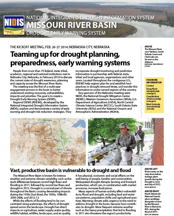
Summarizes Feb 26-27, 2014 meeting in Nebraska City, Nebraska, to kick off Missouri River Basin DEWS. Attended by representatives of more than 70 federal, state, tribal, academic, regional and national institutions to discuss the current state of drought awareness, planning and capacity across the Missouri River Basin. The goal is to create a Drought Early Warning System (DEWS) in the region.
An summary of an assessment of operational and experimental forecast system skill and reliability in the Missouri River Basin.
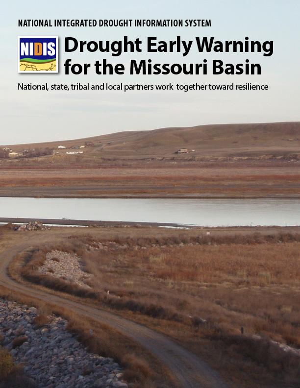
This report documents the development of the regional Drought Early Warning System (DEWS) for the Missouri River Basin from 2012 to present, with a focus on the 2014 launch meeting in Nebraska City, Nebraska. Meeting organizers included NIDIS and the National Oceanic and Atmospheric Administration (NOAA), and the National Drought Mitigation Center (NDMC) at the University of Nebraska at Lincoln
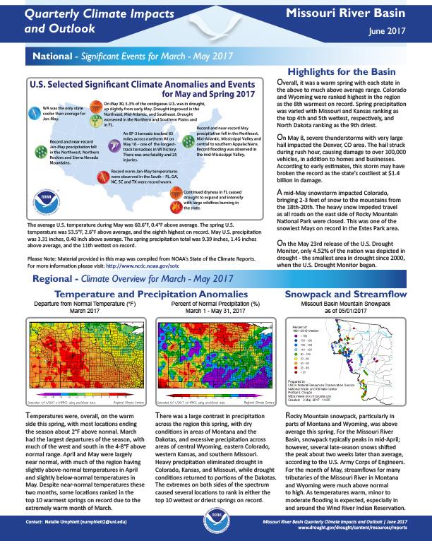
Quarterly Climate Impacts and Outlook for the Missouri River Basin March – May 2017. Dated June 2017.
Overall, it was a warm spring with each state in the above to much above average range. Colorado and Wyoming were ranked highest in the region as the 8th warmest on record. Spring precipitation was varied with Missouri and Kansas ranking as the top 4th and 5th wettest, respectively, and North Dakota ranking as the 9th driest.
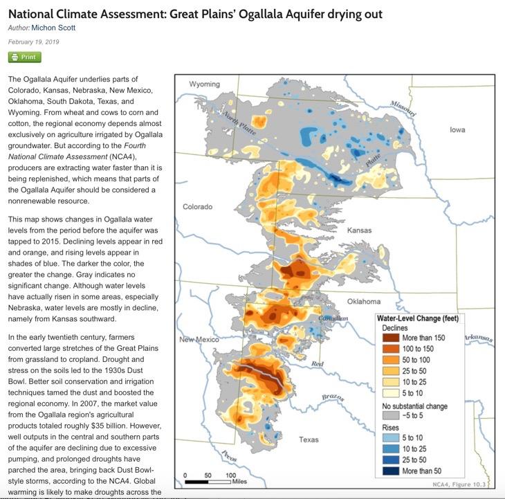
This Climate.gov feature highlights that the Ogallala Aquifer (which underlies parts of Colorado, Kansas, Nebraska, New Mexico, Oklahoma, South Dakota, Texas, and Wyoming) is drying. This will likely be one of the most pressing issues facing water availability in the Southern Plains regions in the coming decades.
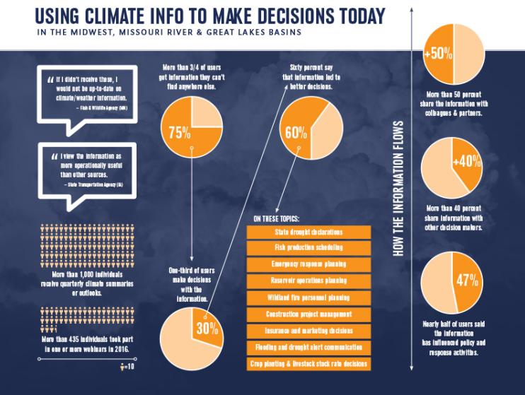
Information from regional Drought Early Warning Systems helped people make better decisions in many sectors, including construction, fish production, and agriculture. A recent survey assessed the value of drought and climate-related webinars and quarterly climate summaries produced for decision-makers in the Midwest and Missouri River Drought Early Warning Systems and in the Great Lakes Basin. The National Drought Mitigation Center at the University of Nebraska-Lincoln led the survey, which was funded by the National Integrated Drought Information System.
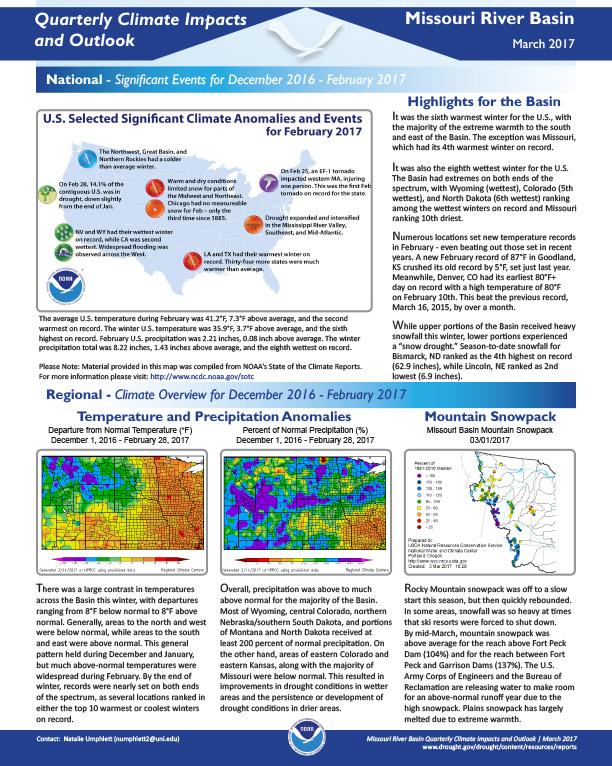
Quarterly Climate Impacts and Outlook for the Missouri River Basin December 2016 – February 2017. Dated March 2017.


