For the latest forecasts and critical weather information, visit weather.gov.
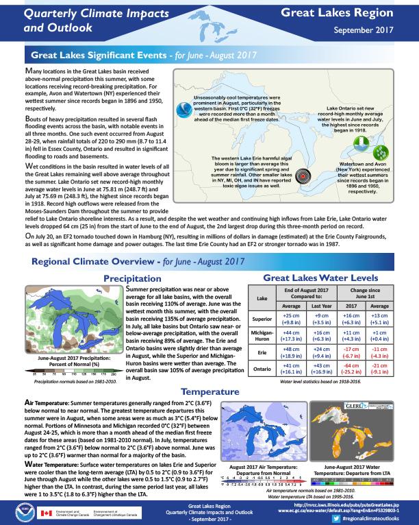
Quarterly Climate Impacts and Outlook for the Great Lakes Region for June – August 2017. Dated September 2017.
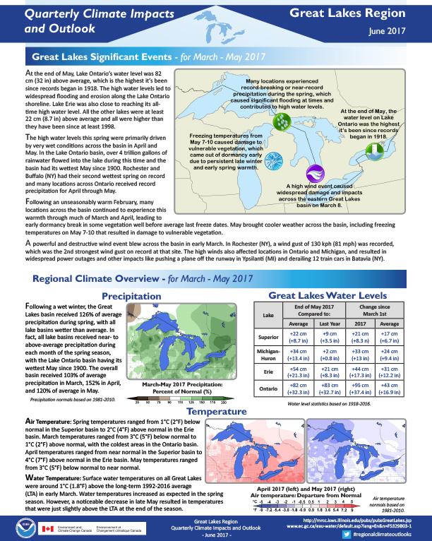
Quarterly Climate Impacts and Outlook for the Great Lakes Region for March – May 2017. Dated June 2017.
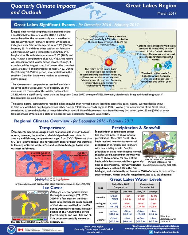
At the end of May, Lake Ontario’s water level was 82 cm (32 in) above average, which is the highest it’s been since records began in 1918. The high water levels led to widespread flooding and erosion along the Lake Ontario shoreline. Lake Erie was also close to reaching its all-time high water level. All the other lakes were at least 22 cm (8.7 in) above average and all were higher than they have been since at least 1998.
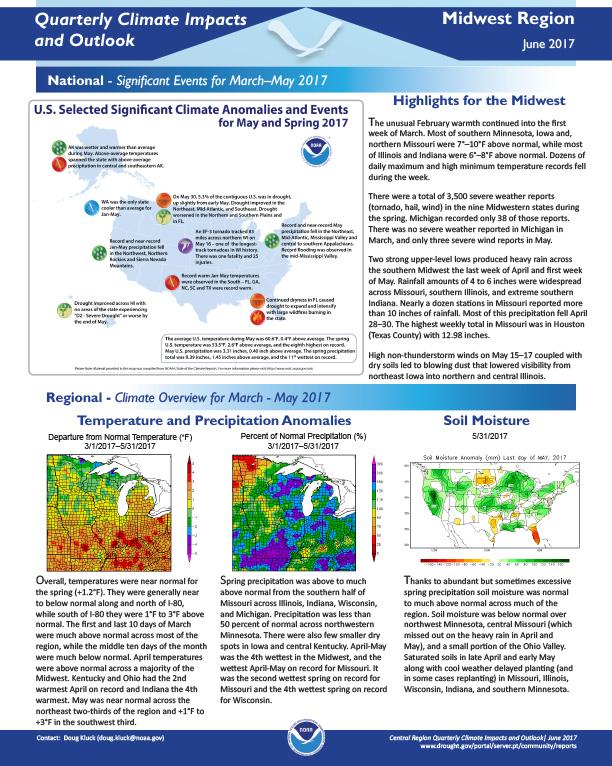
Quarterly Climate Impacts and Outlook for the Midwest Region for March – May 2017. Dated June 2017.
The unusual February warmth continued into the first week of March. Most of southern Minnesota, Iowa and, northern Missouri were 7°–10°F above normal, while most of Illinois and Indiana were 6°–8°F above normal. Dozens of daily maximum and high minimum temperature records fell during the week.
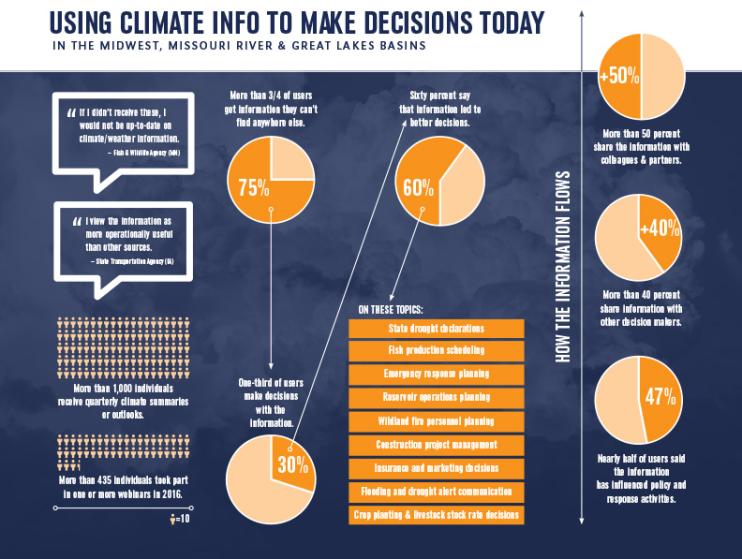
Information from regional Drought Early Warning Systems helped people make better decisions in many sectors, including construction, fish production, and agriculture. A recent survey assessed the value of drought and climate-related webinars and quarterly climate summaries produced for decision-makers in the Midwest and Missouri River Drought Early Warning Systems and in the Great Lakes Basin. The National Drought Mitigation Center at the University of Nebraska-Lincoln led the survey, which was funded by the National Integrated Drought Information System.
Quarterly Climate Impacts and Outlook for the Great Lakes Region for December 2016 – February 2017. Dated March 2017.
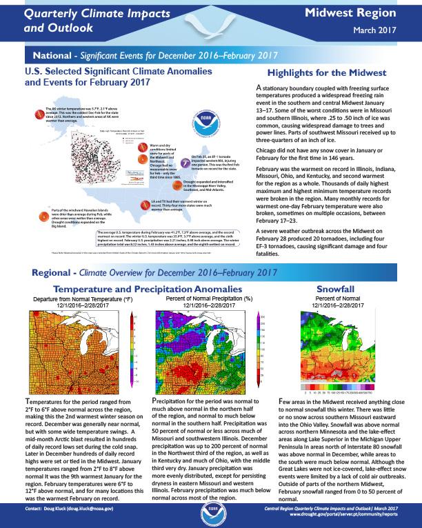
Quarterly Climate Impacts and Outlook for the Midwest Region for December 2016 – February 2017. Dated March 2017.
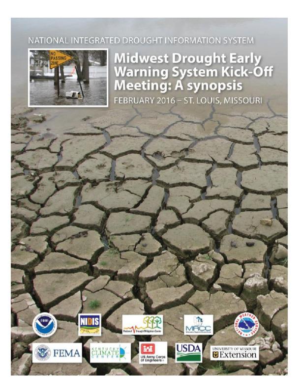
This report documents the Midwest Drought Early Warning System Kickoff Meeting, held February 9-11, 2016 in St. Louis, MO, to formally launch the Midwest DEWS. The multi-day event brought together federal, state, local, private industry and academic partners and other stakeholders for an in-depth discussion on drought and high-precipitation events in the Midwest, with attention to water, climate, land resources and emergency management. Discussions centered on improving the capacity to meet the early warning information needs of decision makers in the Midwest.
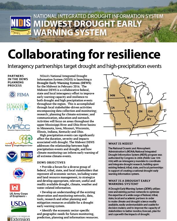
Description of the planning process behind launch of the Midwest Drought Early Warning System in February 2016.
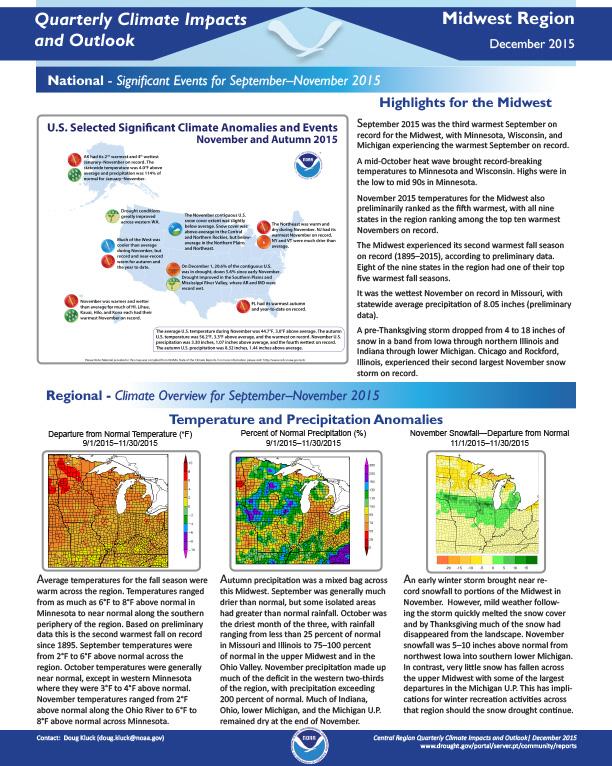
Significant events, climate overview and regional impacts for September-November 2015 in the Midwest, with regional outlook for December 2015 – February 2016.
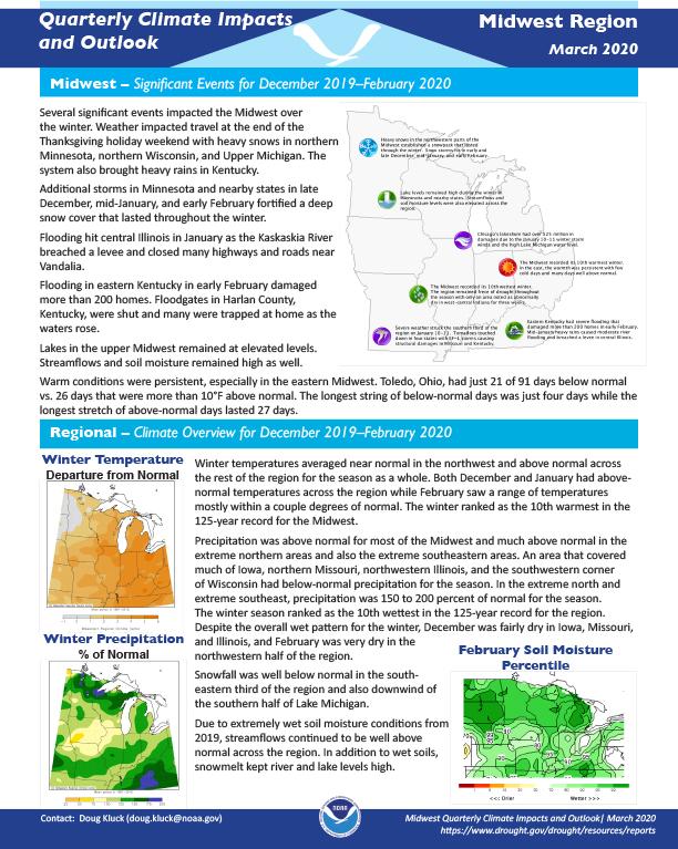
Quarterly Climate Impacts and Outlook for the Midwest Region for December 2019–February 2020. Dated March 2020.
Winter temperatures averaged near normal in the northwest and above normal across the rest of the region for the season as a whole. Precipitation was above normal for most of the Midwest and much above normal in the extreme northern areas and also the extreme southeastern areas. An area that covered much of Iowa, northern Missouri, northwestern Illinois, and the southwestern corner of Wisconsin had below-normal precipitation for the season.


