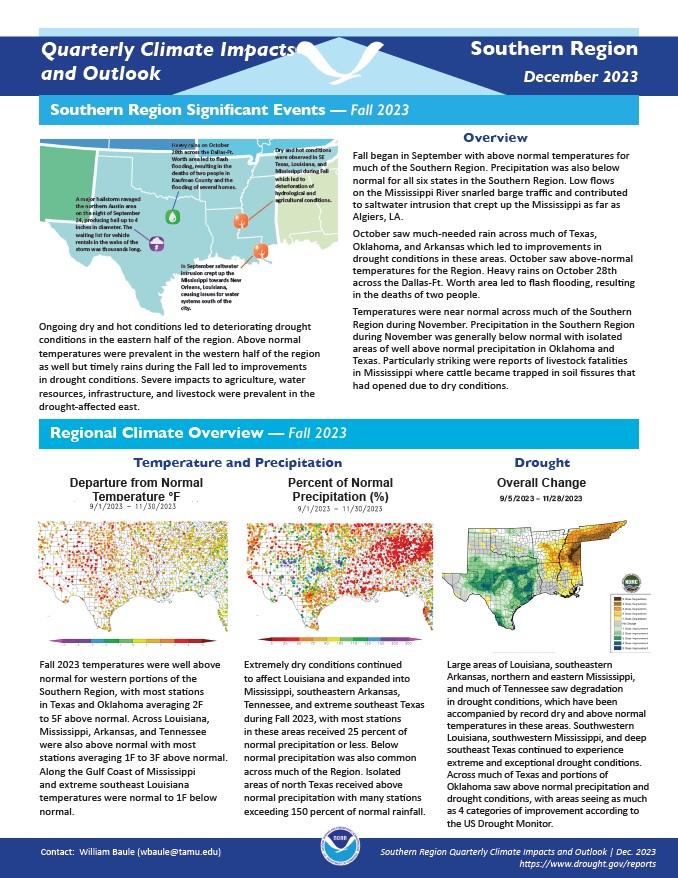
Quarterly Climate Impacts and Outlook for the Southern Region for September–November 2023. Dated December 2023.
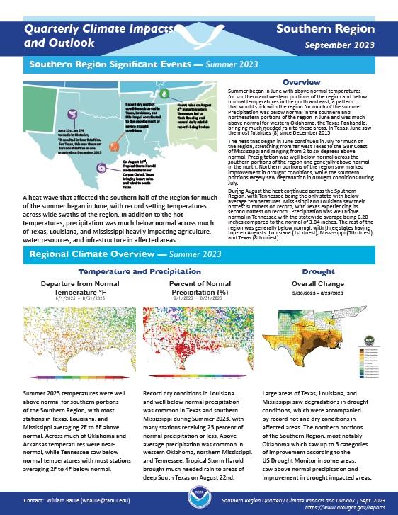
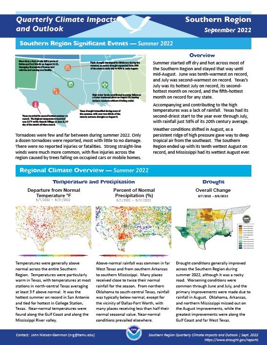
Quarterly Climate Impacts and Outlook for the Southern Region for June–August 2023. Dated September 2023.
Quarterly Climate Impacts and Outlook for the Southern Region for March–May 2023. Dated June 2023.
Spring temperatures were near normal across much of the Southern Region, with most stations averaging 1°F below to 1°F above normal. Along the Gulf Coast, temperatures at many stations were 1°F to 3°F above normal. Below-normal precipitation was common in central Oklahoma, northeastern Texas, the area north and west of San Antonio, far west Texas, eastern Tennessee, and much of Louisiana, with many stations receiving 25% to 70% of normal precipitation.
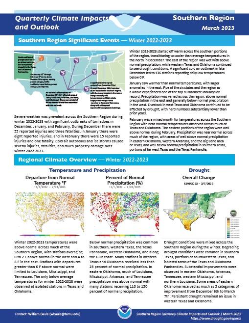
Quarterly Climate Impacts and Outlook for the Southern Region for December 2022–February 2023. Dated March 2023.
Winter 2022–2023 temperatures were above normal across much of the Southern Region, with stations averaging 0 to 2°F above normal in the west and 4 to 8°F in the east. Below-normal precipitation was common in southern, western Texas, the Texas Panhandle, western Oklahoma, and along the Gulf Coast. In eastern Oklahoma, much of Louisiana, Mississippi, Arkansas, and Tennessee precipitation was above normal.
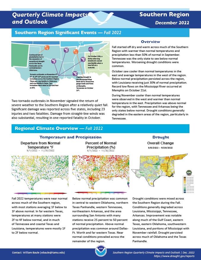
Quarterly Climate Impacts and Outlook for the Southern Region for September–November 2022. Dated December 2022.
Quarterly Climate Impacts and Outlook for the Southern Region for June–August 2022. Dated September 2022.
Summer started off dry and hot across most of the Southern region and stayed that way until mid-August. Weather conditions shifted in August, as a persistent ridge of high pressure gave way to deep tropical air from the southeast.
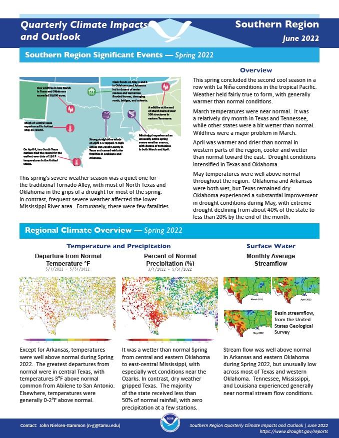
Quarterly Climate Impacts and Outlook for the Southern Region for March–May 2022. Dated June 2022.
Except for Arkansas, temperatures were well above normal during Spring 2022. It was a wetter than normal spring from central and eastern Oklahoma to east-central Mississippi, with especially wet conditions near the Ozarks. In contrast, dry weather gripped Texas.
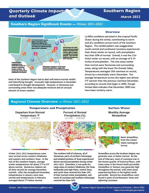
Quarterly Climate Impacts and Outlook for the Southern Region for December 2021–February 2022. Dated March 2022.
Winter 2021–2022 temperatures were near normal across western Oklahoma and western and southern Texas. In the rest of the Southern Region, average winter temperatures ran about 2°F to 4°F above normal. The northern half of Arkansas, all of Tennessee, parts of northern Mississippi, and isolated portions of Texas experienced above-normal precipitation during winter 2021–2022. Elsewhere, it was quite dry.
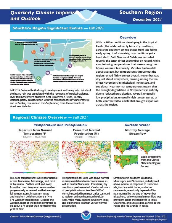
Quarterly Climate Impacts and Outlook for the Southern Region for September - November 2021. Dated December 2021.
Fall temperatures were near normal across Tennessee, Mississippi, and most of Louisiana. Farther west and away from the coast, temperature anomalies progressively increased. Precipitation was above normal in many coastal and near-coastal areas, as well as central Tennessee. Elsewhere, dry conditions predominated.
Quarterly Climate Impacts and Outlook for the Southern Region for June - August 2021. Dated September 2021.
At most stations outside of Texas, summertime average temperatures were within 1 °F of normal. Most of Texas was 0-2 °F cooler than normal. Summer 2021 was exceptionally wet across most of South Texas, parts of West Texas, and almost all of Mississippi, with many stations reporting more than double the normal monthly precipitation amounts.


