Quarterly Climate Impacts and Outlook for the Mid-Atlantic Region for June - August 2021. Dated September 2021.
The majority of the Mid-Atlantic experienced temperatures 1-2 degrees Fahrenheit (F) above normal and some sites had among one of their warmest summers on record. The Mid-Atlantic saw generally above normal precipitation, notably in southern New York and northern Pennsylvania, while some areas in Maryland, Virginia, and the panhandle of West Virginia experienced below normal precipitation.
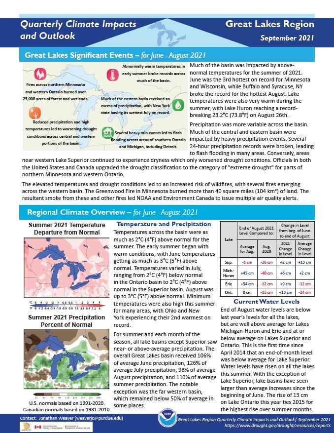
Quarterly Climate Impacts and Outlook for the Great Lakes Region for June - August 2021. Dated September 2021.
Temperatures across the basin were as much as 2°C (4°F) above normal for the summer. For summer and each month of the season, all lake basins except Superior saw near- or above-average precipitation.
Quarterly Climate Impacts and Outlook for the Gulf of Maine Region for March - May 2021. Dated June 2021.
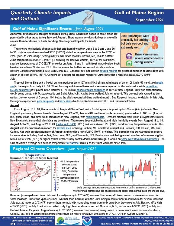
Summer was up to 2°C (4°F) warmer than normal, being record or near-record warm in some locations. Summer precipitation ranged from 50% of normal to 200% of normal.
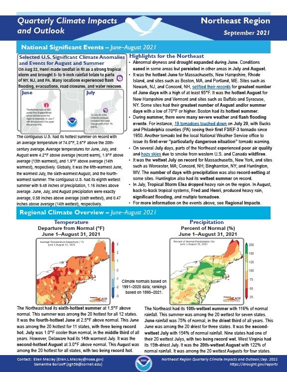
Quarterly Climate Impacts and Outlook for the Northeast Region for June - August 2021. Dated September 2021.
The Northeast had its sixth-hottest summer at 1.5°F above normal. This summer was among the 20 hottest for all 12 states. The Northeast had its 10th-wettest summer with 116% of normal rainfall. This summer was among the 20 wettest for seven states.
Quarterly Climate Impacts and Outlook for the Mid-Atlantic Region for March - May 2021. Dated June 2021.
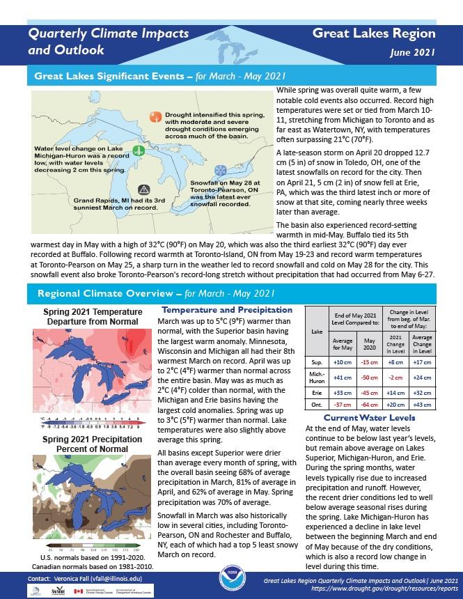
Quarterly Climate Impacts and Outlook for the Great Lakes Region for March - May 2021. Dated June 2021.
Spring was up to 3°C (5°F) warmer than normal. Lake temperatures were also slightly above average this spring. All basins except Superior were drier than average every month of spring, with the overall basin seeing 68% of average precipitation in March, 81% of average in April, and 62% of average in May. Spring precipitation was 70% of average.
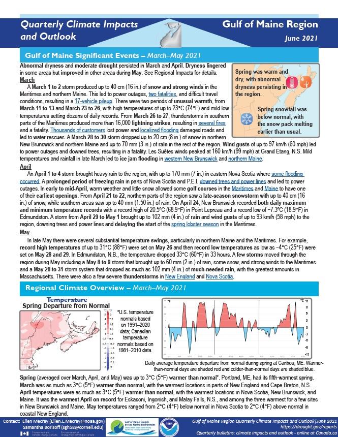
Quarterly Climate Impacts and Outlook for the Gulf of Maine Region for March - May 2021. Dated June 2021.
Spring was up to 3°C (5°F) warmer than normal in the region. Spring precipitation ranged from 50% of normal to 150% of normal. Sea surface temperature (SST) anomalies over the entire Gulf of Maine and Bay of Fundy were strongly above normal (greater than 2°C [4°F]) for the spring season. Anomalies were only slightly weaker around Cape Cod (around 1.5°C [3°F]) and over the Scotian Shelf (around 1.0°C [2°F]).
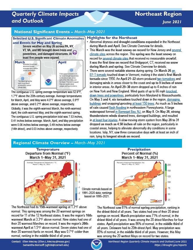
Quarterly Climate Impacts and Outlook for the Northeast Region for March - May 2021. Dated June 2021.
The Northeast had its 15th-warmest spring at 1.3°F above normal. This spring was among the 20 warmest springs on record for 11 of the 12 Northeast states. The Northeast saw 81% of normal spring precipitation, ranking in the driest third of all years. Two states had one of their 20 driest springs on record.
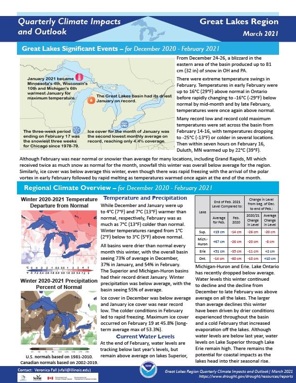
Quarterly Climate Impacts and Outlook for the Great Lakes Region for December 2020 – February 2021. Dated March 2021.
Winter temperatures ranged from 1°C (2°F) below to 3°C (5°F) above normal. Winter precipitation was below average, with the basin seeing 55% of average.
Quarterly Climate Impacts and Outlook for the Chesapeake Bay Region for December 2020 – February 2021. Dated March 2021.


