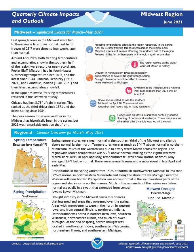
Quarterly Climate Impacts and Outlook for the Midwest Region for March - May 2021. Dated June 2021.
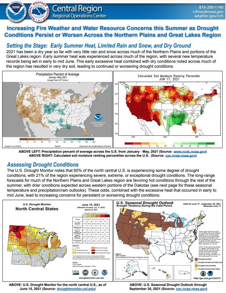
The National Weather Service Central Region developed 2021 Summer Hazard Outlooks in coordination with the NOAA National Centers for Environmental Information, National Integrated Drought Information System (NIDIS), and National Water Center; U.S. Department of Agriculture; National Weather Service River Forecast Centers; and National Interagency Fire Centers' Geographic Area Coordination Centers. This outlook highlights the various Summer hazards that could occur and potential impacts across the Northern Plains and Great Lakes region.
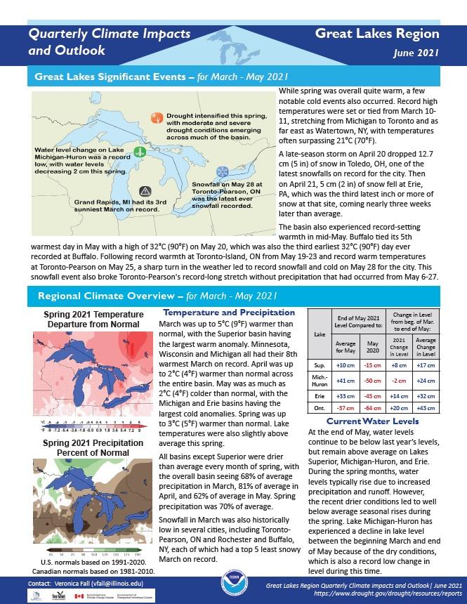
Quarterly Climate Impacts and Outlook for the Great Lakes Region for March - May 2021. Dated June 2021.
Spring was up to 3°C (5°F) warmer than normal. Lake temperatures were also slightly above average this spring. All basins except Superior were drier than average every month of spring, with the overall basin seeing 68% of average precipitation in March, 81% of average in April, and 62% of average in May. Spring precipitation was 70% of average.
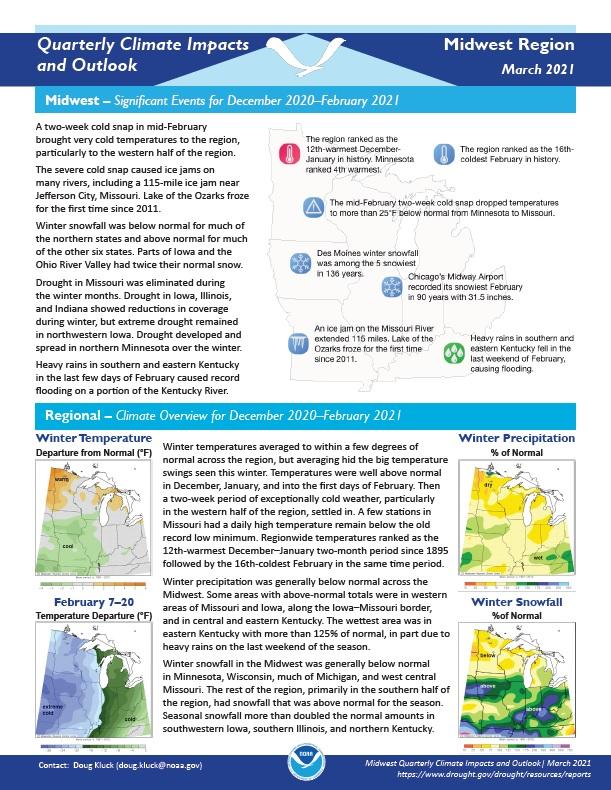
Quarterly Climate Impacts and Outlook for the Midwest Region for December 2020 – February 2021. Dated March 2021.
Winter temperatures averaged to within a few degrees of normal across the region, but averaging hid the big temperature swings seen this winter. Winter precipitation was generally below normal across the Midwest.
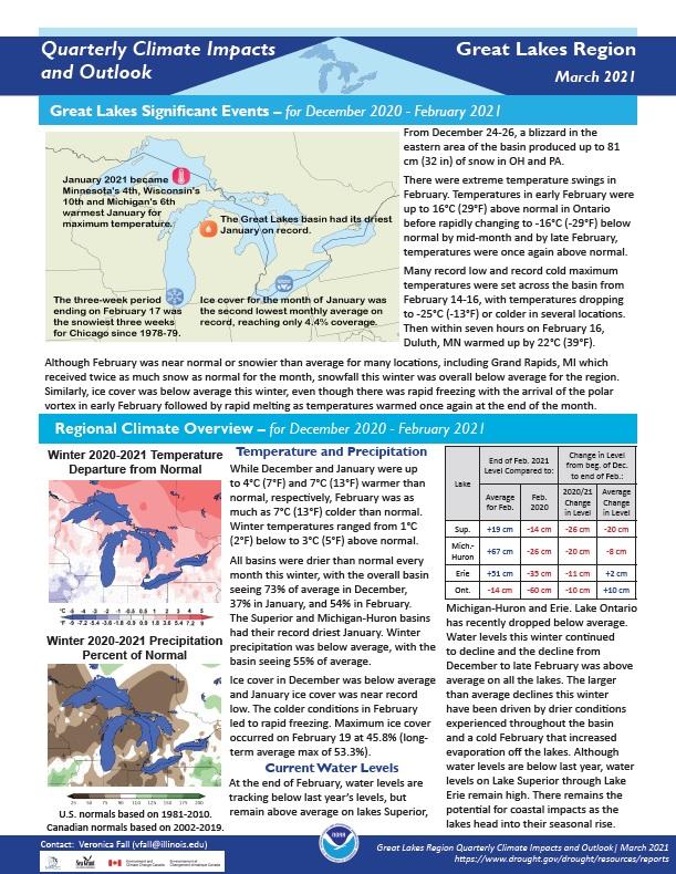
Quarterly Climate Impacts and Outlook for the Great Lakes Region for December 2020 – February 2021. Dated March 2021.
Winter temperatures ranged from 1°C (2°F) below to 3°C (5°F) above normal. Winter precipitation was below average, with the basin seeing 55% of average.
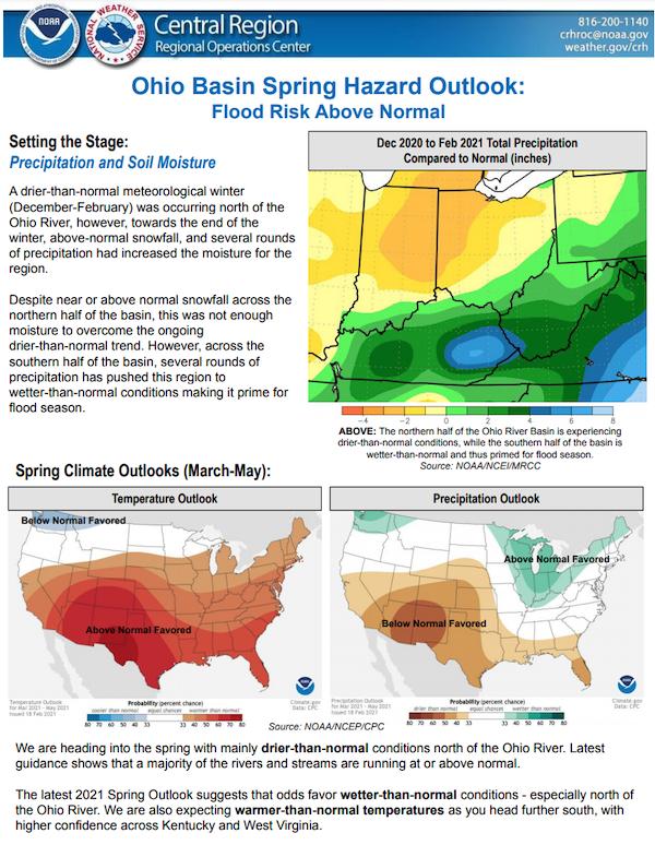
The National Weather Service developed 2021 Spring Hazard Outlooks in coordination with the National Centers for Environmental Information, National Integrated Drought Information System (NIDIS), U.S. Department of Agriculture, National Weather Service River Forecast Centers, and National Interagency Fire Centers' Geographic Area Coordination Centers. This outlook highlights the various Spring hazards that could occur and potential impacts across the Ohio River Valley.
Quarterly Climate Impacts and Outlook for the Midwest Region for September – November 2020. Dated December 2020.
Precipitation totals in the Midwest ranged from less than 50% of normal in northwestern Minnesota to more than 150% of normal in eastern Iowa. Many areas were near normal. Fall temperatures were within 2°F of normal across the Midwest. After more than 1,000 record low daily temperatures in the last half of October, the first 11 days of November saw more than 1,500 record-high daily temperatures.
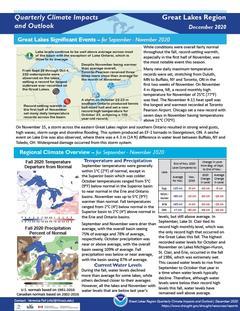
Quarterly Climate Impacts and Outlook for the Great Lakes Region for September – November 2020. Dated December 2020.
While conditions were overall fairly normal throughout the fall, record-setting warmth, especially in the first half of November, was the most notable event this season. Fall precipitation was below or near average, with the basin seeing 87% of average.


