Northeast DEWS Dashboard
Northeast Regional Climate Center (NRCC), NOAA National Integrated Drought Information System (NIDIS)
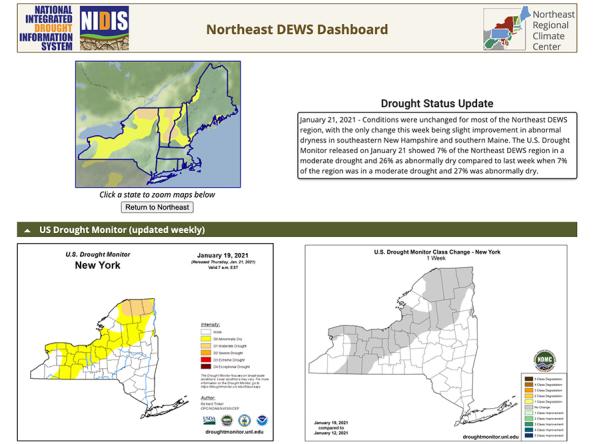
The Northeast Drought Early Warning System (DEWS) Dashboard, hosted by the Northeast Regional Climate Center (NRCC), displays current drought status, impacts, and future conditions for the Northeast DEWS region.
The website displays up-to-date drought maps and tools for the Northeast all in one place, including the weekly U.S. Drought Monitor, precipitation, streamflow and groundwater, standardized precipitation index (SPI), evaporative demand, soil moisture, and NOAA outlooks. Users can select a state to zoom in to that location across all the maps, or view conditions for the entire Northeast region.
Access
Northeast DEWS Dashboard: Access the Dashboard through NRCC's website


