Logo
Related Data & Maps
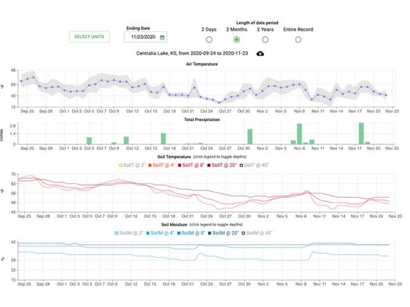
This site provides decision tools and resources using data from weather stations in the SCAN and Tribal SCAN networks. The Soil Climate Analysis Network, also known as SCAN, supports natural r
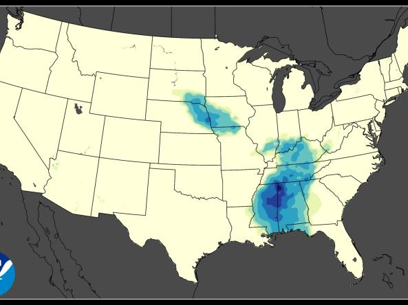
ACIS NRCC Interpolated (Grid 1) is a gridded dataset that includes area averages of daily maximum, minimum, and average temperatures and daily precipitation amounts for the contiguous Uni
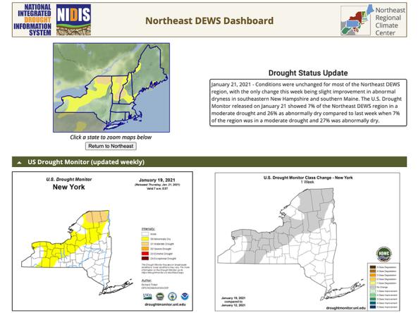
The Northeast Drought Early Warning System (DEWS) Dashboard, hosted by the Northeast Regional Climate Center, displays current drought status, impacts, and future conditions for the North
Related Webinar Recaps


Related Drought Status Updates

July 16, 2026

October 3, 2024
October 30, 2024
November 14, 2024
December 13, 2024
March 14, 2025
Related News

Site Section
News & Events
Building Drought Resilience in the Mid-Atlantic: Strategic Planning Meeting for New Mid-Atlantic Drought Early Warning SystemFrom the unpredictability of flash droughts to dry conditions that threatened water supplies in major cities last year, the Mid-Atlantic faces complex challenges. To confront these growing risks, more than 50 federal, state, academic, and regional stakeholders convened to

Site Section
News & Events
In 2024, heat and a lack of rainfall led to widespread drought across the Mid-Atlantic states (Delaware, Maryland, New Jersey, Pennsylvania, Virginia, West Virginia, and the District of Columbia). For some locations, this was the worst drought the region experienced in more than two decades. NOAA’s National Integrated Drought Information System (NIDIS), Northeast Regional Climate Center (
Related Documents
Document Preview

Document Date
June 2026
Document Preview

Document Date
June 2026
Document Preview

Document Date
March 2026
Document Preview

Document Date
March 2026
Document Preview

Document Date
December 2025
Document Preview

Document Date
December 2025
Document Preview

Document Date
September 2025
Document Preview

Document Date
September 2025
Document Preview

Document Date
September 2025
Document Preview

Document Date
June 2025
Document Preview

Document Date
June 2025
Document Preview

Document Date
March 2025