Site Section
Data & Maps
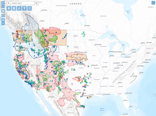
WaterSMART Data Visualization Tool
Associated Agencies
U.S. Department of the Interior (DOI) Bureau of Reclamation
Through WaterSMART (Sustain and Manage America’s Resources for Tomorrow), the U.S. Bureau of Reclamation works cooperatively with states, tribes, and local entities as they plan for and implement actions to increase water supply through investments to modernize existing infrastructure and attention to local water conflicts. The WaterSMART Data Visualization Tool is an interactive map that allows users to explore WaterSMART projects funded since 2010.
How To
- Click the "Time Slider Visualization" button to interact with WaterSMART projects funded since 2010.
- Move the slider at the bottom left to select a time range of projects to view.
- Select a region or dot on the map to learn more information about that project.
Partner(s)
Representative Image