Logo
Site Section
Partner
U.S. Bureau of Reclamation
An Agency/Organization of:
Related Data & Maps
HydroData is the U.S. Bureau of Reclamation’s hydrologic database access portal.
The Reclamation Information Sharing Environment (RISE) is an open data system for viewing, accessing, and downloading the U.S. Bureau of Reclamation's water and water-related data.
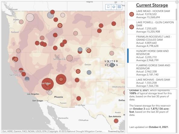
The Bureau of Reclamation's interactive Reservoir Storage Dashboard provides current conditions for 44 major Reclamation reservoirs and comparisons with historical storage data.
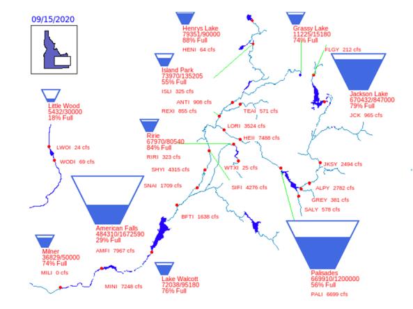
Reservoir storage "teacup" diagrams for U.S. Bureau of Reclamation dams in the Pacific Northwest region.
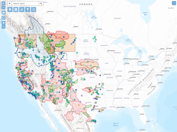
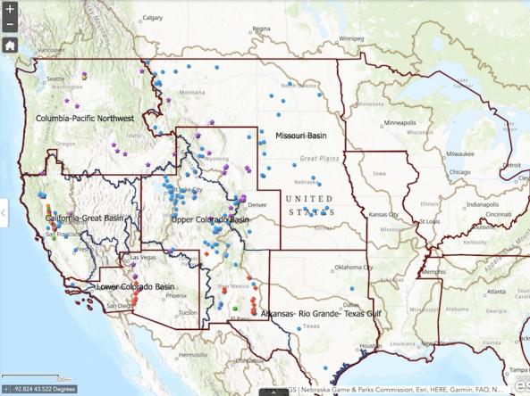
The WaterSMART Data Visualization Tool is an interactive map that allows users to explore Bureau of Reclamation WaterSMART projects funded since 2010.
Related Webinar Recaps

Related News
Site Section
News & Events
Key Points
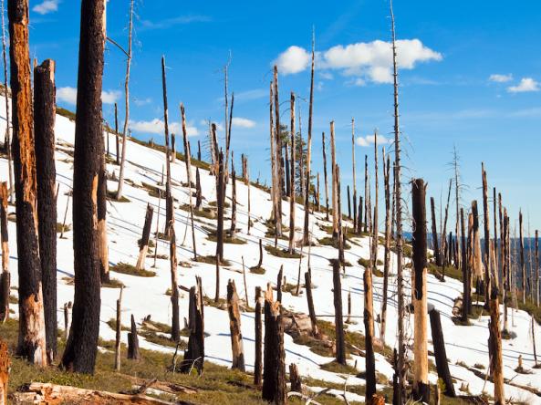
Fires are burning higher in elevation, increasing the geographical overlap between burned areas and seasonal snow zones (areas with persistent snowpack throughout the winter season).
We found a 10-fold increase in fire in California's seasonal snow zones in 2020–2021 versus 2001–2019.
Wildfires accelerate snowmelt resulting in earlier snow disappearance come spring

Site Section
News & Events
The Bureau of Reclamation's FY 2020/2021 WaterSMART Drought Response Program: Drought Contingency Planning Grants Funding Opportunity Announcement (FOA) is now available on grants.gov. Applications are accepted through Wednesday February 5, 2020 at 4pm MST for FY20 funding. The FOA will be updated in early 2020 with the FY21 application submission deadline.
Under the
Site Section
News & Events
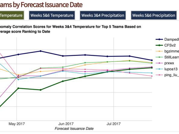
Kicked off in March 2017, the Sub-Seasonal Climate Forecast Rodeo comprised of a year-long, real-time forecasting competition. The Bureau of Reclamation sponsored the competition in partnership with the National Oceanic and Atmospheric Administration (NOAA), U.S. Geological Survey, U.S. Army Corps of Engineers, and California Department of Water Resources.
Competition Results
-- Click
Site Section
News & Events
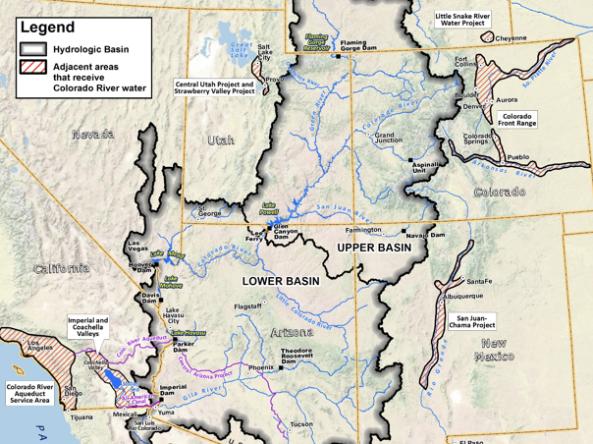
The Colorado River provides water to almost 40 million people and 4 million acres of farmland. Since 2000, historically dry conditions have added stress to the Colorado River’s water resources. As a result, the risk of reaching critically low elevations at Lakes Powell and Mead has increased nearly four-fold over the past decade. Critically low reservoir levels could affect compliance with the
Site Section
News & Events
With approximately one third of the Sub-Seasonal Climate Forecast Rodeo under their belts, team standings are tightening and the seasons are changing. This means top honors in each of the four categories are very much up for grabs, and that cool-season forecasts will play a big role in determining which teams are well positioned on the leader board heading into the spring home stretch
Site Section
News & Events
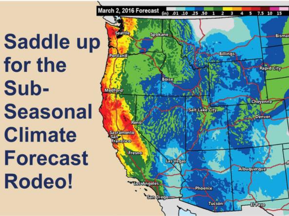
About the Rodeo
The Sub-Seasonal Climate Forecast Rodeo is a year-long, real-time forecasting competition, focused on western U.S. temperature and precipitation for weeks 3&4 and weeks 5&6. The Bureau of Reclamation is sponsoring the competition in partnership with NOAA, USGS, and the U.S. Army Corps of Engineers. Contestants submit forecasts every other week, and these are
Related Documents
Document Preview

Document Date
May 2023
Document Preview

Document Date
January 2016