U.S. flag

An official website of the United States government

The U.S. government is closed. This site will not be updated; however, NOAA websites and social media channels necessary to protect lives and property will be maintained. To learn more, visit commerce.gov.

For the latest forecasts and critical weather information, visit weather.gov.
DATA & MAPS

Select categories to browse data

Looking to Download Data? The Drought.gov team reformats data from multiple partners into web- and GIS-ready formats, which we use throughout Drought.gov. These data are free for all to download.
Search Results(6)

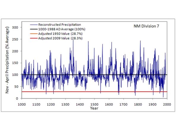
This CLIMAS Southwest Paleoclimate Tool provides detailed paleoclimate information for Arizona and New Mexico. 

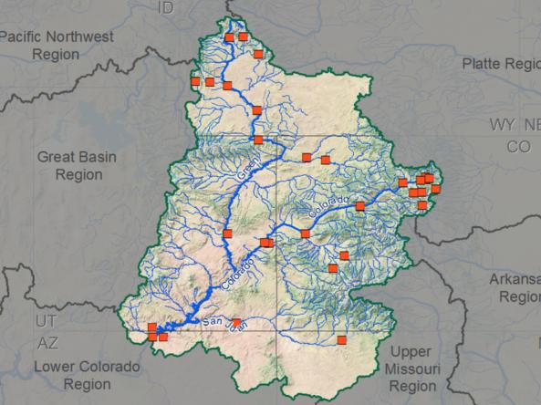
Selected research papers, reports, and other resources which show the current state-of-knowledge and the progress in our understanding of the variability of climate and hydrology in the Colorado River Basin and the potential impacts of future climate change.

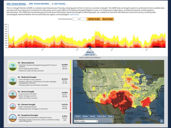
 The U.S. Drought Portal's Historical Data & Conditions Tool displays three historical drought datasets side by side on an interactive time series graph and map: U.S. Drought Monitor (2000 - Present), Standardized Precipitation Index (1895 - Present), and Palmer Modified Drought Index (0 BCE - 2017). These data are available for download in CSV, XML, and JSON format.

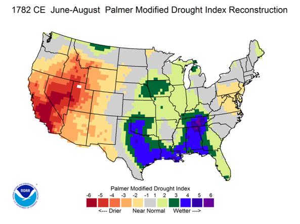
The Living Blended Drought Atlas (LBDA) is a recalibrated data series of June-July-August Palmer Modified Drought Index (PMDI) values by United States climate division, compiled by blending tree-ring reconstructions and instrumental data from the coterminous United States.