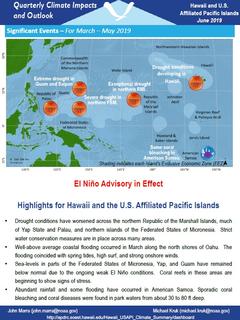
Quarterly Climate Impacts and Outlook for Hawaii and the U.S. Pacific Islands Region for March – May 2019. Dated June 2019.
Includes significant events, regional climate overview, and sectoral impacts for March – May 2019; regional outlook for June – August 2019.
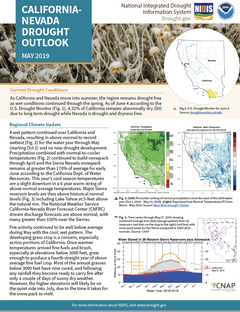
As California and Nevada move into summer, the region remains drought free as wet conditions continued through the spring. As of June 4 according to the U.S. Drought Monitor, 4.32% of California remains abnormally dry (D0) due to long term drought while Nevada is drought and dryness free.
A collection of reports from two Pacific Islands Climate Adaptation Science Center workshops:
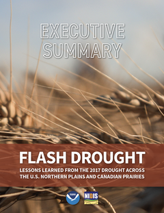
This publication is a summary of the original 72-page report. To learn more about the 2017 U.S. Northern Plains and Canadian Prairies drought, analysis, and mitigation efforts, download a copy of the full report (high resolution PDF , low resolution PDF)
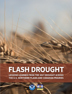
The 2017 drought was a rapid-onset event for northeast Montana, the Dakotas, and the Canadian Prairies during the spring and summer of 2017. It was the worst drought to impact the U.S. Northern Plains in decades and it decimated crops across the region, resulting in $2.6 billion in agricultural losses in the U.S. alone, not including additional losses in Canada. The unique circumstances of this drought created an opportunity to evaluate and improve the efficacy of drought-related coordination, communication, and management within the region in preparation for future droughts.
This assessment is a National Oceanic and Atmospheric Administration (NOAA) response to a request by the National Integrated Drought Information System (NIDIS) for an evaluation of the causes, predictability, and historical context of the 2017 United States Northern Great Plains drought. This assessment was led by a team of weather and climate experts from NOAA’s Earth System Research Laboratory’s Physical Sciences Division and its Cooperative Institute located at the University of Colorado Boulder.
According to the U.S. Drought Monitor’s drought severity designations, “Abnormally Dry” conditions crept into the Southwest region in October 2017 and deepened into widespread “Moderate Drought” in November 2017. The region was in “Severe Drought” by January 2018; “Extreme Drought” by March 2018; and “Exceptional Drought” by May 2018. The “Exceptional Drought” lingered in the region until January 2019. In 2018, the region experienced more than 45 weeks in drought.
When a drought strikes, the ramifications can be costly. Individuals, communities and the environment can suffer when rain fails and water supplies diminish. Devastating droughts during the last decade have brought increased attention to the slow-creeping natural disaster and prompted more and more communities, stakeholders and agencies to become proactive in their approach to preparing for the next drought.
California and Nevada’s climate and weather patterns create fire-prone environments for many wildland–urban interface communities, highlighting the value in understanding the relationships between drought and wildfire. More specifically, information is needed on how drought indices are related to fire danger outputs that are commonly used in fire management.
Between 2016 and 2018, the U.S. Department of Agriculture (USDA) Southern Plains Climate Hub led a project to assess the impacts of the recent historic 2016 and 2018 wildfires on the Southern Plains.