USDA Drought Disaster Designations
United States Department of Agriculture (USDA)
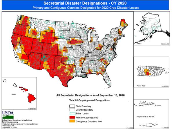
Agriculture-related disasters and disaster designations are quite common. Many counties in the United States have been designated as disaster areas in the past several years, even in years of record crop production.
The Secretary of Agriculture is authorized to designate counties as disaster areas to make emergency loans (EM) available to producers suffering losses in those counties and in counties that are contiguous to a designated county. In addition to EM eligibility, other emergency assistance programs, such as FSA disaster assistance programs, have historically used disaster designations as an eligibility trigger.
This map product displays counties declared primary (red) or contiguous (orange) disaster counties, where producers may be eligible for emergency aid.
How to
What can I do with these data?
- View the current counties declared primary or contiguous disaster counties
How do I use the site?
- View the map to identify if you are located in a declared disaster county
- Download a list of designated primary and contiguous counties where a drought disaster declaration is in effect (PDF)