NDMC & NIDIS Introduce New U.S. Drought Monitor Maps for NWS Regions
Through a partnership with NIDIS, the National Drought Mitigation Center (NDMC) has introduced two new ways to view the U.S. Drought Monitor map. Users can now view maps specific to the regions of NOAA’s River Forecast Centers (RFCs) and Weather Forecast Offices (WFOs), making it easier for the National Weather Service (NWS) to meet the needs of decision-makers and better understand the drought status within their entire service area boundaries.
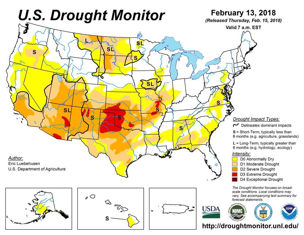
The U.S. Drought Monitor is a well-known resource for decision makers, scientists, and a range of other stakeholders interested in drought conditions across the US. Published weekly through a partnership between NOAA, the USDA, and the NDMC at the University of Nebraska-Lincoln, the U.S. Drought Monitor is produced though a collaborative effort of more than 425 contributors across the country, consolidating current climatic, hydrologic, and soil conditions with reported impacts and observations. The results are presented in multiple formats, including maps that range from nationwide to county-level, written analysis of conditions for each of the seven climate regions, and data in multiple formats like GIS and Time Series.
Stakeholders will now be able to download their region maps for use in briefings and reports, to share on social media, and to make informed decisions that improve their region’s capacity to plan, adapt, change, and recover in the face of drought conditions. Ray Wolf, program manager for the NWS Central Region Climate Services in Davenport, Iowa, explained that providing the data in a format tailored to these regions provides a clearer picture to decision makers: “For the Quad Cities, we’re half in Iowa and half in Illinois. One focused right on our office will fit right in to how we want to display the information. Having a local entry point is helpful.”
There are 121 WFOs and 12 RFCs that will now have access to customized maps of the U.S. Drought Monitor, as well as the same data resources available at a national scale and to all other supported geographical scales – including the USDA’s Climate Hub regions. This enhancement to the U.S. Drought Monitor is supported by the Drought Risk Management Research Center, a partnership between NDMC and NIDIS to provide innovations in research and information delivery to improve drought risk management and resilience across the United States.