Quarterly Climate Impacts and Outlook for the Missouri River Basin June – August 2020. Dated September 2020.
Summer 2020 was one of the warmest on record for many states in the region, including CO (3rd), NE (9th), ND (10th), SD (11th), and WY (11th). It was also one of the driest summers for CO (7th), IA (14th), NE (16th), and WY (16th).
Quarterly Climate Impacts and Outlook for the Chesapeake Bay Region for June – August 2020. Dated September 2020.
The entire region experienced warmer-than-normal conditions; it was the hottest summer on record for Norfolk, Virginia, and Harrisburg and Williamsport, Pennsylvania. This summer saw a wide range of precipitation conditions; the northern portions of the Chesapeake Bay watershed had an abnormally dry summer, while the southern and eastern portions of the watershed experienced above normal precipitation.
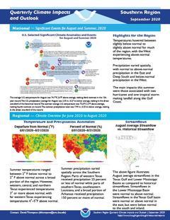
Quarterly Climate Impacts and Outlook for the Southern Region for June – August 2020. Dated September 2020.
Temperatures hovered between slightly below normal to slightly above normal for much of the region, with the West experiencing above-normal temperatures. Precipitation varied spatially, with normal to above-normal precipitation in the East and Deep South and below-normal precipitation in the West.
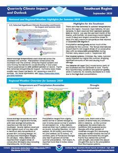
Quarterly Climate Impacts and Outlook for the Southeast Region for June – August 2020. Dated September 2020.
Above-average temperatures were recorded over Virginia and Florida, with near-average temperatures reported over the rest of the Southeast. A few stations observed their top 5 wettest summers on record, including Staunton, VA and Hickory, NC. In contrast, parts of Florida and Georgia only had 70 percent of normal summer precipitation.
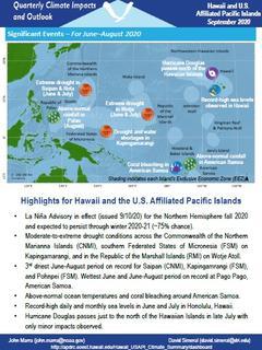
Quarterly Climate Impacts and Outlook for Hawaii and the U.S. Pacific Islands Region for June – August 2020. Dated September 2020.
Includes significant events, regional climate overview, and sectoral impacts for June – August 2020; regional outlook for September – November 2020.
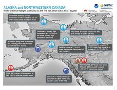
Quarterly Climate Impacts and Outlook for Alaska and Northwestern Canada for December 2019 – February 2020; outlook for March – May 2020. Dated March 2020.
The winter period, December 2019 to February 2020, was colder than normal in almost all of Alaska and most of central and northern Yukon and Northwest Territories. This past winter was the first normally cold Yukon winter in the last few years.
Quarterly Climate Impacts and Outlook for the Great Lakes Region for December 2019 – February 2020. Dated March 2020.
Most of the Great Lakes states had one of their top 10 warmest winters on record. Winter was drier with the basin seeing 84% of average. There was below average ice cover due to warm air temperatures and lack of consecutive days below freezing.
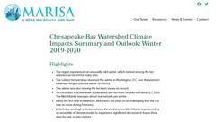
Quarterly Climate Impacts and Outlook for the Chesapeake Bay Region for December 2019 – February 2020. Dated March 2020.
The entire region experienced an unusually mild winter, which ranked among the ten warmest on record for many sites. Precipitation departures from normal show that the Chesapeake Bay watershed experienced both more and less precipitation than historical averages.
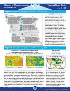
Quarterly Climate Impacts and Outlook for the Missouri River Basin December 2019 – February 2020. Dated March 2020.
Seasonal temperatures for the majority of the Missouri Basin were much above normal. The main exception to this warmth was the mountainous areas of Colorado and Wyoming. Meanwhile, precipitation varied across the region, with the largest departures occurring across eastern parts of the region.
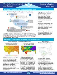
Quarterly Climate Impacts and Outlook for the Southern Region for December 2019 – February 2020. Dated March 2020.
Winter temperatures were above normal for much of the region with the west experiencing smaller departures from normal due to a cooler February. Winter precipitation varied spatially across the region with wetter than normal conditions in the north and east and drier than normal conditions in parts of the west and south.


