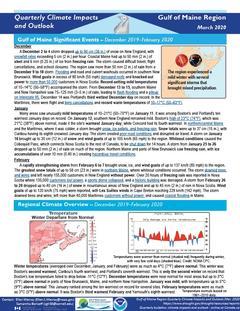
Quarterly Climate Impacts and Outlook for the Gulf of Maine Region for December 2019 – February 2020. Dated March 2020.
Winter temperatures were as much as 4°C (7°F) above normal. Winter precipitation ranged from 50% of normal to 150% of normal. In Nova Scotia, this winter ranked among the ten driest for the Greenwood and Truro areas.
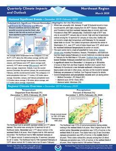
Quarterly Climate Impacts and Outlook for the Northeast Region for December 2019 – February 2020. Dated March 2020.
The Northeast had its seventh warmest winter at 4.1°F above normal. This winter was among the 10 warmest for all 12 Northeast states. The Northeast saw 113% of normal precipitation during winter, ranking in the wettest third of all years.
Quarterly Climate Impacts and Outlook for the Southeast Region for December 2019 – February 2020. Dated March 2020.
Above-average temperatures were recorded over most of the Southeast. Maximum temperatures were generally near normal, but minimum temperatures were 3-6 F above normal due to high humidity and cloud cover. Precipitation ranged from slightly below normal in the Florida peninsula to over 10 inches above normal in northern Alabama.
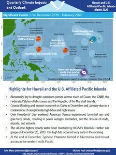
Quarterly Climate Impacts and Outlook for Hawaii and the U.S. Pacific Islands Region for December 2019 – February 2020. Dated March 2020.
Includes significant events, regional climate overview, and sectoral impacts for December 2019 – February 2020; regional outlook for March – May 2020.
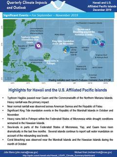
Quarterly Climate Impacts and Outlook for Hawaii and the U.S. Pacific Islands Region for September – November 2019. Dated December 2019.
Includes significant events, regional climate overview, and sectoral impacts for September – November 2019; regional outlook for December 2019 – February 2020.
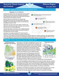
Quarterly Climate Impacts and Outlook for the Midwest Region for September – November 2019. Dated December 2019.
Temperatures in the region averaged below normal in the upper Midwest and above normal further southeast. The continued wetness of 2019 persisted into the fall. Year-to-date precipitation ranked among the top 10 in all nine states, with new records in Wisconsin, and the Midwest.
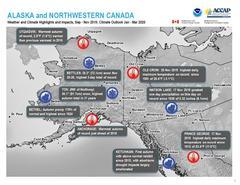
Quarterly Climate Impacts and Outlook for Alaska and Northwestern Canada for September – November 2019; outlook for January – March 2020. Dated December 2019.
Autumn 2019 began with drought or abnormal dryness in southern Alaska, stretching from the Alaska Peninsula in the west to the Panhandle in the east. Repeated autumn storms brought a range of near normal to much above normal precipitation to southwest and south central Alaska.
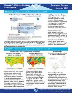
Quarterly Climate Impacts and Outlook for the Southern Region for September – November 2019. Dated December 2019.
Fall temperatures as a whole were near normal, but there were two distinct regimes. Record warmth was experienced from September through early October while the end of October through November were much cooler than normal. Precipitation behaved in a similar fashion, with several stations experiencing their driest September on record followed by their wettest October on record.
Quarterly Climate Impacts and Outlook for the Chesapeake Bay Region for September – November 2019. Dated December 2019.
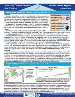
Quarterly Climate Impacts and Outlook for the Gulf of Maine Region for September – November 2019. Dated December 2019.
Autumn temperatures (averaged over September, October, and November) ranged from 2°C (4°F) below normal to near normal in most areas, with eastern Massachusetts up to 1°C (2°F) above normal. Autumn precipitation (accumulated from September to November) ranged from 50% of normal to 150% of normal.


