Quarterly Climate Impacts and Outlook for the Northeast Region for September – November 2019. Dated December 2019.
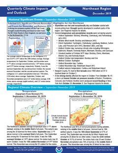
The Northeast's autumn average temperature was 0.1°F above normal, ranking in the middle third of all years. The Northeast saw 95% of normal precipitation during autumn, ranking in the middle third of all years.
Quarterly Climate Impacts and Outlook for the Southeast Region for September – November 2019. Dated December 2019.
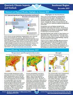
Above-average temperatures were recorded over most of the Southeast. Mean temperatures were in the top five warmest at 35 long-term stations. Autumn precipitation was below normal for most of the Southeast region. None of the long-term stations ranked within the top 10 wettest for the season.
Quarterly Climate Impacts and Outlook for the Great Lakes Region for September – November 2019. Dated December 2019.
Autumn temperatures ranged from 2°C (4°F) below normal to 2°C (4°F) above normal. Autumn precipitation ranged from 88% to 125% of average, with the overall basin seeing 115% of average.
Quarterly Climate Impacts and Outlook for the Missouri River Basin September – November 2019. Dated December 2019.
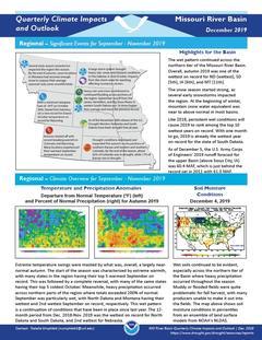
Extreme temperature swings were masked by what was, overall, a largely near-normal autumn.The wet pattern continued across the northern tier of the Missouri River Basin. Overall, autumn 2019 was one of the wettest on record for North Dakota (wettest), South Dakota (5th), Iowa (6th), and Montana (11th).
Quarterly Climate Impacts and Outlook for the Western Region for September – November 2019. Dated December 2019.
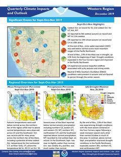
Autumn temperatures were well below normal across the northern tier of the region while near to above normal temperatures were observed across California and the Southwest. Several areas of the West reported below normal autumn precipitation including northern California, eastern Utah, and western Colorado. Montana, northern Wyoming, northwestern Utah, and the Southwest reported above normal precipitation.
Current Drought Conditions
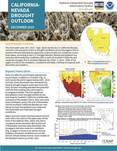
The 2020 water year (Oct. 2019 - Sept. 2020) started dry in California-Nevada and led to the presence of dry or drought conditions across the region, first in southern Nevada followed by expansion of abnormally dry conditions across both states, according to the U.S. Drought Monitor. Recent precipitation has removed abnormally dry conditions (D0) in parts of southern California and moderate drought (D1) in southern Nevada. As of Dec. 5, 2019, ~82% of the region is in D0 or D1 conditions.
Current Drought Conditions
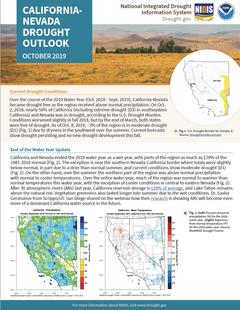
Over the course of the 2019 Water Year (Oct. 2018 - Sept. 2019), California-Nevada became drought free as the region received above normal precipitation. On Oct. 2, 2018, nearly 50% of California (including extreme drought (D3) in southeastern California) and Nevada was in drought, according to the U.S. Drought Monitor. Conditions worsened slightly in fall 2018, but by the end of March, both states were free of drought. As of Oct. 8, 2019, ~3% of the region is in moderate drought (D1) (Fig. 1) due to dryness in the southwest over the summer.
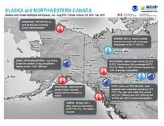
Quarterly Climate Impacts and Outlook for Alaska and Northwestern Canada for June – August 2019; outlook for October – December 2019. Dated September 2019.
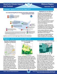
Quarterly Climate Impacts and Outlook for the Midwest Region for June – August 2019. Dated September 2019.
The Midwest had close-to-normal temperatures for the summer across the entire region. Summer precipitation was near normal in the upper two-thirds of the region and above normal in the southern third.
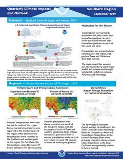
Quarterly Climate Impacts and Outlook for the Southern Region for June – August 2019. Dated September 2019.
Summer temperatures were near normal for much of the region. Below-normal temperatures were reported in the northern part of the region, while above-normal temperatures were reported in the southern and western parts of the region. Summer precipitation was above normal across much of the Southern Region with the exception of much of Texas and western Oklahoma.


