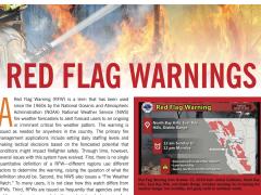
2020 U.S. Fire Outlook
2020 U.S. Fire Outlook
With most of the Western United States experiencing drought or dryness, this summer has the potential to be an especially challenging wildland fire year. Bryan Henry, Meteorologist with the National Interagency Fire Center (NIFC), recently provided the 2020 U.S. Fire Season Outlook in a presentation for the May NIDIS CA/NV DEWS Drought & Climate Outlook Webinar. Henry will also provide another update during the June 22 NIDIS Pacific Northwest DEWS webinar.
Below is a summary of Henry’s presentation, updated by NIDIS with the latest data and maps. For the official NIFC Outlooks, please visit https://www.predictiveservices.nifc.gov/outlooks/outlooks.htm.
Assessing Primary Factors Impacting Fire Season
- Fall 2019 was very dry along the West Coast.
- Winter snowpack was at least average except across Oregon, California, and south- central Alaska.
- Spring snowpack melting rates were faster than average except along the Northern Continental Divide. Spring was overall warmer and drier than average in the West except in mid-May.
- Fine fuel loading is above average in many areas for the third consecutive year.
- An average monsoon is expected to arrive by mid-July.
Precipitation
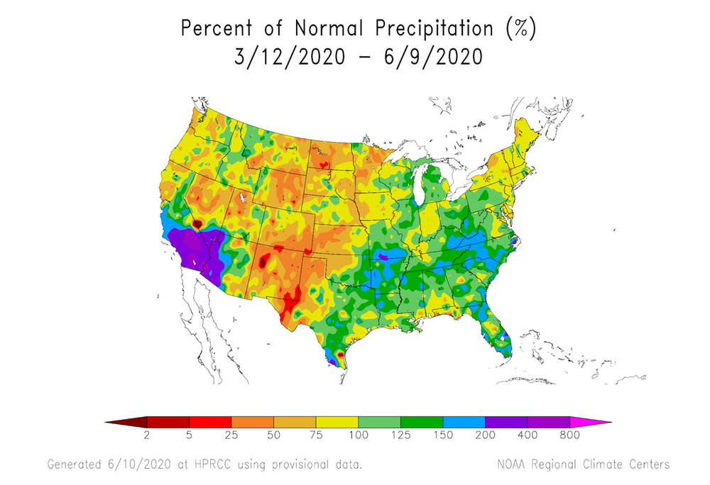
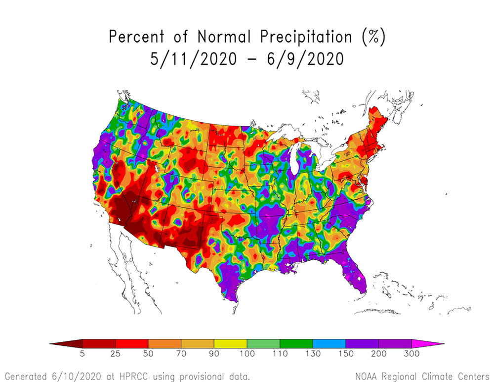
The past 90 days saw drier than average conditions across most of the western 2/3 of the country, with exceptions in the Southwest.
Over the past 30 days, the trend has reversed with the Southwest being much drier than average and the Northwest getting needed precipitation. Overall, most of the U.S. from the Great Plains westward has been drier than average plus Northern MN, the Upper Peninsula in MI, the Northeast, and other areas scattered across the East.
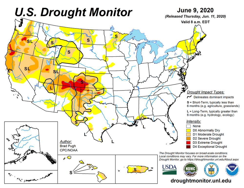
Drought
Long-term drought remains in place across the Northwest, Great Basin, and the Four Corners regions. Some improvement has occurred across the Northwest before the emergence of the traditional dry summer, ridging patterns.
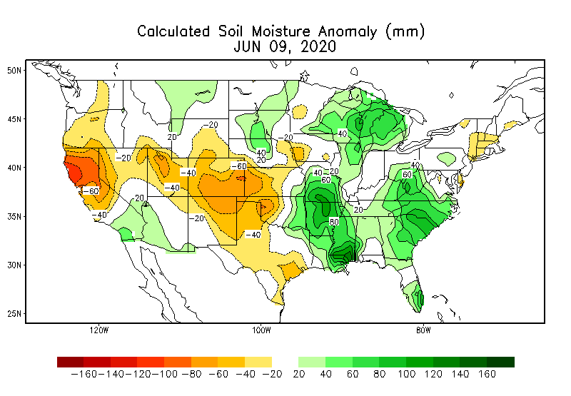
Soil moisture anomalies have marginally improved along the West Coast but are worsening across Colorado, Northern New Mexico, and Utah.

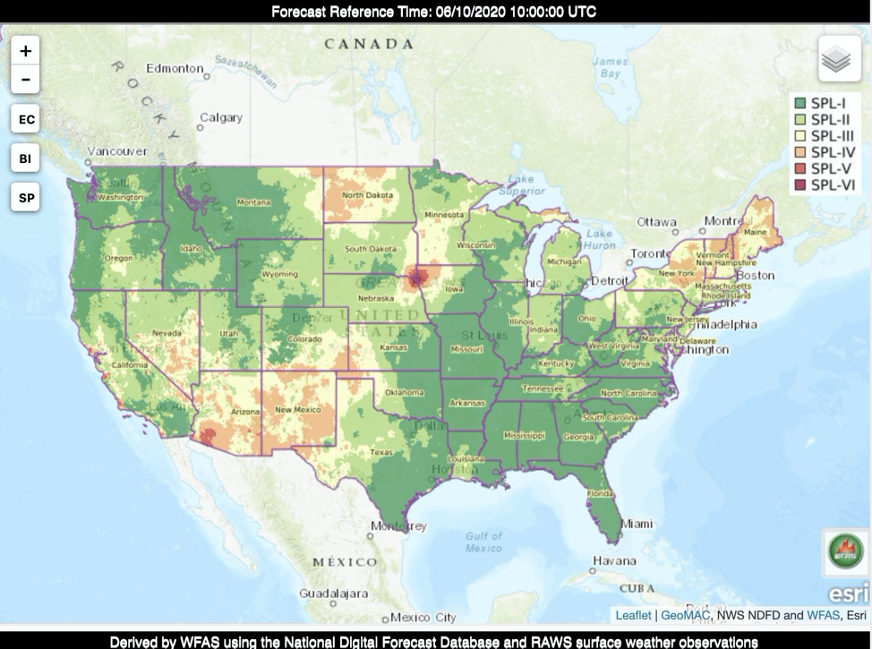
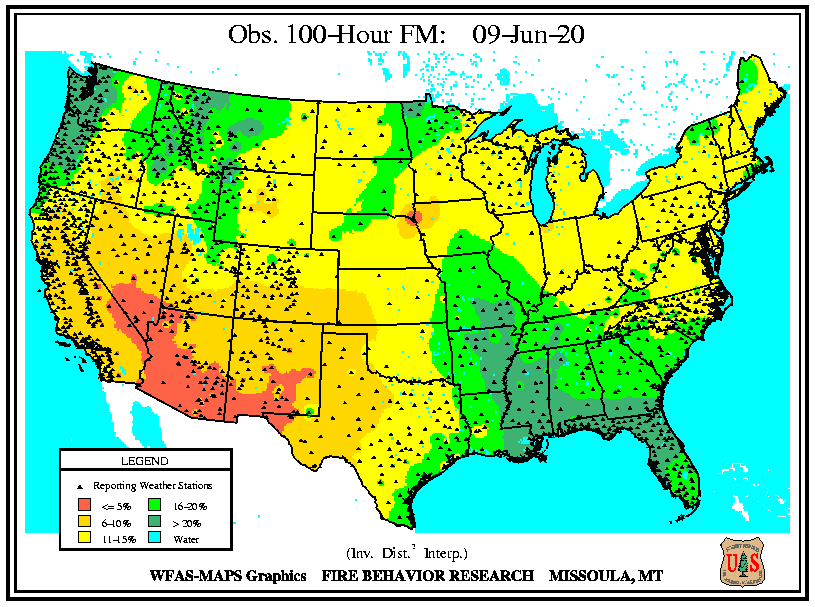
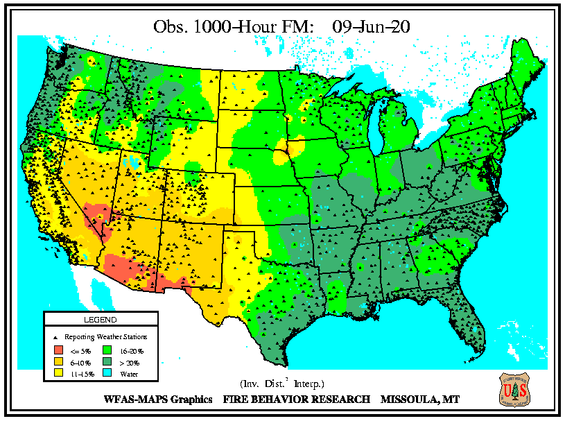
Fuels
The Four Corner states and the Central through Southern Great Basin are showing critically dry fuels that are receptive to fire activity. The Upper Peninsula of Michigan is also very dry as is New England. Dryness is now encroaching into Wyoming. Marked improvement has occurred across the Northwest.
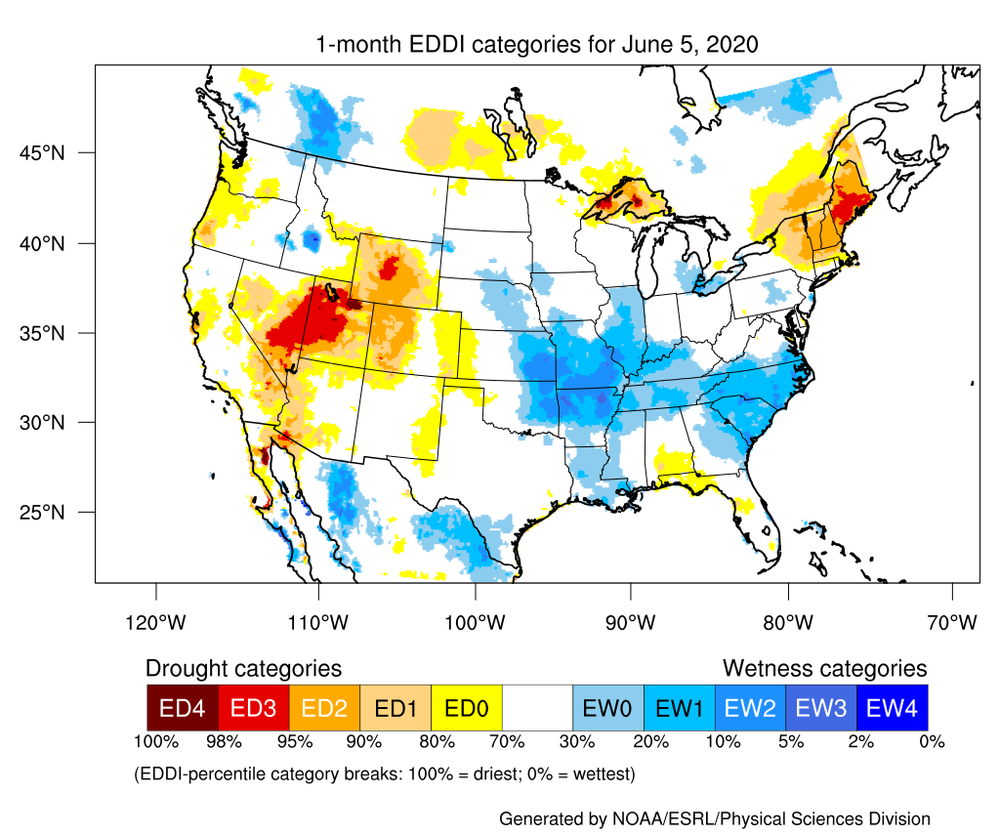
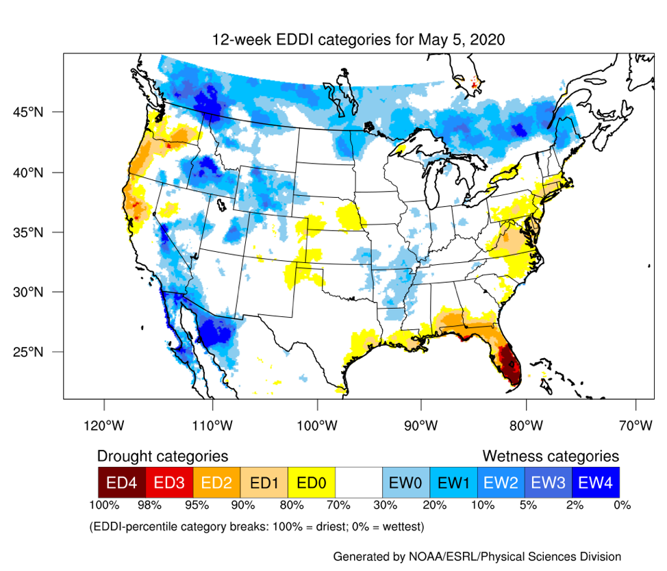
EDDI
Trends in the Evaporative Demand Drought Index (EDDI) are encouraging for the Northwest and Northern California. However, across the Great Basin, the Four Corner states, and West Texas, conditions are worsening as the vegetation becomes more drought-stressed. Central Wyoming is also becoming a spot of increasing dryness. Most of Florida and South Alabama are improving.
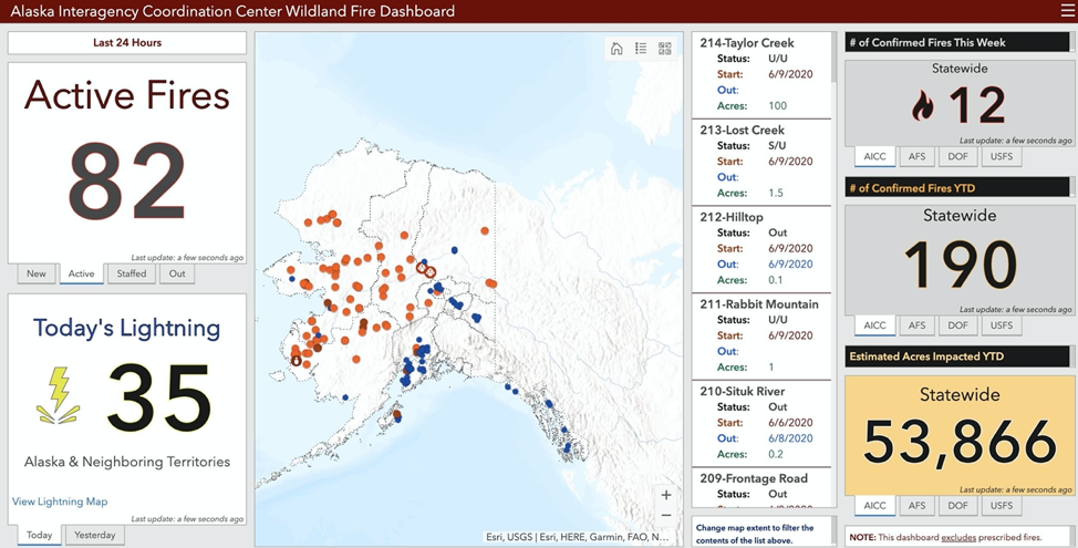
Alaska
At the end of May, the majority of the burnable terrain in Alaska had undergone green-up. Surface fuels have been cleared of snow, and drying is beginning to descend into the duff layers. Thunderstorm season has begun and fires started by lightning are occurring. There are currently 82 active fires as of 6/10.
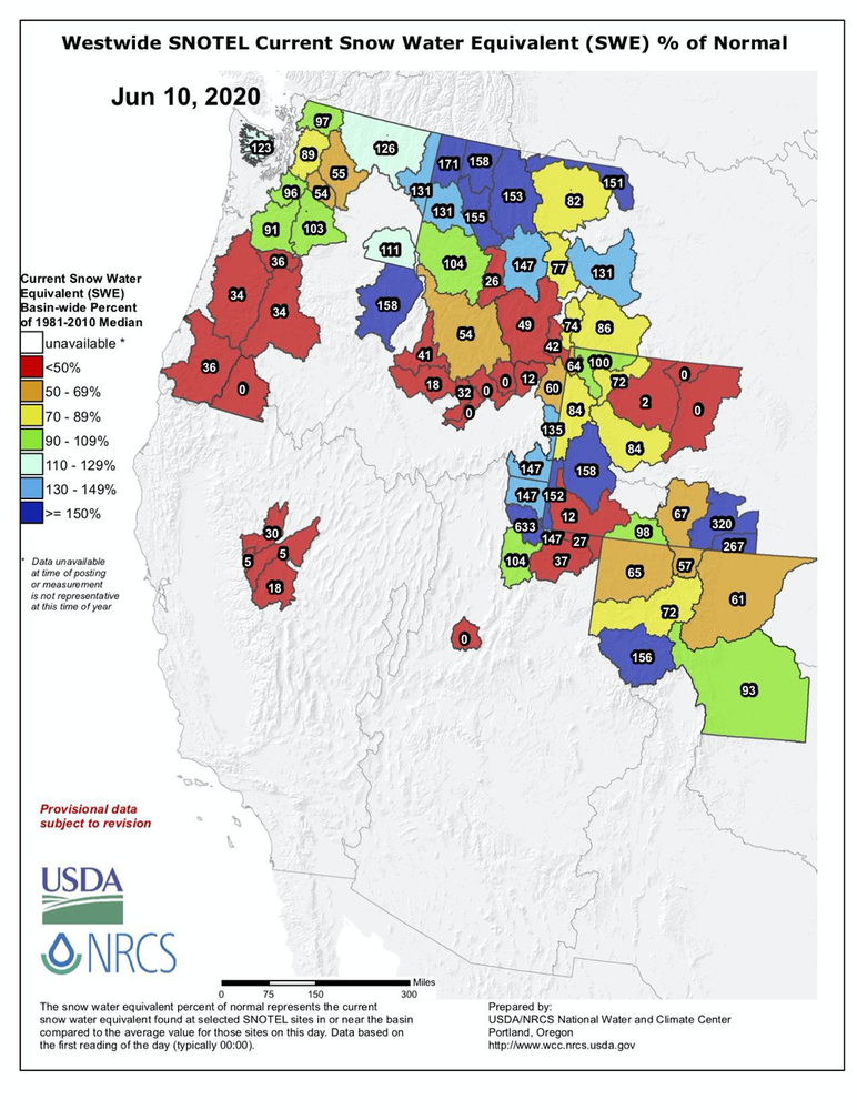
Snowpack
Dramatic changes have occurred in the mountain snowpack levels across most of the West over the past month and a half. Snowpack melting rates have accelerated greatly. Snowpack in many basins is completely gone, in most cases earlier than average.
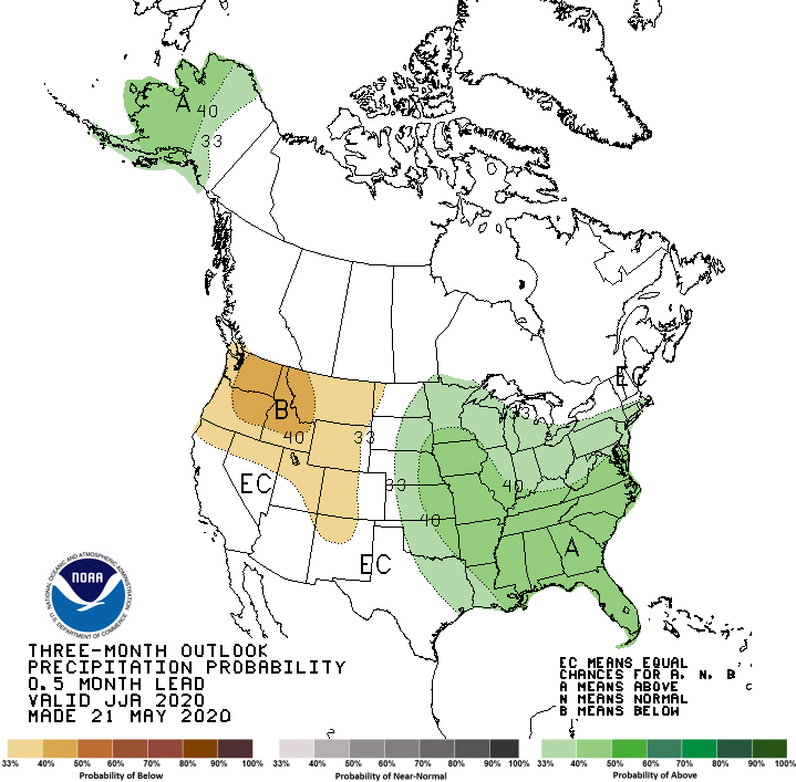
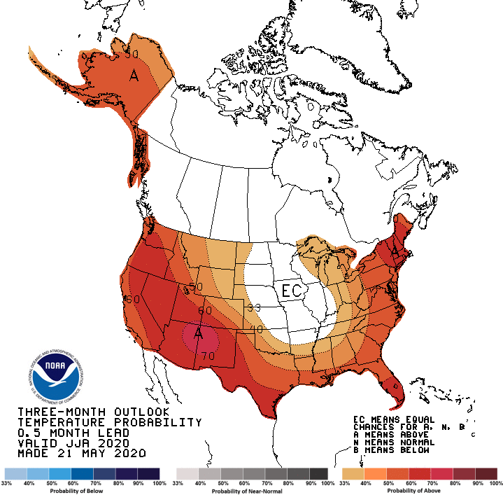
CPC Outlooks
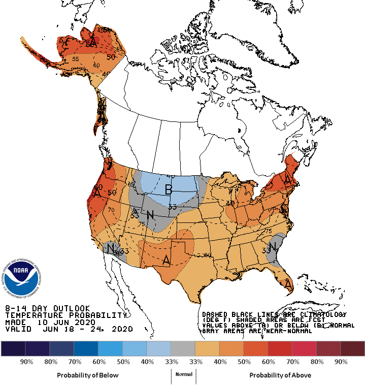
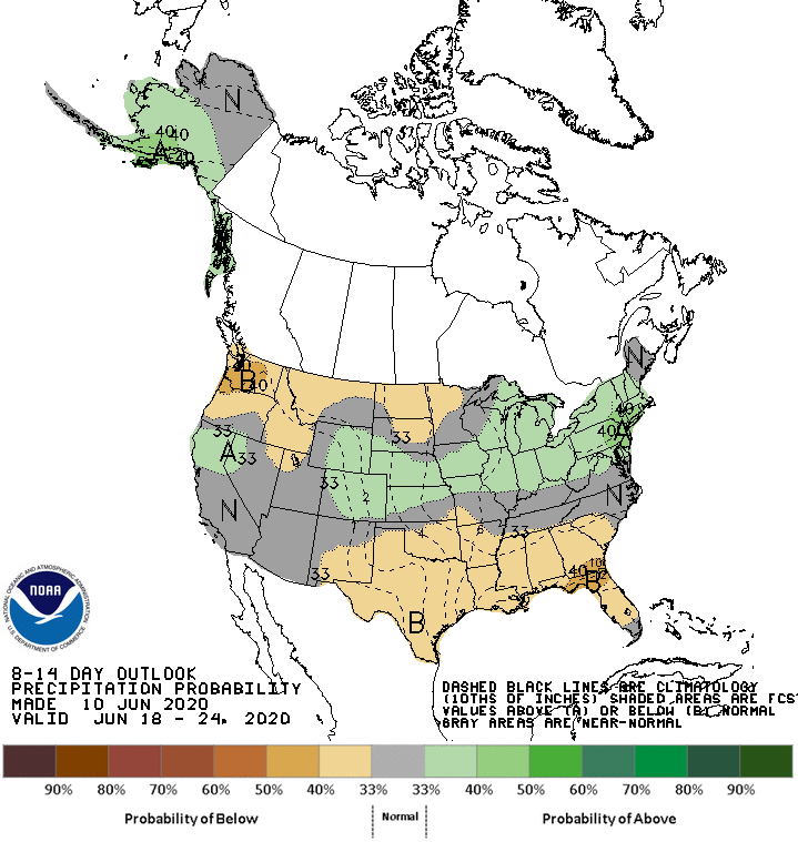
The 8-14 Day Outlook suggests elevated probabilities for above normal temperatures for just about the entire U.S., with the exception of the Northern Plains. It looks like below normal precipitation for the South/Southeast and North/Northwest, with above normal precipitation running from the Central Rockies across to the Northeast.
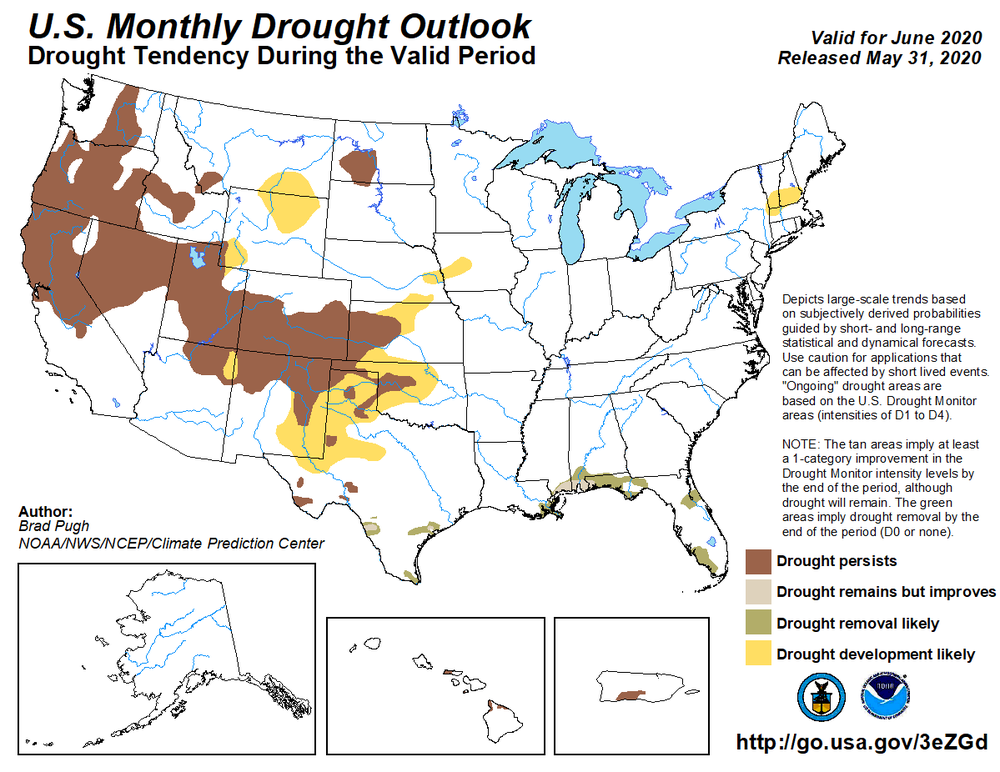
The one-month outlook suggests a greater potential for long-term hotter and drier than average conditions across the West during the fire season. Long-term model data from various sources are in general agreement on this scenario, so confidence in the data is “moderate.”
In Summary
Alaska
Average fire season expected. Activity is increasing across the state. Indices are elevating. Overall warmer and wetter than average conditions are expected.
Pacific Northwest
A wet pattern has delayed the onset of more significant activity. A dry/hot summer pattern is slowly emerging. Prepare for an above average season in most areas.
California and Southwest
The Southwest is entering its peak season, which will slow by mid-July. California will transition into fire season in June with above activity observed by July.
Great Basin
The southern Basin is entering its peak. Fuels are receptive. A gradual transition north is expected in June and July with above normal activity expected.
Northern Rockies
Normal transition into fire season is expected. Snowpack is coming off the Divide at an average rate. Above normal potential expected July-Aug across western areas.
Rocky Mountain
Southern Colorado is under extreme drought. Large fire potential is above normal. Wyoming is becoming increasingly receptive as fuels dry.
Eastern Area
Minnesota and the Upper Peninsula of Michigan are much drier than average. New England is showing dryness as well. Some mid-term relief is expected and should temper fire potential.
Southern Area
West Texas remains very dry. Florida is improving, but Northeast Florida remains a concern. Most other locations are wetter than average.
Progression Through Season
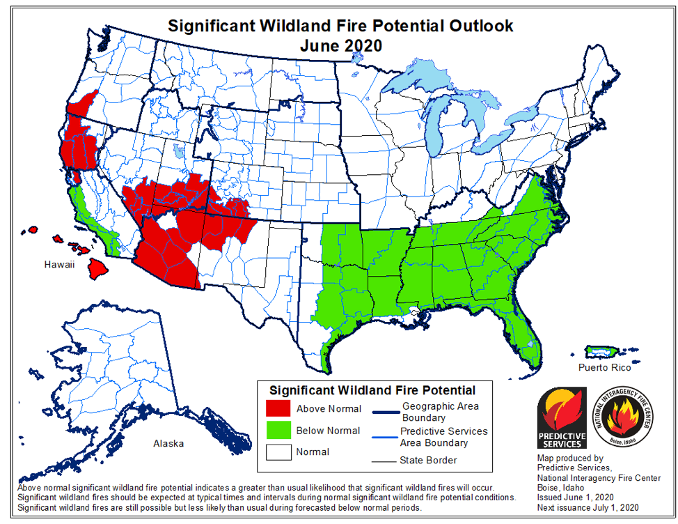
June
The Southwest fire season will peak as the GB becomes more active. Mountain snowpack is gone in most areas. Fine fuels begin to cure elsewhere with some increased activity observed. Alaska peaks late in the month.
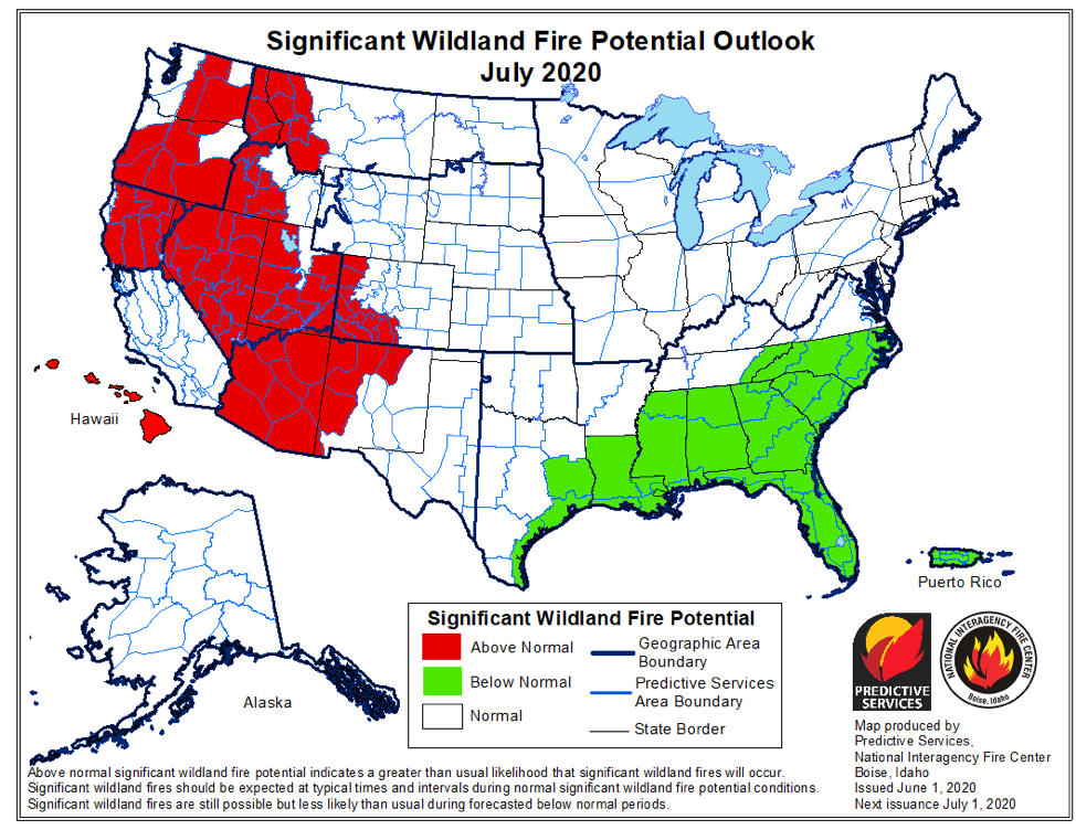
July
The remainder of the West enters its peak season. Monsoonal convection ends across the Southwest and Southern Colorado while an increase in lightning leads to more starts further north. Alaska’s season ends by late month.
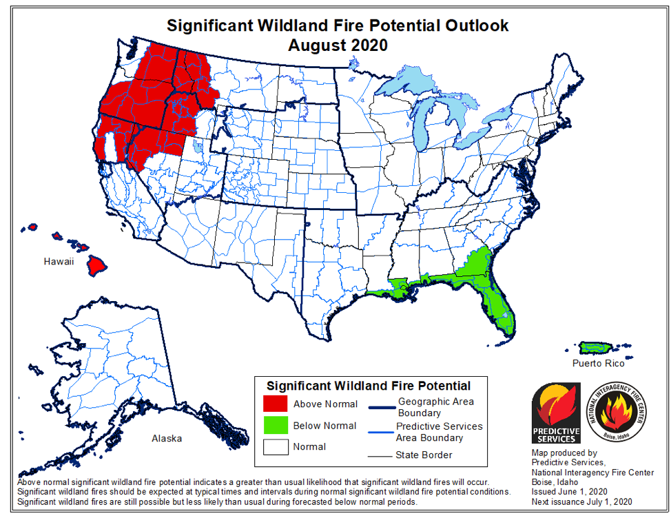
August
The Western Fire Season peak continues. Focus points of most significant activity will be the Pacific Northwest, Southern Idaho, California, and Nevada (early). Dry frontal passages might be more of a concern for winds this year if ridge events are weaker.
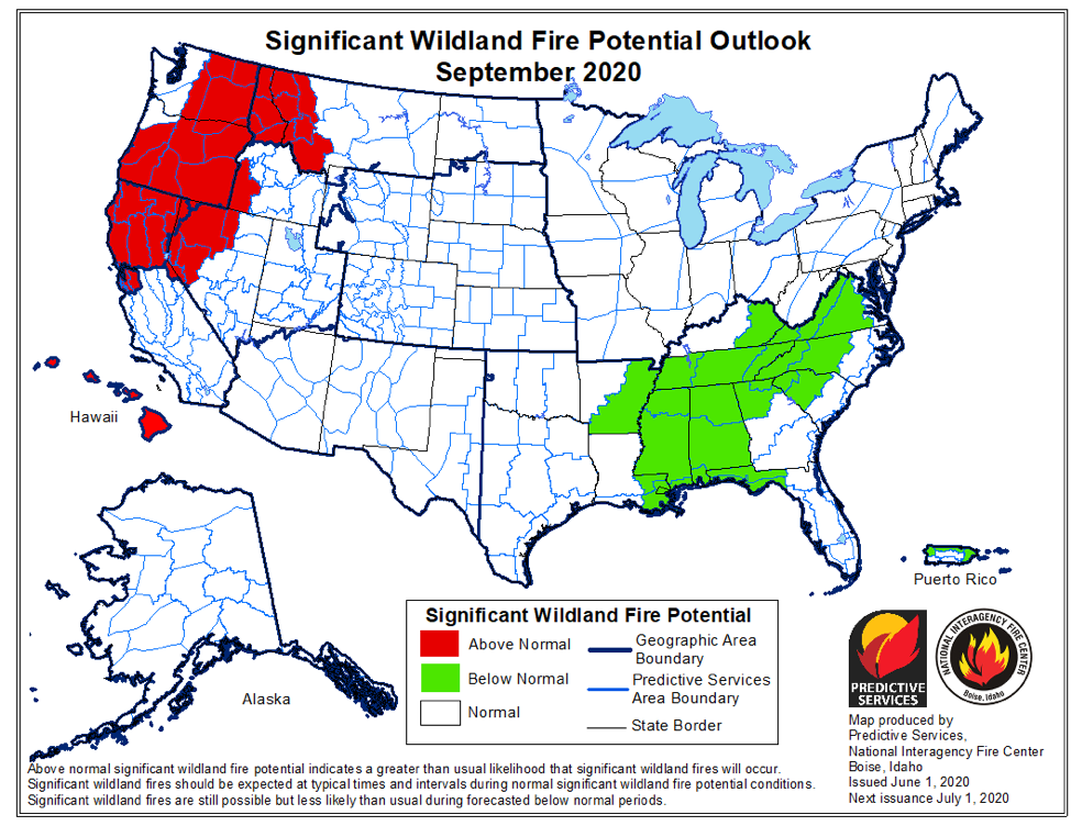
September
The Pacific Northwest, Northern California, and western Portions of the Northern Rockies will remain at peak activity early in the month. Wet frontal passages will begin to curtail activity by mid-month.
National Wildland Fire Potential Outlooks
Thanks to Bryan Henry, Meteorologist with the National Interagency Fire Center.