Snowpack Data Inform Decisions Across the Pacific Northwest
Every winter, vast quantities of snow start accumulating in the Cascades and Rocky Mountains of the Pacific Northwest. This snow typically reaches a peak volume in late March or early April. Snowpack is the largest reservoir in the Pacific Northwest. As spring and summer temperatures warm, the snow begins to melt and increase river flows from March through July. The increase in flows can result in flooding, but where storage facilities exist to capture the water, accurate monitoring of the snowpack can significantly reduce the risk of floods. The stored water can be used for agriculture, fisheries, energy, industry, drinking water, and recreation.
Snowpack monitoring is essential to supporting decision-making across many sectors. This vital resource to the Pacific Northwest is measured by the Snow Survey and Water Supply Forecasting Program (SSWSFP, Snow Survey), which is part of the U.S. Department of Agriculture (USDA) Natural Resources Conservation Service (NRCS).
What Is the Snow Survey Program?
The Snow Survey was created in 1934 during the Dust Bowl—a period of intense drought across the West and Great Plains—partly in response to farmers’ requests for better predictions of water availability for agriculture. Today, the program is one of the primary sources of information for water management in the West.
The Snow Survey program operates a network of nearly 950 automated hydrological and meteorological stations in the western United States, commonly referred to as Snow Telemetry (SNOTEL) and SNOTEL-light (SNOLITE) stations. The Snow Survey also manually measures snowpack at an additional 1,130 sites across the West. NRCS offices support snow surveyors, water supply specialists, hydrologists, and technicians who collect, analyze, and maintain the SNOTEL network and data to communicate that information to interested parties throughout their regions. These observational data on the amount of water contained in the snowpack are used to produce water supply forecasts for nearly 600 locations across the West.
Snowpack Data Helps Predict Water for Agriculture, Communities, and More
Water managers and agricultural producers closely track how the snowpack is developing to determine how much water will be available during the irrigation season, which typically runs from April through October. Agricultural producers rely on accurate measurements of precipitation and snow water equivalent (SWE, the amount of liquid water frozen in snow) to decide what crops to plant each year. These decisions are often made early in winter.
Reservoir operators use SNOTEL data to decide how much water to store for use by agricultural producers during the dry summer months or release for flood prevention in spring. SNOTEL data is the sole source of snowpack data for many states to provide drought warning to water users (including agricultural, municipal, industry, and environmental sectors) and to inform planning for immediate and long-term drought impacts.
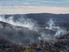
The SNOTEL network has monitored snowpack continuously for longer than any other network in the western United States. The observational and predictive data provided through the network support decision-making in many sectors and for many applications, including agriculture, industrial and municipal water supply, fisheries and wildlife management, flood control, and hazard-risk assessments associated with drought, wildfire, flooding, landslides, and avalanches. Data are aggregated across state lines and watershed boundaries, provided at a scale most useful to decision-makers.
Maintaining Reliable, High-Quality Snowpack Data
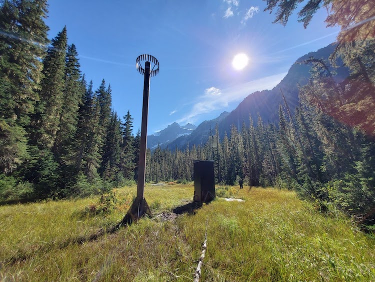
Each SNOTEL and SNOLITE station requires regular maintenance to operate reliably. Snow surveyors are as busy during summer as during winter. During summer, access to sites is much easier, and conditions are more amenable to routine servicing of instruments. However, during winter, access can be arduous, often requiring skis, snowmobiles, SNOCATs, or helicopters.
Regular maintenance includes emptying accumulated water in each station’s precipitation gauge and maintaining snow pillows, which weigh the snow to measure the water content contained in the snowpack. These instruments are pivotal for collecting snowpack data for decision-making. SNOTEL sites additionally measure snow depth, air temperature, soil moisture, and soil temperature. Annual maintenance also includes rotating equipment and sensors for re-calibration, upgrading sensors, and removing vegetation to ensure operability and reliable data collection. Data from automated SNOTEL stations and manually measured snow courses must be managed regularly by Snow Survey staff to ensure quality and public availability.
Below are a few examples of how SNOTEL data informs proactive decision-making across the Pacific Northwest.
SNOTEL Supports Cropland Irrigation and Flood Risk Management in Idaho
In Idaho, approximately 75% of the state’s annual surface water comes from mountain snowpack. The snowpack is also the primary source for groundwater recharge. Irrigated agriculture (86%), aquaculture (11%), and public supply or domestic water (1.6%) account for around 99% of the surface water used in Idaho. SNOTEL sites are pivotal for allowing decision-makers in Idaho to understand the amount of annual surface water that will be available for these sectors.
April 1 streamflow forecasts rely on accurate snowpack data and play an important role in determining water allotments during the upcoming irrigation season. Dam operators also use these forecasts in combination with the SNOTEL data to decide how much water to release for flood risk management operations during the spring runoff season. In the Big Wood watershed, the Snow Survey April 1 streamflow forecast is used to conjunctively manage groundwater and surface water use within the drainage basin. A threshold streamflow volume triggers specific, agreed-upon water management actions, such as reducing groundwater pumping and delivering additional storage water to senior water right holders. These actions help water users sustainably manage their water supply.
SNOTEL Supports Drought Early Warning in Washington
SNOTEL data have also played a key role in drought early warning in Washington, leading to reduced impacts on agriculture and other sectors. Washington defines drought conditions and procedures for state Drought Emergency Declarations in state statute. State law has two conditions that guide a drought declaration: (1) water supply is below 75% of normal (compared to average for the last 30-year period), statewide or in specific geographic areas, and (2) the water shortage will likely create undue hardship for water users or the environment.
In a drought year, junior water right holders are more likely to have their water right curtailed or even cut off entirely, which can be catastrophic to growers with a substantial investment in perennial crops, such as apples and wine grapes. The early planning facilitated by snowpack data is thus essential to effective drought preparedness and response. For example, in April 2024, SNOTEL data provided early warning of drought for the state of Washington, providing them the information needed to declare a Drought Emergency Declaration before drought conditions deteriorated and drought impacts worsened. This early action opened up resources to those who may be affected. Without the drought declaration based on NRCS snowpack data, they would not have been able to take this action.
SNOTEL Supports Planning for Floods and Fish in Oregon
In Oregon, real-time SNOTEL observations allow resource managers and emergency responders to monitor conditions and respond proactively, helping safeguard agriculture, infrastructure, and communities. For example, the North Unit Irrigation District (NUID) uses SNOTEL data from the Crooked River Basin to manage Prineville Reservoir operations and mitigate flood risk. In February 2025, flows reached 8,400 cubic feet per second (cfs) above the reservoir. NUID's use of SNOTEL data allowed them to begin drawing down storage in advance, preventing damage to critical infrastructure.
The Oregon Department of Fish and Wildlife (ODFW) applies SNOTEL data to support species recovery, habitat management, and system operations. These applications include calibrating hydrologic models, informing instream water right settlements, and predicting reservoir fill and pre-spawn mortality. Additionally, ODFW integrates SNOTEL data into Columbia River System water management discussions and spring Chinook fishing season planning—where snowpack forecasts help determine expected environmental conditions and associated harvest estimates.
High-quality, reliable snowpack data are essential for decision-makers across sectors in the Pacific Northwest—and throughout the western U.S. Learn more about the Snow Survey Program and the SNOTEL network from NRCS, or view more snow data and maps on Drought.gov.