
The purpose of this Northwest Florida Water Management District Water Supply Assessment update is to determine, “Whether existing and reasonably anticipated sources of water and conservation efforts are adequate to supply water for all existing legal uses and reasonably anticipated future needs and to sustain the water resources and related natural systems.” Learn more and view past water supply assessment updates on the Northwest Florida Water Management District website.

The Georgia Water Conservation Implementation Plan (WCIP) provides guidance to help Georgia’s seven major water use sectors effectively implement water conservation statewide. The major water use sectors include: agricultural irrigation; electric generation; golf courses; industrial and commercial; landscape irrigation; domestic and non-industrial public uses; and state agencies. Each sector-specific chapter of the WCIP details water conservation goals, benchmarks, best practices, and implementation actions designed to reduce water waste, water loss, and where necessary, water use.

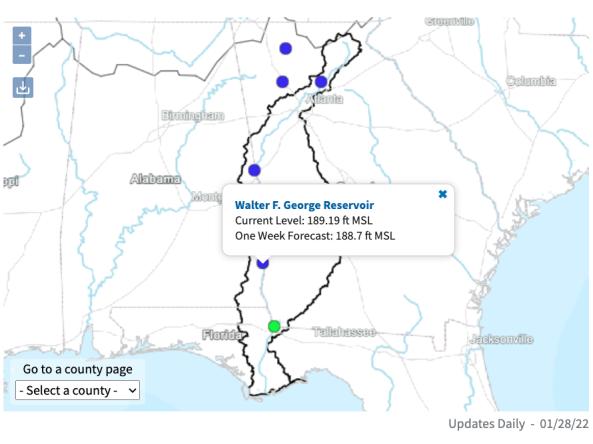
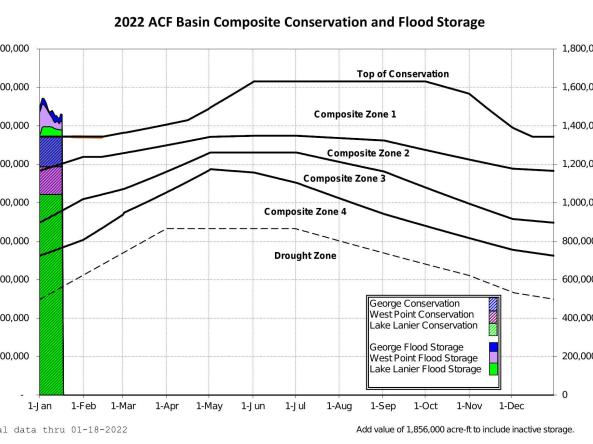
It is U.S. Army Corps of Engineers policy that water control plans be continually reviewed, updated, and adjusted as needed to ensure that the best use is made of available water resources. This March 2017 revision to the basin master water control manual describes the systemwide water control plan for the Apalachicola-Chattahoochee-Flint (ACF) River Basin. This manual provides a general reference source for ACF water control regulation. It is intended for use in day-to-day, real-time water management decision-making and for training new personnel.

The purpose of the Alabama Drought Management Plan is to provide information and procedural details associated with Alabama’s drought planning and response activities. The 2018 revision of the Plan is now fully in accordance with the Alabama Drought Planning and Response Act and the subsequent regulations promulgated in support of that Act.